
A Stormy Australia Day Ahead for the East and North

Australia Day will be a stormy one for much of northern and eastern Australia as a deep trough brings sparky skies.
Much like the past few days, storms will spark up this Australia Day over large parts of the Northern Territory, Queensland and eastern New South Wales, as well as the Kimberley in Western Australia.
A large inflow of tropical moisture is piling in from the Arafura, Coral and Tasman Seas. A line from Kalumburu (WA), through Tennant Creek (NT) and Quilpie (Qld) to Nowra (NSW) and all areas to the northeast of this line could see some showers and storms, including Darwin, Brisbane and Sydney.
Due to the large influx of moisture, any storm that forms could bring heavy rain, with a risk of some flash-flooding possible, more likely for western Qld. Some places could receive more than 80mm of rain from some storms, with large parts expecting 20-40mm.
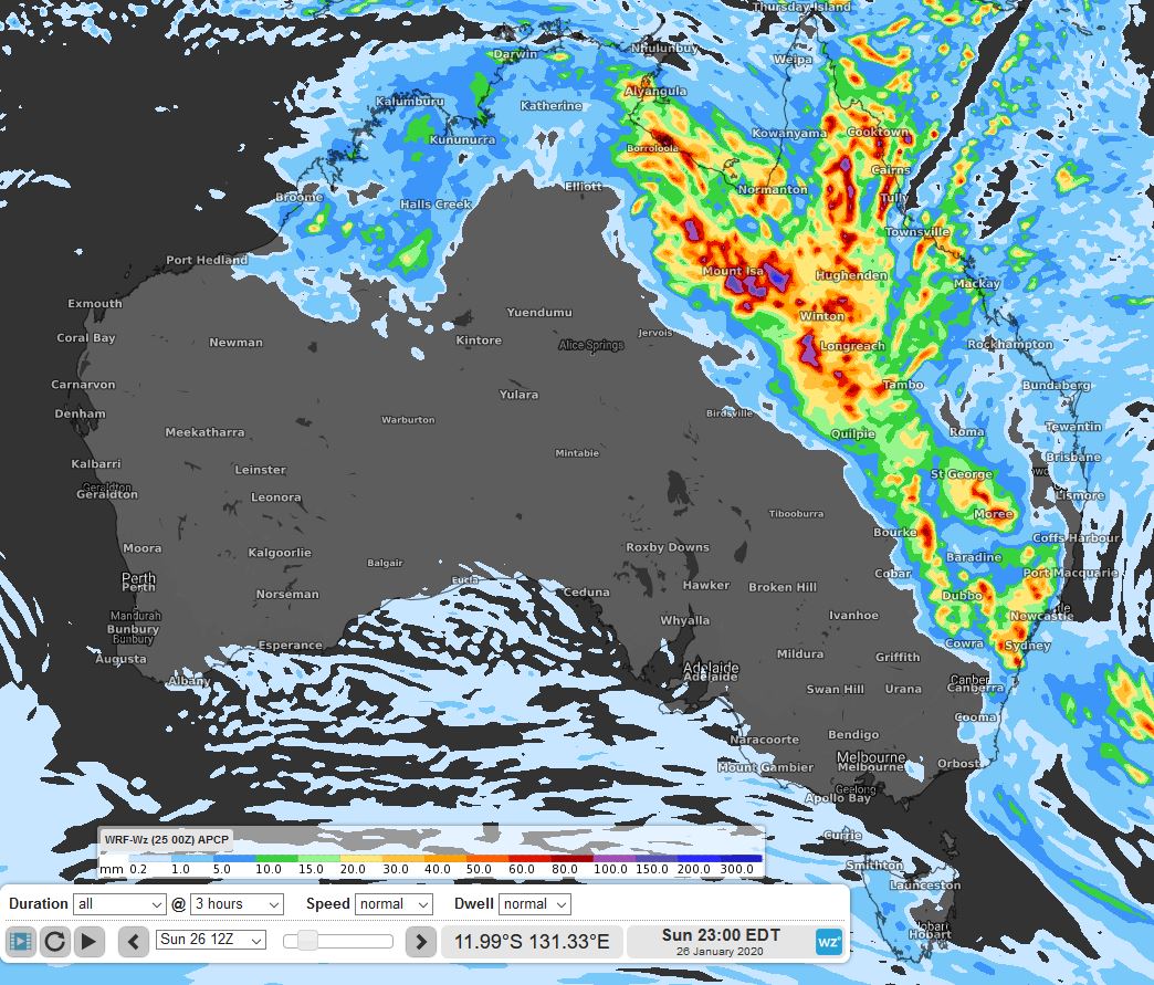
Image: Predicted 24hr precipitation on Australia Day
Areas around the Hunter, Central Tablelands and Sydney could see large (20c size) hail and possibly even giant (golf ball) sized hail, as well as damaging winds and heavy rainfall.
From Monday, the trough should split in two, returning one back to the tropical north and another weakening over NSW. While storms could again occur in the same areas on Monday and Tuesday, they are less likely to be as severe or as widespread as Australia Day.