
A soggy weekend in the east
After a briefing spell of warmth in the east, conditions are set to get a little cooler and much wetter this weekend.
A low-pressure trough, along with a low forming off the NSW coast, will bring significant cloud and widespread rain across New South Wales, and eastern Victoria.
New South Wales is set to see the heaviest rain, with widespread falls of 40-80mm over eastern parts of the state between now and the end of Sunday 30th. Heavier falls are possible with 100-200mm a chance over the south coast of NSW, with most of this falling on Sunday 30th.
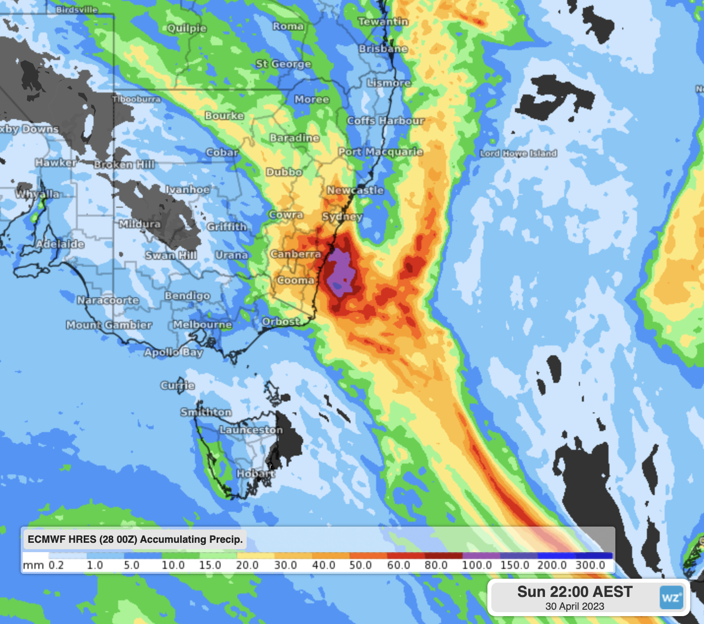
Accumulated precipitation to 10AEST using ECMWF 00Z
Rainfall will ease into Monday 1st as the low weakens and moves further offshore, with high pressure moving in briefly behind this and temperatures rising ahead of the next front expected about Tuesday 2nd.