
A severe, stormy week ahead for NSW
Severe thunderstorms are expected every day this week over parts of NSW as a series of troughs deepen over the state.
Monday will start with thunderstorms flashing across the Central Tablelands, Illawarra and South Coast as the sun rises, potentially bringing damaging winds and heavy rainfall.
As a southerly change moves up the coast during Monday, further storms are expected through much of the central and northern parts of the state, possibly including Sydney, Wollongong, Blue Mountains and Newcastle regions. These storms could produce large, possibly giant hail, damaging winds and heavy rain.
From Tuesday, the trough will start to stall over the northeast of the state. While showers are more likely for the coast, storms are likely to break out each day over the Northern Tablelands, Slopes and Plains. These storms are most likely to produce heavy rain, but could still lead to some large hail and damaging wind gusts.
From mid-week, another trough over western NSW will broaden and deepen, bringing scattered-to-widespread storms over most of the central corridor, including west of the divide. With persistent east-to-northeasterly winds flowing over the northeast, plenty of moisture will support heavy rain in the thunderstorms. Some storms are also possible about the east coast, but more likely isolated amongst heavy showers.
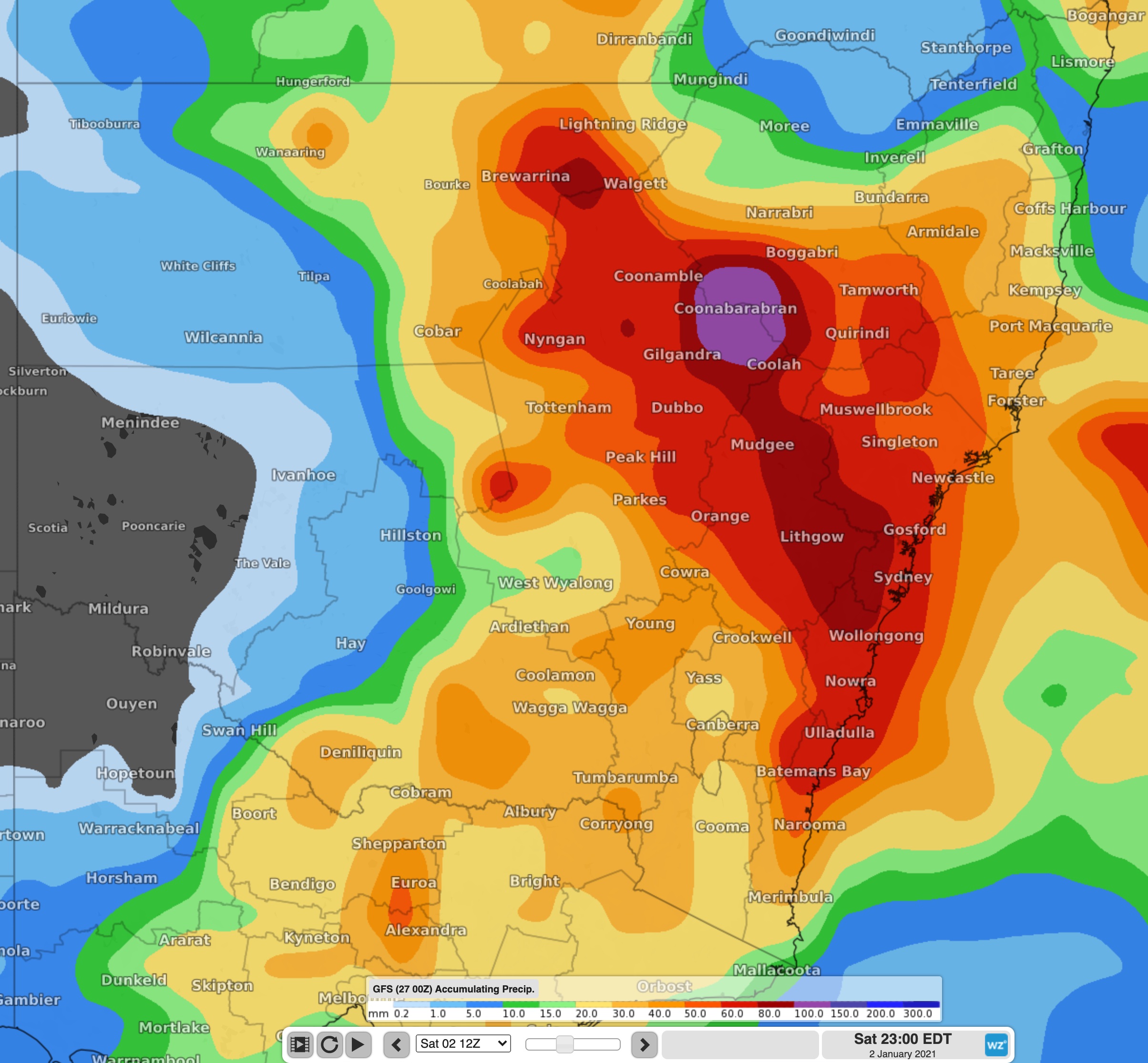
Image: Forecast accumulated until 11pm Saturday 2nd
With severe thunderstorms a high chance every day during the week, it is important to stay up to date with the latest warnings here.