
A night to forget in Victoria
Howling winds, heavy rain and flooding. Last night wasn't pleasant in Victoria.
A complex low pressure system has been causing sustained strong winds and heavy rain in parts of central and eastern Victoria between during the last 12-24 hours.
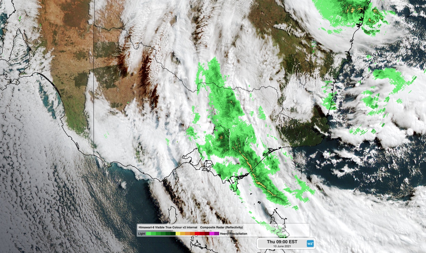
Image: Composite satellite and radar image showing clouds and rain over eastern and central Victoria on Thursday morning.
As of 9am on Thursday, dangerous weather was still going, and numerous severe weather and flood warnings were in place.
Some areas of the West and South Gippsland District received more than 200 mm of rain during the 24 hours to 9am on Thursday. This included 267 mm at Mount Tassie and 215mm at nearby Balook. This was the heaviest rain in records dating back to 1999 for Balook.
Other notable totals during this period were 64mm at Coldstream and 55mm at Latrobe Valley, which was the highest daily total in 10 years at both locations.
The heavy rain was accompanied by persistent wild winds, with gusts exceeding 100km/h at a number of weather stations between Wednesday night and Thursday morning. Here are some of the strongest winds that were recorded:
- 124 km/h at Hogan Island at 9:06pm
- 119km/h at Puckapunyal at 10:01pm
- 115km/h at Wilsons Prom at 9:37pm
- 115km/h at Mt William at 10:52pm and 12:34am
- 109km/h at Mt Buller at 6:16pm
- 104km/h at Kilmore Gap at 9:16pm
- 98km/h at Redesdale at 4:08am
- 91 km/h at St Kilda Harbour at 12:33am
These powerful winds affected a large area of Victoria overnight, bringing down trees and cutting power to a hundreds of thousands of homes and buildings.;
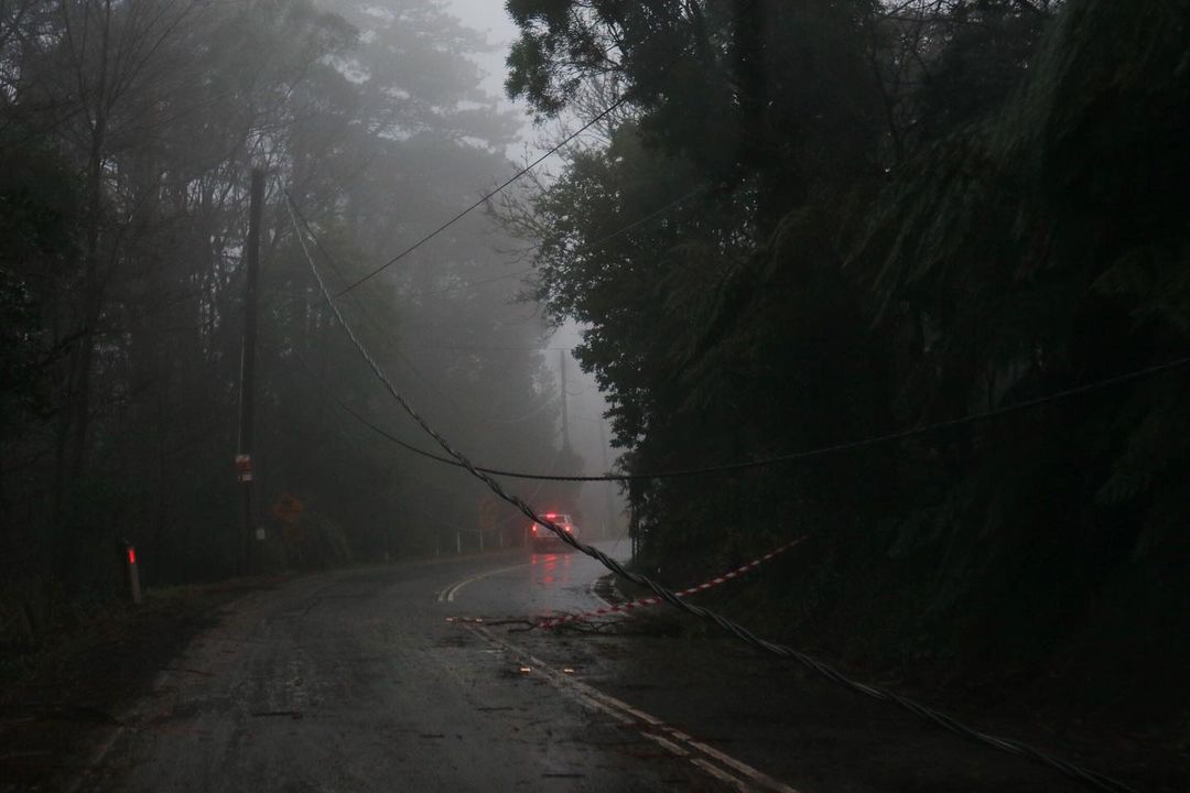
Image: Rain-covered roads littered with storm damage in the Dandenong Ranges on Thursday morning. Source: @photography_trh / Instagram
Several flood warnings have been issued over eastern Vicotria in response to the inundating rain from the last 24 hours.
As of 10am AEST on Thursday, moderate to major flood warnings were in place for the Mitchell, Wonnangatta, Avon, Macalister, Thompson, Latrobe, Tanjil, Morwell, Yarra, Watts and Goulburn Rivers and Tralragon Creek.
An evacuation order was issued for the Traralgon Creek area at 10:30am AEST on Thursday in response to the rapidly rising floodwaters.
Rain will ease over Victoria from Thursday afternoon, although some follow-up rain is expected on Friday and Saturday as the complex low pressure system lingers over the western Tasman Sea. While these falls won't be as heavy as the last 24 hours, they will be falling into already inundated catchments, so further flooding is possible.
Check the latest weather and flood warnings regularly for the most up-to-date information.