
A frosty welcome to winter in southeast Australia
Winter has arrived with a sharp bite across southeast Australia, bringing widespread frost and sub-zero temperatures to mark the start of the winter season. Towns and cities across Vic, Tas, NSW and the ACT awoke to single-digit and negative temperatures — and for many, it was the coldest morning this early in the season in decades.
While a cold start to June is nothing unusual, this year stands out for how early the low temperatures have arrived. Across southeastern Australia, many locations experienced their coldest morning this early in the season in more than two decades. Bairnsdale in Victoria was especially notable, recording its lowest temperature this early in the season in 82 years at 0.9°C. Other significant lows included Kyabram at -0.9°C—the coldest morning this early in the season in 36 years—and Cooma Airport at -6.3°C, its coldest morning this early in the season in 32 years. Several Victorian towns, including Coldstream (-1.6°C), Shepparton (-0.7°C), Swan Hill (-0.9°C), and Tatura (-1.5°C), all saw their coldest temperatures this early in the season in 28 years. South Australia’s Loxton also experienced a chilly -2.0°C, the coldest temperature this early in the season in nearly three decades.
Now, let’s take a look at the absolute minimum temperatures recorded this morning across the southeast:
- Cooma Airport (NSW): -6.3°C.
- Liawenee (Tas): -5.7°C – coldest this early in the year in 9 years;
- Ouse (Tas): -4.0°C – coldest June day in 2 years;
- Perisher Valley (NSW): -3.6°C – coldest this early in the year in 3 years;
- Butlers Gorge (Tas): -3.6°C – coldest this early in the year in 14 years;
- Marrangaroo (NSW): -3.3°C and Omeo (VIC): -2.8°C – both recording their coldest temperatures this early in the year in 4 years;
- Horsham Airport (Vic): -2.4°C;
- Renmark Airport (SA): -2.2°C – coldest this early in the year in 8 years.
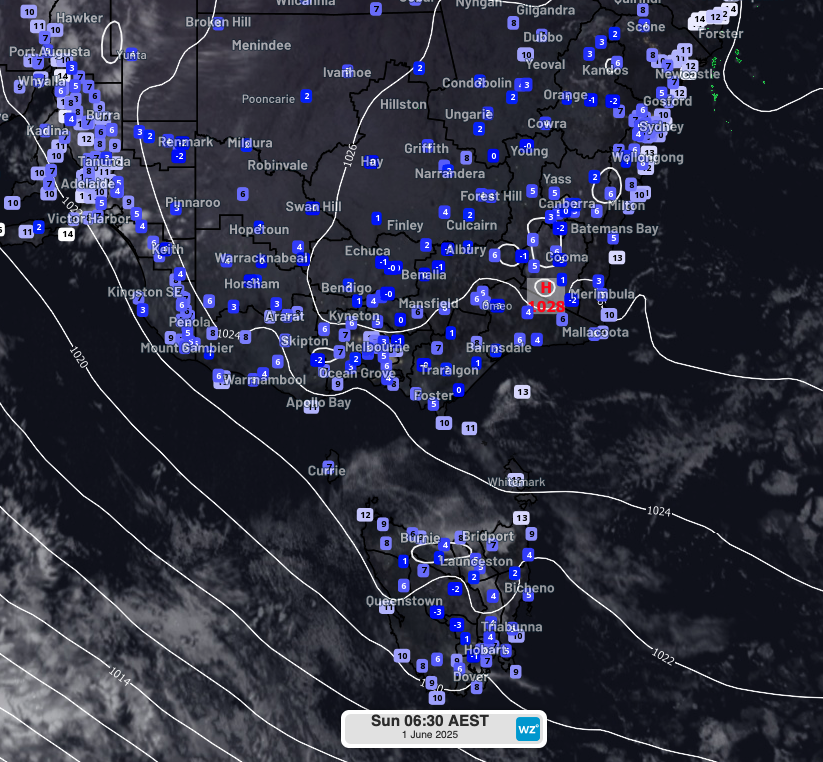
Image: Observed temperatures at 6:30am EST on Sunday 1st June across southeast Australia.
What caused the cold?
A key factor in this morning’s chill was very low dew point temperatures across the southeast. The dew point is the temperature to which air must cool for condensation to occur (i.e., for dew or frost to form). A low dew point means the air is very dry, which allows temperatures to fall more quickly overnight since there’s less moisture to absorb and hold onto heat energy.
Dry air combined with clear skies and light winds under a high pressure cell provided the perfect conditions for strong radiative cooling — ideal for widespread frost and cold air pooling in valleys and low-lying areas.
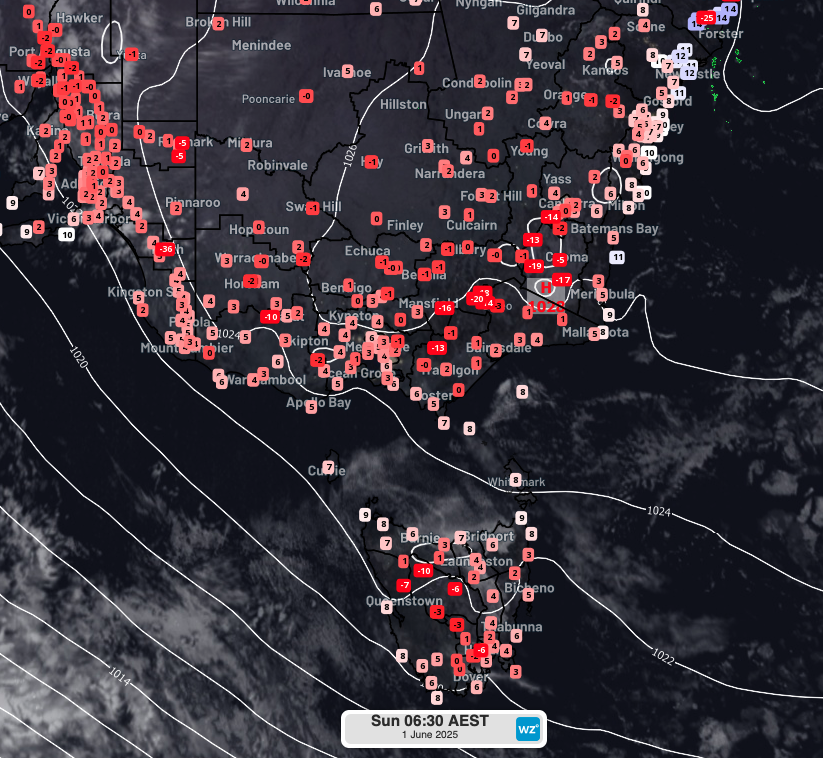
Image: Observed dew point temperatures at 6:30am EST on Sunday 1st June across southeast Australia.