
A dry week ahead for Queensland to end a very wet May on the northern coast
After an April-like monthly rainfall for the Tropical Coast, settled conditions are expected over the coming week.
Townsville has collected 77mm so far this month, which represents more than double the average May rainfall. Cairns and Innisfail have also registered rainfall well above the long-term monthly average, with 151 and 453mm, respectively.
Some locations of the Central Coast have received near average rainfall. Mackay has picked up 123mm, just 20mm above the May average rain. In contrast, shower activity was infrequent further south. Brisbane, with only 9mm so far this month, could break the previous driest May record, 10mm in 2006.
Continuous onshore flow bringing moisture along the northern coast produced frequent showers over the first half of the month. A cloud band caused by tropical moisture from the Indian Ocean and cold and dry air in the south led to heavy falls across much of inland and northern parts of the state during this week.
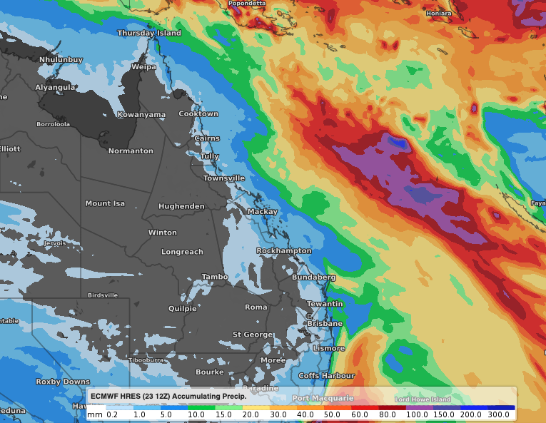 Image: Forecast accumulated rainfall from Sunday 24th to Sunday 31st, according to the ECMWF-HRES model.
A large high over the Great Australian Bight will extend a ridge across Queensland bringing settled conditions over the next few days. As the high is expected to move east, a few more showers along the coast may still add more millimetres in the gauges for the remainder of the month.