
46 degrees and snowing on the same day
Australia, land of contrasts, you have well and truly done it again.
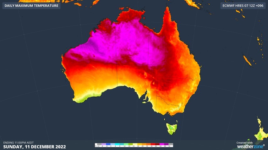
On a day when temperatures reached 46.1°Cat Roebourne Airport in northwest WA, snow licked the highest parts of the NSW Snowy Mountains and Victorian Alps, with temperatures plummeting to -2.1°C overnight at Thredbo.
This was the scene on Monday evening at the top of Thredbo. The date-stamped image proves that yes, these were indeed blizzard conditions almost two weeks into summer.
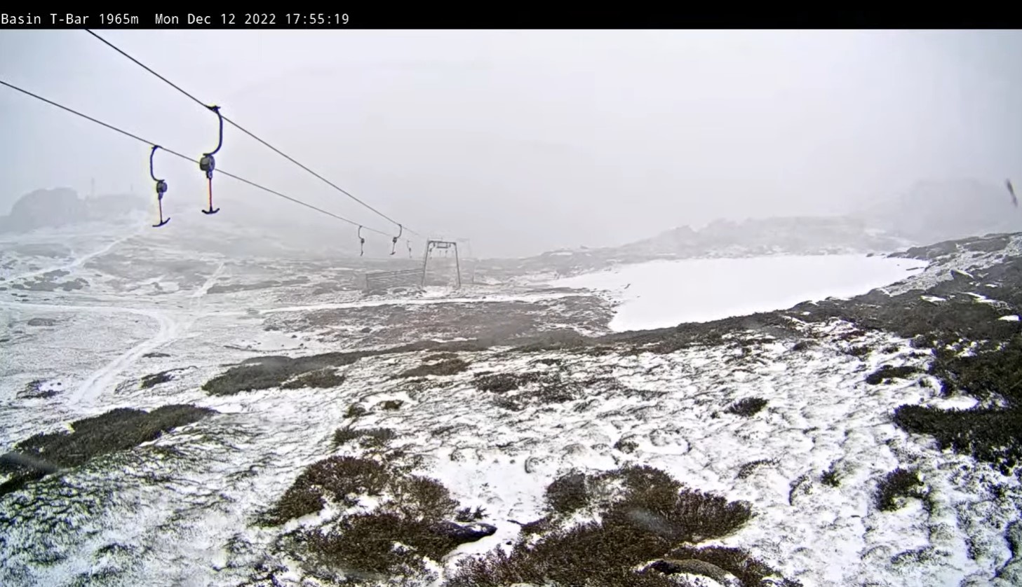
Image: The large area of white on the right is a remnant winter snow patch. Everything else is Monday evening's fresh snow. Source: Thredbo.com.au.
We've written quite a few stories like this lately highlighting dramatic national temperature contrasts – most notably this one on November 15, where there were 50-degrees of difference between Australia's warmest and coldest places within about half a day.
We could have written an even more dramatic one this week, as Mandora in northwest WA recorded a site record of 48.5°C on Sunday afternoon, after Perisher Valley recorded a record-equalling summer low of -7°C early on Friday morning.
That was 55.5 degrees of difference within a couple of days!
Of course – as our loyal Weatherzone readers often remind us in comments on social media – it's a big, wide country out there, so you learn to expect some pretty dramatic temperature differences.
You're right, we do. But not necessarily this dramatic, and here's why.
We have seen far more cold outbreaks than usual in the last month or so. The band of low pressure systems that circulates the Southern Ocean has been particularly active in late spring and early summer in terms of "breaking through" and pushing northwards to SE Australia.
At the same time, northern parts of the country have been seriously heating up. Indeed, as we told you recently, there has been a pretty severe heatwave lasting several days, which is at last starting to wane this Tuesday.
So while yes, absolutely, Australia is a land of contrasts on almost any day of the year, it's pretty rare to have a severe heatwave in the country's hottest corner and a cold outbreak in our coldest corner at the same time.
But that's happened quite a lot lately.
So when will it finally warm up down south?
Last week, we told you that a double burst of summer snow was on its way. Last night was the second burst.
Turns out there's actually a bit of a sneaky third burst of mountain snow on its way later tonight and into Wednesday.
This latest cold front will keep things cool for this time of year for quite a few days in all the southeastern capital cities and pretty much everywhere in between, we're afraid.
We'll doubtless tell you more about this Tuesday night system on Wednesday morning, as some very chilly December temps look likely for Wednesday, especially in Victoria and southern New South Wales.