
3000 km tropical moisture feed from N Qld to Tas
The same weather system which brought extremely heavy flooding rain to North Queensland in recent days is now delivering a steady stream of moisture all the way south as far as northern Tasmania.
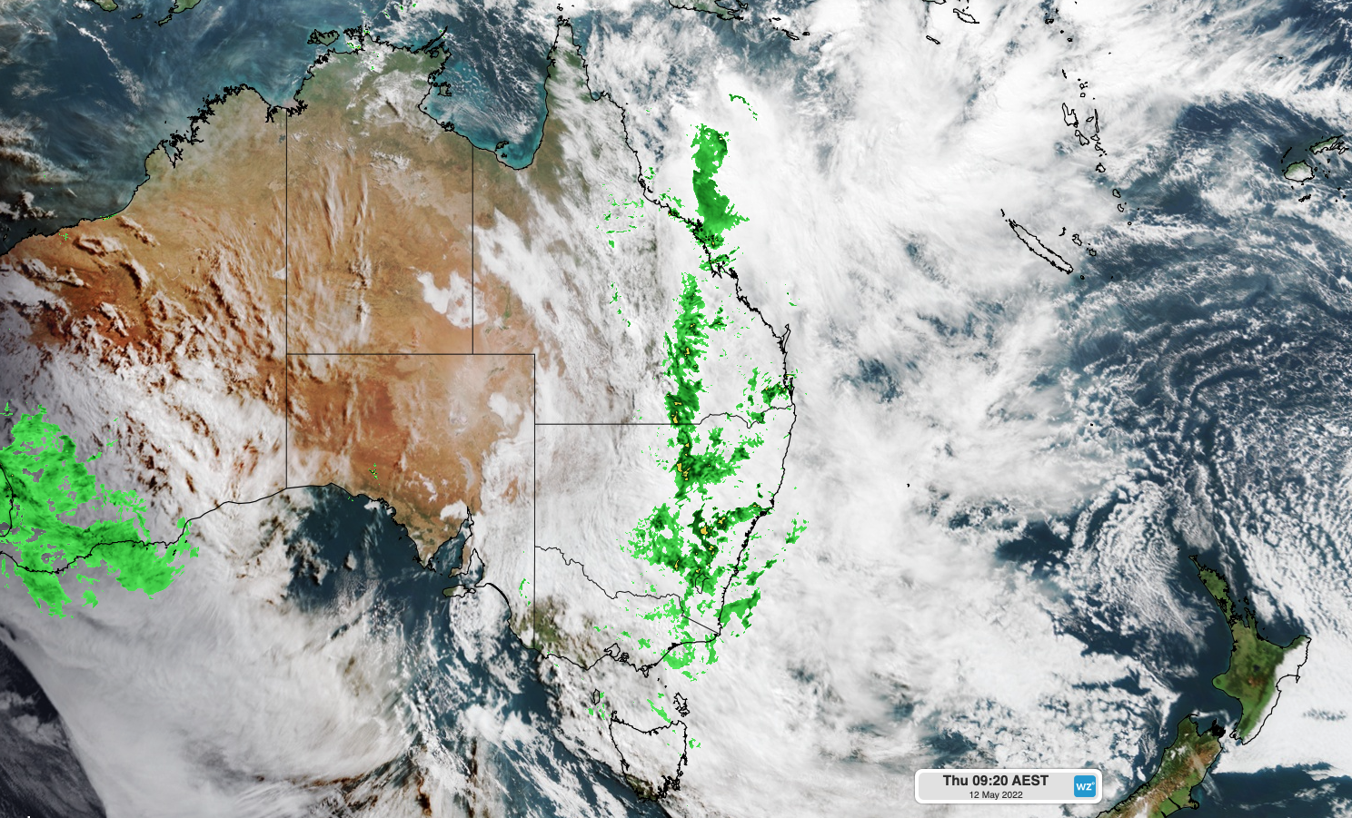
That's a 3000-kilometre moisture feed, and you can see it streaming southwards on the video loop below.
So what's causing it?
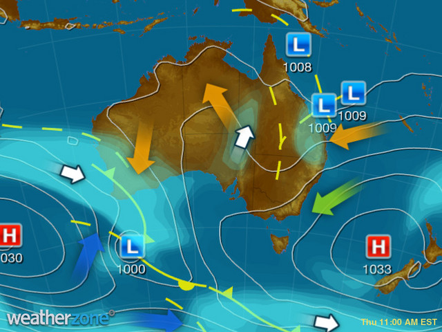
The heavy showers are located mostly to the east of a trough which runs from the southern part of the Cape York Peninsula all the way to the Lower Western forecast district of NSW.
Meanwhile a strong high centred over the Tasman Sea near New Zealand is funnelling moisture across NSW and Qld, as you can see on this morning's synoptic chart.
The result? Rain, and plenty of it, in areas that don't often get much at this time of year. Virtually the whole of Qld has seen rain in the last 24 hours, while some of the readings of note to 9 am on Thursday morning in parts of far-inland NSW include:
- Collarenebri (Upper Western) 54 mm
- Brewarrina (Upper Western) 36 mm
- Griffith (Riverina) 25.6 mm
Coastal regions are of course also copping serious rain in this weather set-up, with Brisbane seeing 40.4 mm to 9 am Thursday and Sydney 31.4 mm. Rain continues in those cities on Thursday, as it does along much of the east coast.
But the remarkable aspect of this weather system, as mentioned, is the flow of tropical moisture to inland regions further south, which we've also captured on this composite satellite and radar still below.
Speaking of inland regions further south, heavy rain is also falling Canberra today, with 18.2 mm in the gauge up to 9 am Thursday, and a similar amount (or perhaps more) likely to fall today. Today's rain has already taken the capital past its modest May average of 28 mm, in what is typically the driest month of the year.
Rain should begin to ease off on Friday in some (but not all) of the areas mentioned, with moderate to heavy falls possibly continuing in parts of QLD and NSW.
In places where the sun pops out on Friday and into the weekend, temps should be quite warm for this time of year because of all the tropical air lingering around.