
2021 in Victoria starts with sparks
As Victorians woke up to face a brand new year, skies over parts of the state were cloudy and gloomy as thunderstorms moved over the region.
A low pressure trough over the southeast has been strengthening and, in the early hours of Friday morning, began to trigger thunderstorms. The majority of cloud-to-ground strikes that have been observed until now have occurred in central areas of the state, mainly the Northern Country district. So far, rainfall totals have been fairly modest, with the largest totals being 16mm and 14mm at Tatura and Kyabram respectively
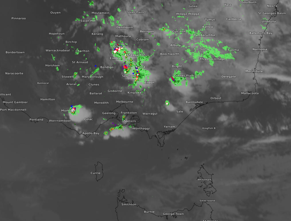
Image: Satellite (Himawari-8) imagery with lightning (cloud-to-ground) and radar overlay at 7:30am EDT on Friday
However, the area of effect is expected to expand as the day progresses. On Friday, during the afternoon and evening, western parts of Victoria could see thunderstorms appear with the possibility of these storms becoming severe. The main features of this system will be large hail and heavy rain, which could lead to localished flash flooding.
The trough that is causing these storms should persist in the southeast, extending the showers and storms over the weekend. Skies look to clear up over Victoria from about midway through next week but until then, be sure to check out the latest warning information here.