
2020 already wetter than 2019 in parts of eastern Australia

Parts of southeast Queensland and northeast NSW have seen more rain during the last six weeks than they did during all of 2019.
A stream of moisture-laden air feeding into a coastal trough caused persistent and heavy rain, along with thunderstorms, in southeast Queensland and northeast NSW on Wednesday and Thursday morning.
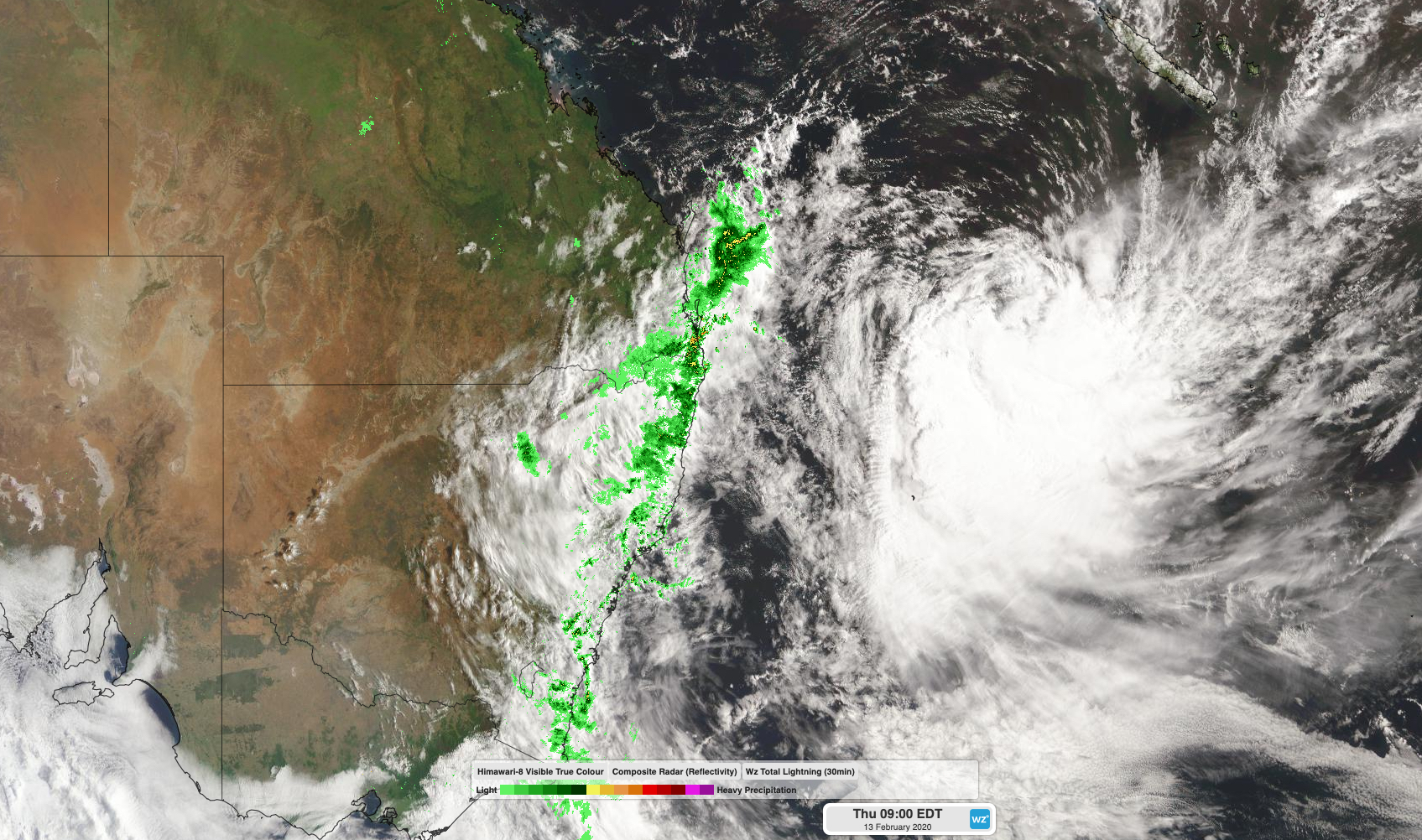
Image: Satellite and radar imagery showing rain over eastern Australia on Thursday morning.
During the 24 hours to 9am on Thursday, widespread falls over 100mm were recorded along the coast and adjacent inland from Noosa down to Port Macquarie. The heaviest falls during this period occurred in the Northern Rivers district of NSW, where a rain gauge in the Burringbar area received 272mm.
Other notable 24-hour totals to 9am on Thursday included 232mm Queensland's Sunshine Coast Airport, its heaviest rain in records dating back to 1994, and 178mm at Gold Coast Seaway, which is their best February rain in at least 26 years.
This latest bout of heavy rain comes after an exceptionally wet week along this stretch of Australia's eastern seaboard and a notably wet start to 2020.
Coolnagatta has received 590mm of rain during the past week, which is higher than any monthly total observed at the site since 1988. This deluge brings their running total for 2020 to 899mm as of 9am on Thursday, easily exceeding the 825.6mm that fell at the site during all of 2019.
Gold Coast Seaway's 891.4mm so far this year is also higher than the 827.8mm they picked up in 2019.
South of the border, a rain gauge at Cudgera Creek, near Pottsville, registered 784mm of rain during the seven days ending at 9am on Thursday. Further south, mainland Australia's eastern-most rain gauge at Cape Byron collected 614.8mm during the past week, bringing their running total for 2020 up to 854.2mm, exceeding the 766.2mm they collected in 2019.
Showers and thunderstorms will continue to affect northeast NSW and southeast Queensland each day during the next week, with severe thunderstorms likely in some areas. The impending rain may cause flash flooding at times, particularly with thunderstorm activity.