
Tropical Cyclone Hayley forms northwest of the Kimberley
Tropical Cyclone Hayley has formed northwest of the Kimberley early on Monday morning, with residents and businesses readying themselves for heavy rainfall and strong winds.
Hayley became the third system to be named within the Australian region early on Monday morning, located approximately 535 km northwest of Broome, WA. The other two systems to have been named were Severe Tropical Cyclone Fina in November and Tropical Cyclone Grant in December.
Video: Satellite imagery on Sunday, December 28, showing the tropical low that would become Hayley developing to the northwest of the Kimberley. Source: Weatherzone.
Current forecast track and intensity could see Hayley become a category 2 or 3 system later today or on Tuesday, less than 200 km north of Broome. However, unfavourable atmospheric conditions expected closer to the Kimberley coast could see this system weakening before making a potential landfall near Cape Leveque. Damaging to destructive wind gusts could reach 140 km/h along the coastline north of Broome late on Tuesday.
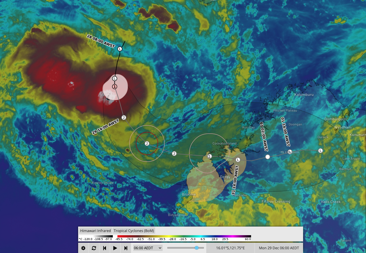
Image: Forecast track for Tropical Cyclone Hayley as seen on the Weatherzone Layers page. Source: Weatherzone.
Even if Hayley weakens below tropical cyclone intensity, heavy flooding rainfall is expected for parts of the Kimberley as the system tracks inland. Some areas could receive 200-300mm of rain in 24-36 hours, increasing the risk of flash flooding cutting off vital transport routes and roads.
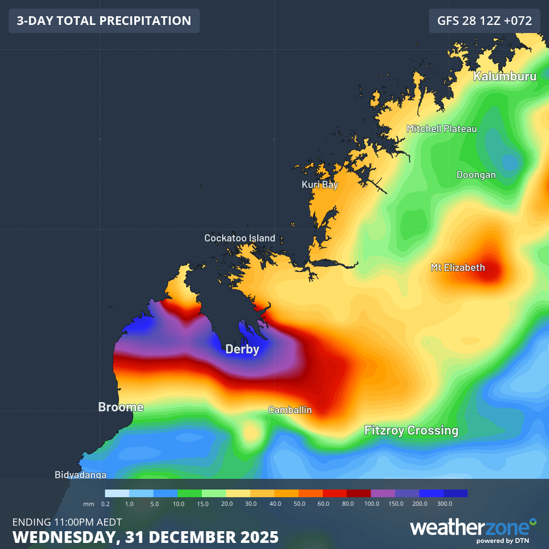
Image: Forecast 3-day rainfall accumulations according to the GFS computer model. Source: Weatherzone.
Keep track of the latest warnings and tropical cyclone advisories on the Weatherzone Warning and Tropical Cyclone pages.