Distance and latitude/longitude coordinates are displayed when you mouse over the map. The origin for distance measuring is indicated by a red dot and defaults to either your location, if specified and in range, or the location of the radar/the centre of the map. The origin may be changed by clicking elsewhere on the map.
Lightning Strikes
LATEST
15 MINS AGO
30 MINS AGO
45 MINS AGO
60 MINS AGO
Ground strike
Cloud to cloud strike
Lightning Strikes Notes
Lightning information is updated at the same time as radar information.
Lightning Heatmap
0.1
15
60
Lightning Pulses / Square kilometre per minute
Lightning Heatmap Notes
Lightning information is updated at the same time as radar information.
Accumulated Rainfall (since 9am)
<0.2 mm
<5 mm
<10 mm
<25 mm
<50 mm
<100 mm
100 mm+
Accumulated Rainfall Notes
Rainfall since 9am local time is displayed with coloured dots.
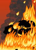
Fire Danger
No Rating
Moderate
High
Extreme
Catastrophic
Index 0-5
6-11
12-23
24-49
50-99
100+
Fire Danger Notes
Fire danger data and rating definitions are provided by the National Council for Fire & Emergency Services in line with the Australian Fire Danger Rating System (AFDRS). For more information please visit https://www.afac.com.au/initiative/afdrs.