
Damaging winds in multiple states
A strong cold front will cause damaging winds in southeastern Australia during the next 24 hours, with some states already in the thick of the wild weather.
The satellite image below shows the cold front crossing the nation’s southeast early on Monday afternoon. The front is marked by the thick band of cloud over southern NSW and the ACT.
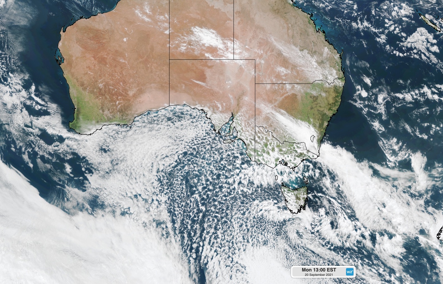
Image: Visible true-colour satellite image captured at 1pm AEST on Monday by the Himawari-8 satellite.
To the south of this front is a large mass of speckled clouds, which has formed in a broad mass of very cold air that has travelled up from the Southern Ocean.
Ahead of the front, much warmer and drier air is causing clear skies across much of NSW and Queensland.
The map below shows modelled air temperature about 1.5 kilometers above the ground at 1pm AEST on Monday, which is when the satellite image above was captured.
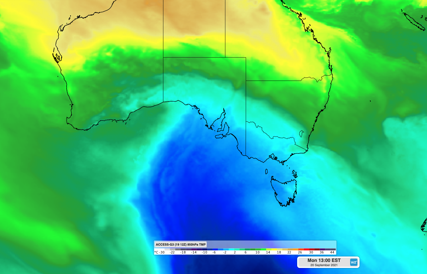
Image: Cold air and warm air fighting it out over Australia on Monday.
The contrast between these two air masses, which we explored in more detail earlier today, is causing strong and dangerous winds across southeastern Australia. This is because wind is one of the ways the atmosphere restores equilibrium when two contrasting air masses clash into each other.
As of 3pm AEST on Monday, severe weather warnings were in place for damaging winds in central and western Victoria and southeastern districts of South Australia.
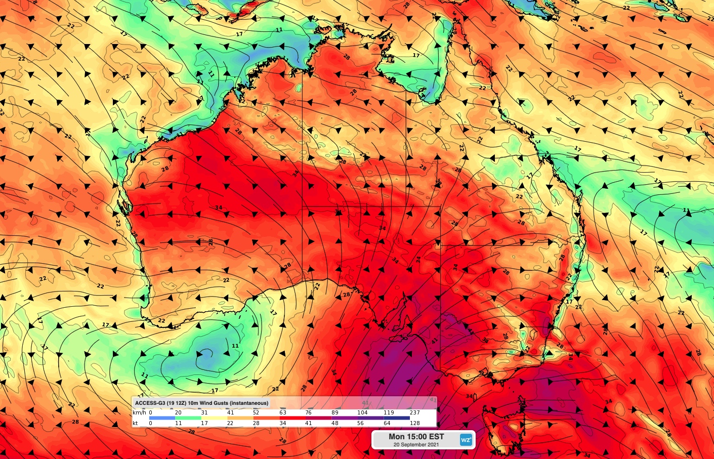
Image: Forecast wind gust speed and direction at 3pm AEST on Monday, according to the ACCESS-G model.
Some of the strongest gusts so far today have included 133km/h at Hogan Island, 109km/h at Wilsons Promontory, 107km/h at Mt Buller. Other notable gusts were 87 km/h at Cape Willoughby in SA and 80km/h at Avalon and St Kilda in Victoria.
Looking ahead, blustery winds will also spread up through eastern and northern Australia during the rest of Monday and on Tuesday.
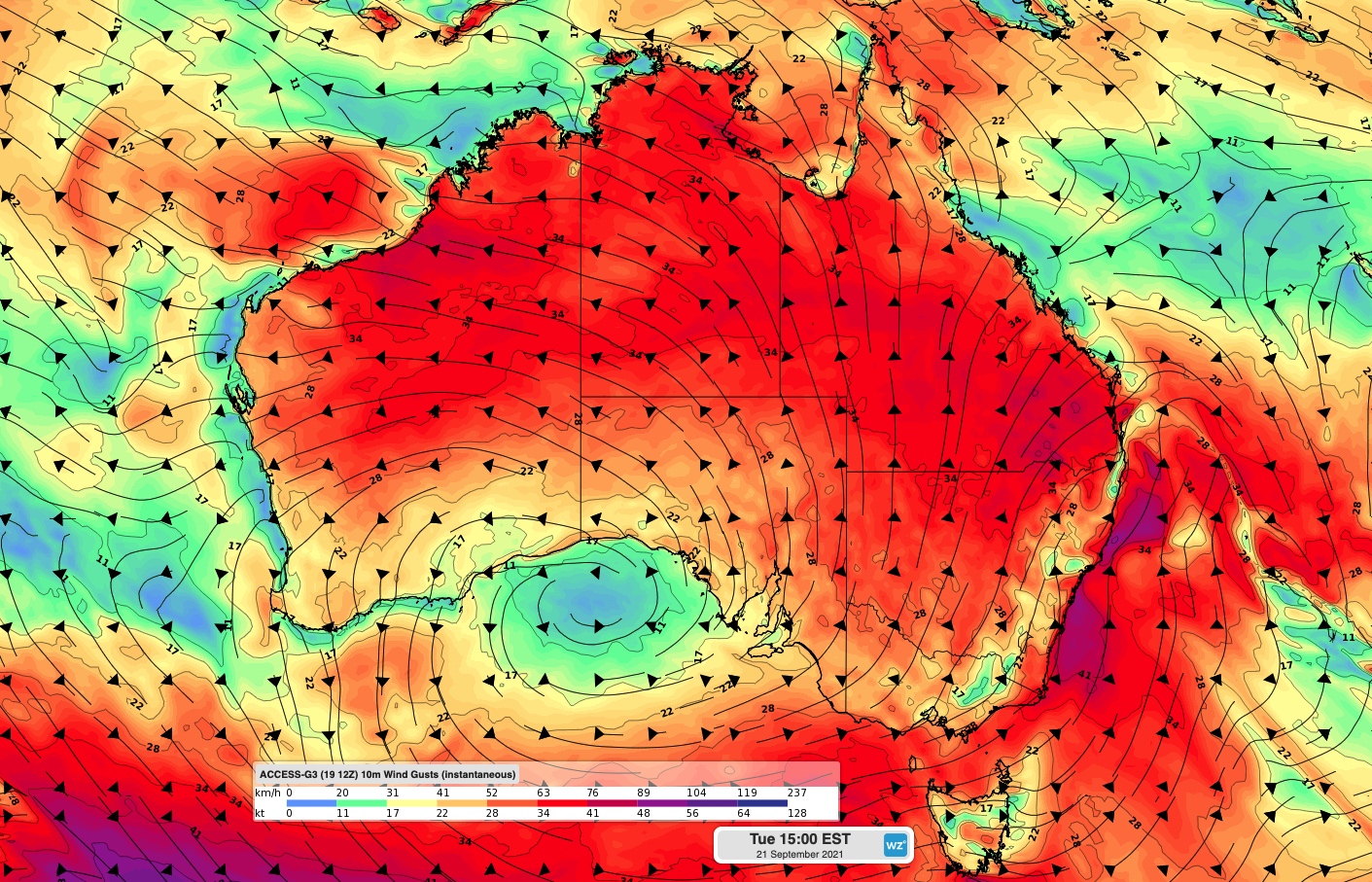
Image: Forecast wind gust speed and direction at 3pm AEST on Tuesday, according to the ACCESS-G model.
This surge of wind could case damaging gusts in some areas, along with elevated fire danger ratings in parts of northern Australia and dangerous surf along the NSW coast.
A hazardous surf warning is in place for the Sydney, Hunter and Macquarie coasts on Tuesday.