
The last big snow dump of season 2021?
Spring snowfalls are on the way, and that's good news for the Victorian ski resorts, which are still open to visitors to parts of regional Victoria.
The NSW resorts have been closed for several weeks due to Covid lockdown, however Perisher and Thredbo are also reopening this weekend, and they should also receive a welcome top-up of snow from Saturday through to Tuesday, perhaps with some rain in between.
The cover is still holding up OK at the largest resorts in both states. The photo below shows Mt Hotham in Victoria on Friday morning, with the beginner runs on the summit area looking enticing to say the least.
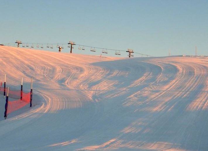
Image: Source: @hothamalpineresort via Instagram.
Hotham currently has four lifts spinning to cater for the reduced number of visitors, Falls Creek also has four, while Buller has eight.
Click on each resort to see the updated snow report, as more lifts may open for weekend visitors. Then again, fewer lifts may run, depending on the wild weather conditions forecast for much of the weekend.
In NSW, the official snow depth measured by Snowy Hydro at Spencers Creek, roughly halfway between Perisher and Thredbo, was 125.2 cm on Wednesday, September 15. The season peak was 183.6 cm on July 29.
So what's the deal with this weekend's snow-bearing weather system?
Actually, it's two distinct cold fronts, as Weatherzone meteorologist Ben Domensino wrote earlier today. The first will move across the mountains on Saturday, delivering snow down to about 1400 metres in NSW and 1200m in Victoria.
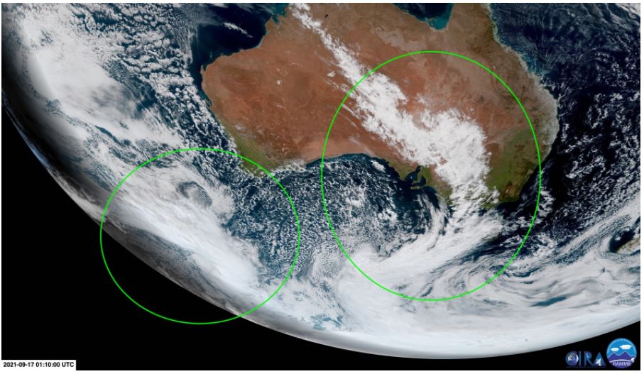
The second – which was still south of WA this morning, as you can see on this image captured by the Himawari-8 satellite – will sweep north across the mountains from late Sunday into Monday, with cold winds and snow showers sticking around until at least the first part of Tuesday.
The second front is the colder of the two. Snow may turn to rain at lower elevations ahead of it, but snow should then fall to as low as 900 metres. As ever, you can stay on top of all the snow forecasts on the Weatherzone snow page.
After this twin system begins to dissipate by midweek next week, it's not clear when the next significant dump of snow is on the horizon. Heavy falls can occur across the Australian Alps at any time of year – yes, even in summer – but they definitely become less likely once you hit late September.
We'll keep reporting on snow conditions here at Weatherzone right up till the traditional closing weekend in early October, at which point we'll do a season summary.
For now, this season is in the average range in NSW taking into account the last 70-odd years of Snowy Hydro data.
In Victoria, season 2021 has perhaps been a little below average in terms of duration. While metre-plus depths were recorded at all VIC resorts by late July, the season was later to start, due to the state missing out on an unusual easterly system that delivered heavy snow to NSW in early June.