
Intense Rainfall: Over 100mm in just 3 days over NSW
The advance of a trough across the north and center of the state spread clouds across the state and, together with humid onshore winds, intensified instability in eastern NSW, leading to intense rainfall.
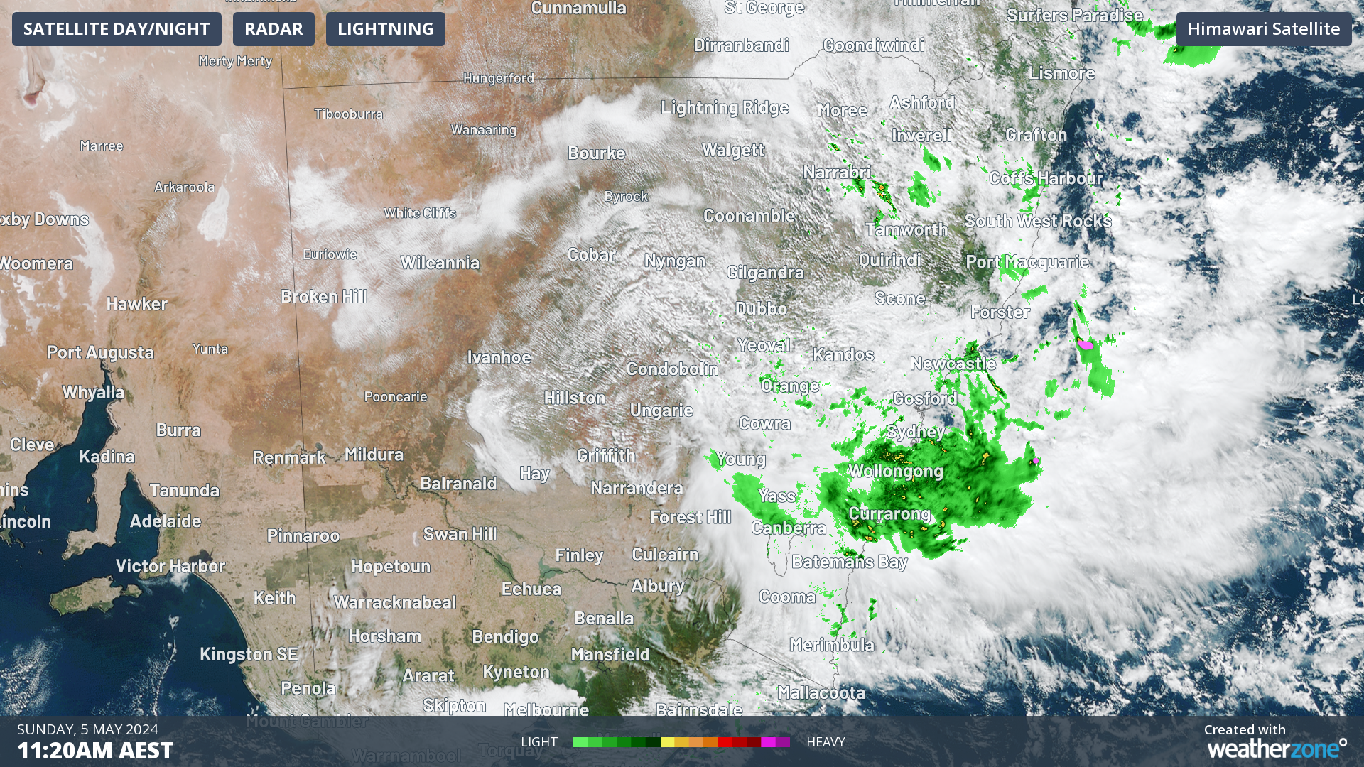 Image: Satellite and radar images on Sunday 5th at 11:20am AEST.
Sydney Airport recorded 51.2mm in just 3 days and since the beginning of the month, it has already made (96.2mm) slightly above the May average (95.9mm).
Other locations also experienced significant rainfall in the last 3 days:
- Jervis Bay Airfield: 177.2mm
- Kiama: 109.4mm
- Ulladulla: 105.4mm.
The rain is not over yet. Over the next 24 hours, more water is expected to fall, especially in the eastern part of the state, including the Sydney area. The map below indicates areas in red where an accumulation of 60-80mm of rain is expected over the southeast until 10 am on Monday.
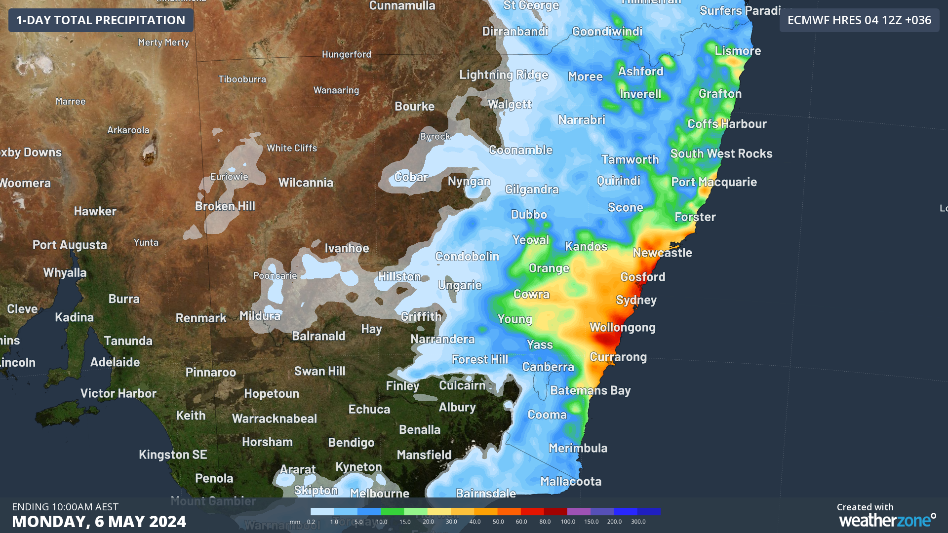 Image: 24hour rainfall to 10am AEST on Monday 6th according with ECMWF.
Southeasterly winds will continue to bring rain throughout the week, although not as intense or consistent as in recent days.
By the end of the week, another trough is expected to cross the state, possibly spreading more significant rain across the north and east of NSW. Follow the Weatherzone homepage for more updates.