
Wintry end to autumn in Perth

A cold front will sweep over southwestern Australia during the next 48 hours, bringing a burst of wet and wintry weather in the final days of autumn.
Showers, thunderstorms, blustery winds, and cold air will spread over southwestern districts of Western Australia on Friday with the passage of a cold front.
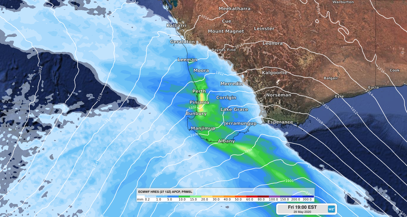
Image: Accumulated 6-hour rainfall and mean sea level pressure on Friday evening, according to the ECMWF-HRES model.
While this system won't be as strong or severe as the front that affected the state last Sunday and Monday, it will bring weather that could be dangerous.
Widespread falls of 5-20mm are likely between Jurien Bay and Albany from this system, while some places along the lower west coast could pick up more than 30mm. Some of the heavier falls will occur with thunderstorms.
A burst of blustery winds will also develop near and behind the front, which has prompted a gale warning for the Leeuwin and Albany Coasts.
Cold air in the wake of the front will move over the state's southwest from Friday afternoon, before spreading further north and east during Friday night and Saturday morning.
Perth's forecast top of 17 degrees on Saturday is around five degrees below average for this time of year. It may also become the city's fourth day so far this month to stay below 17.5 degrees, which hasn't happened during May since 2006.