
Wild week of weather on the horizon for Australia
Australia is in for a dynamic mix of weather next week, with potential for flooding rain, severe thunderstorms, temperatures over 45ºC and tropical cyclones.
Summer is always a busy time for weather in Australia. This is because the summer months are exposed to the year’s most intense and prolonged solar heating, which provides plenty of energy for extreme weather.
Next week will be a perfect example of how active a week of Australian summer weather can be.
The week will start out with rain and thunderstorms across large areas of Qld as moisture-laden easterly winds feed an inland low pressure trough. This wet and stormy weather should also spread to parts of the NT and NSW in the middle of the week.
There is potential for heavy rain, flooding and severe thunderstorms in northern and eastern Australia from this system, with Qld likely to see the heaviest accumulated rainfall. The image below shows how much rain is being predicted during the next seven days by one computer model, which covers the period from today (Friday) until Thursday next week.
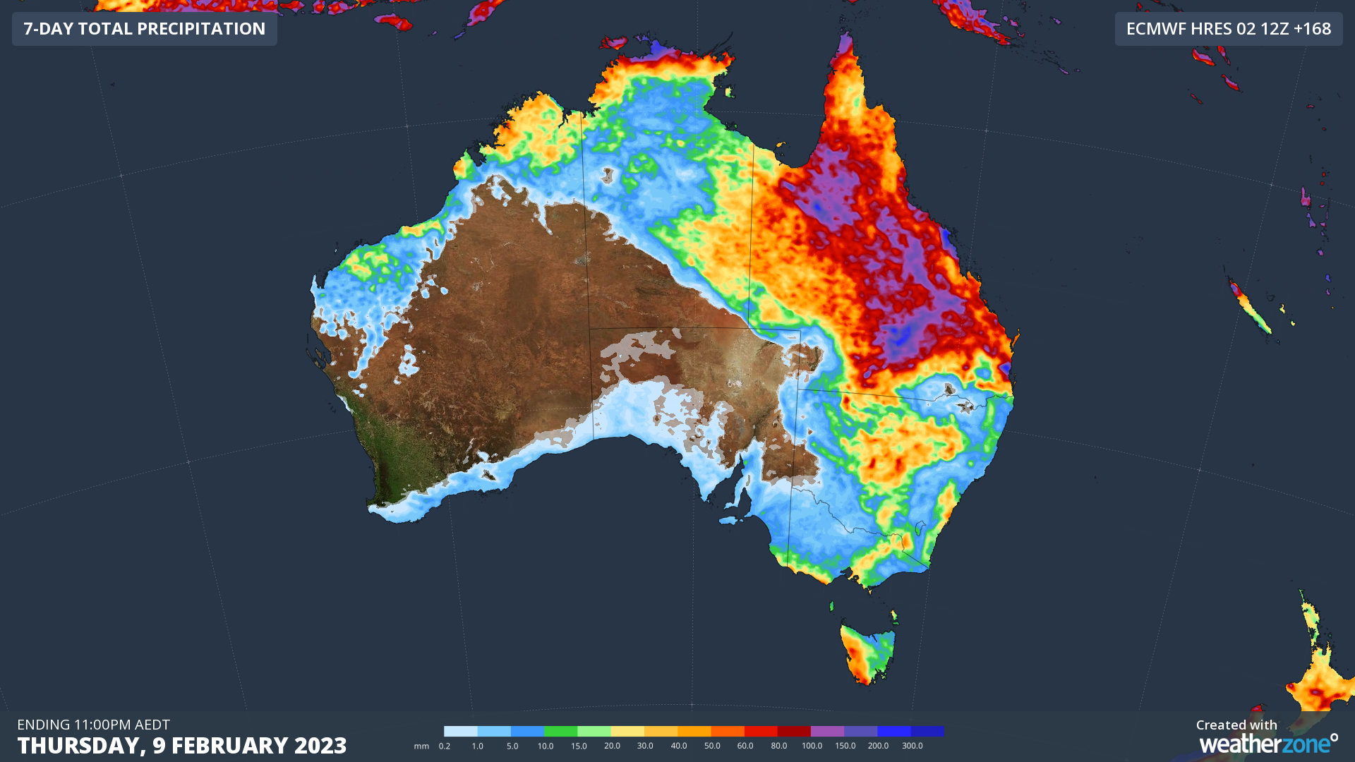
Image: Forecast accumulated rain during the seven days ending at 11pm AEDT on Thursday, February 9, 2023.
Another thing you will notice on the map above is the large area of western and central Australia that is going to stay dry over the coming week. This run of clear weather will allow an intensely hot air mass to build up, with temperature likely to push into the mid-forties for several days from around Wednesday 8th or Thursday 9th.
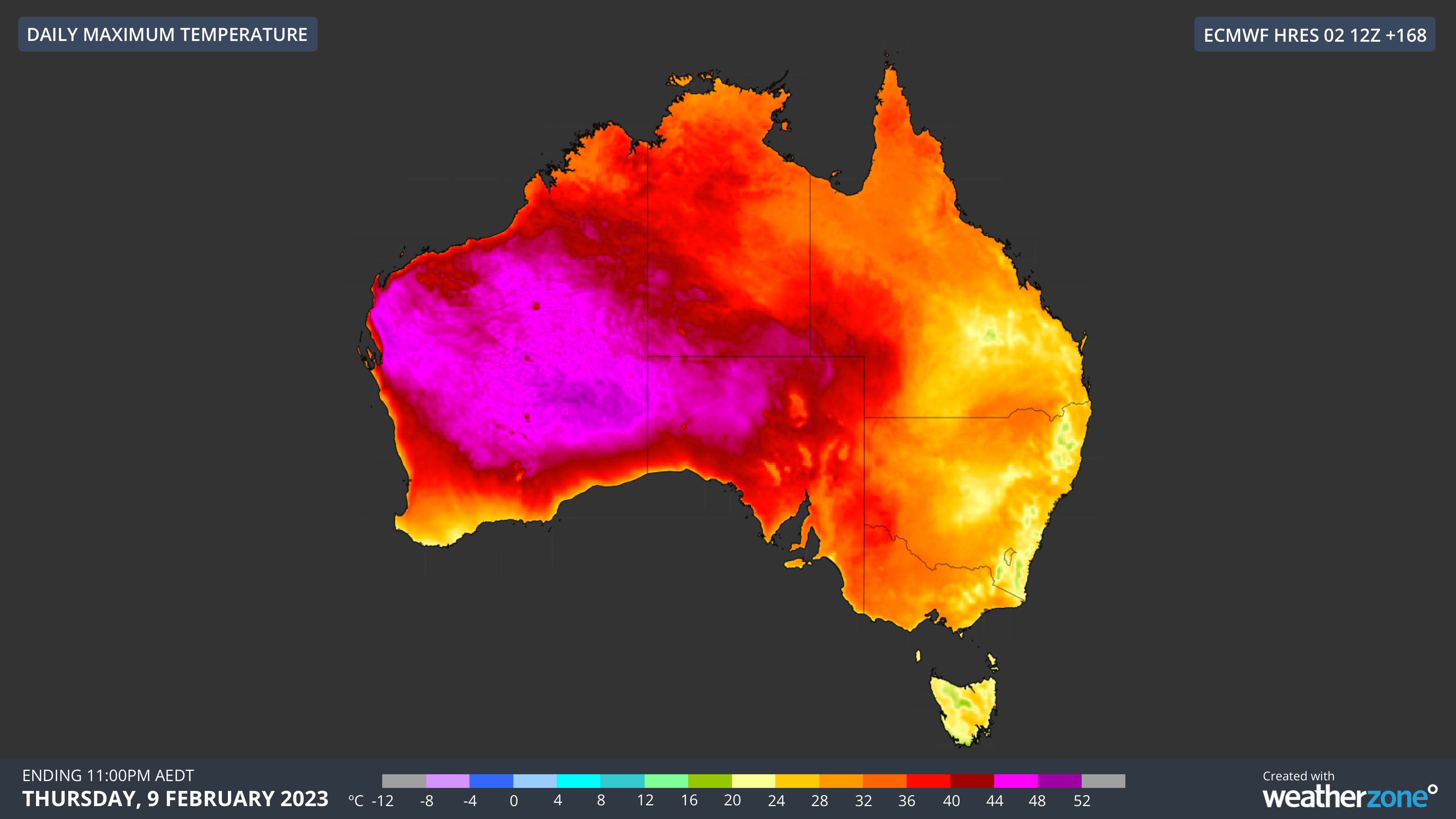
Image: Forecast daily maximum temperature on Thursday, February 9, according to the ECMWF model.
In addition to the extreme heat and heavy rain over the Australian continent next week, there will also be a lot happening over the waters surrounding the continent.
The return of the Madden-Julian Oscillation will enhance the risk of tropical cyclone development in the Australian region next week. Some models even suggest that there could be multiple tropical cyclones in the region by the middle of the week, however it’s too early to know whether any potential tropical cyclones will directly affect the Australian coastline.
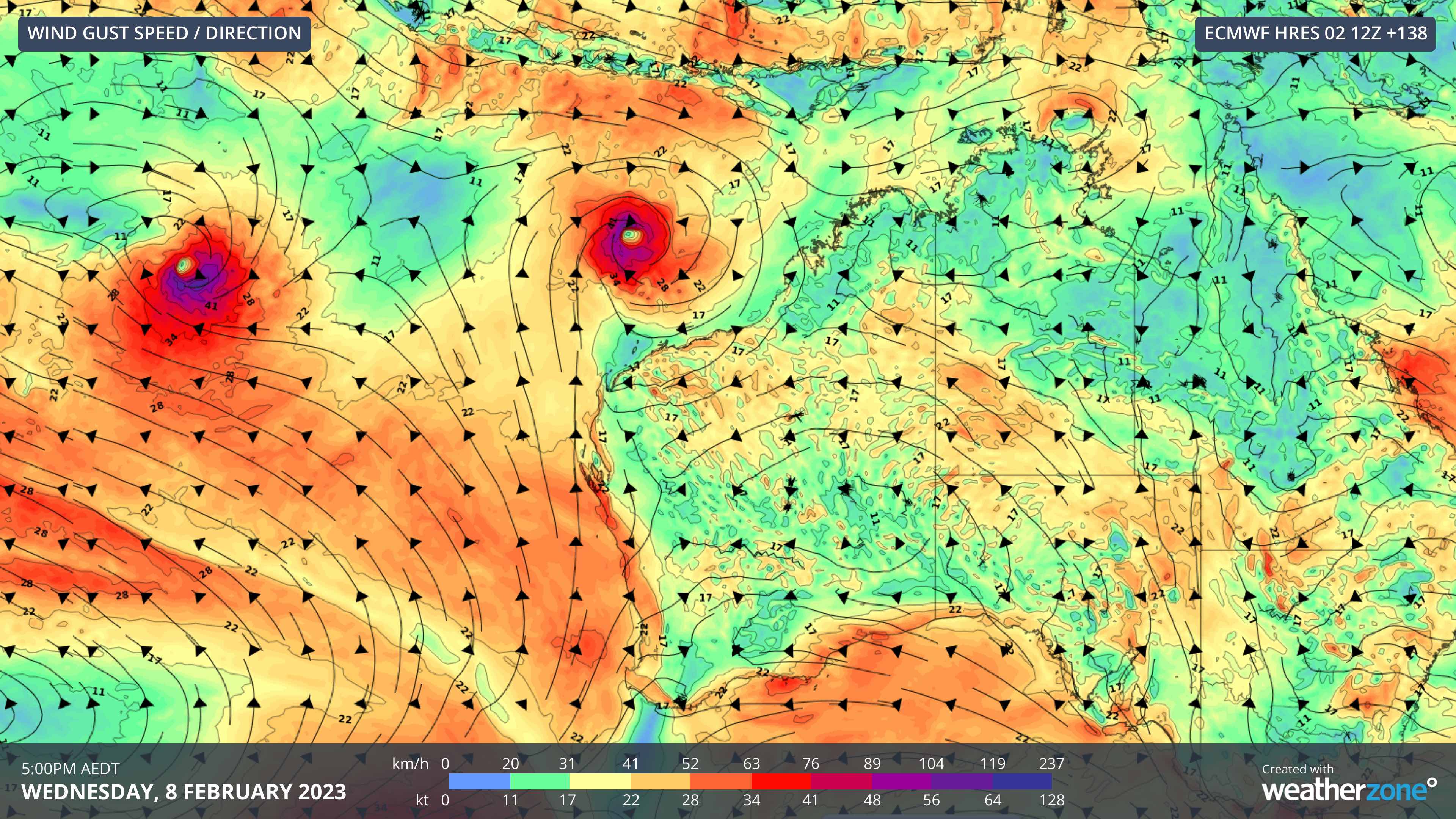
Image: Forecast wind gust speed and direction on Wednesday next week, according to the ECMWF-HRES model, showing two potential tropical cyclones to the northwest of Australia.
There is potential for dangerous weather in several states and territories next week, so be sure to keep up to date with the latest forecasts, warnings and weather news throughout the week.