
Why is it so windy in Australia this week?
Severe weather warnings for damaging winds are stretching across four states today, spanning an area from Western Australia to NSW.
This comes after wind gusts of 135 km/h were recorded in South Australia on Saturday and Western Australia early on Tuesday morning.
So, what's making it so windy in Australia this week?
The image below shows what our side of Earth looked like at 4pm AEDT on Tuesday. This spectacular view was captured by the Himawari-8 satellite from close to 35,800 kilometres above the ground.
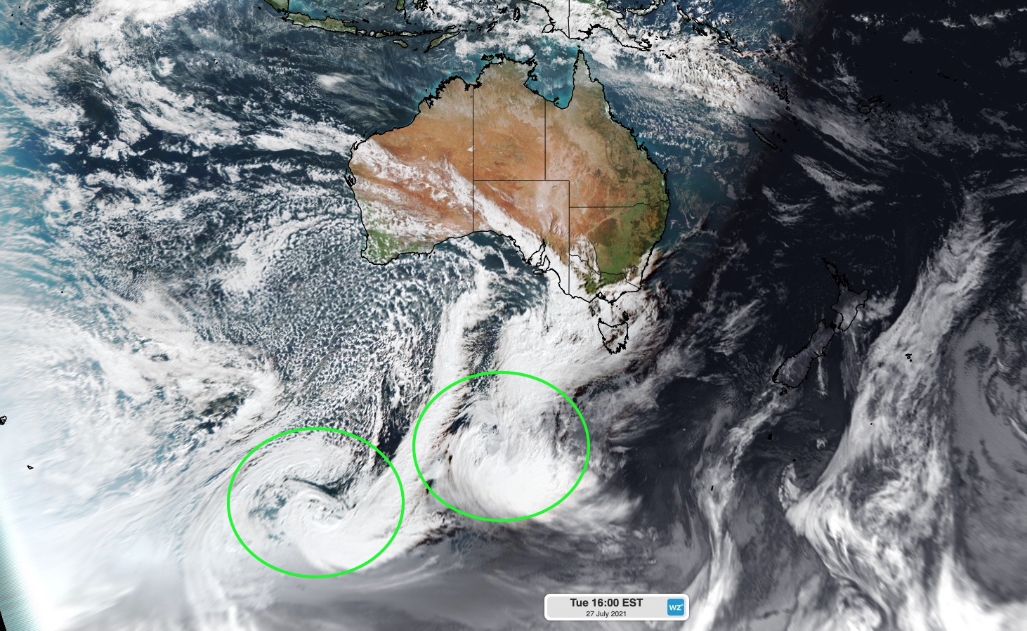
Image: Himawari-8 visible ture colour satellite image captured at 4pm AEST on Tuesday, July 27. The green circles have been added to highlight a pair of low pressure systems.
The green circles on the image above highlight two deep low pressure systems. While these lows are located a few thousand kilometres to the south of Australia, they are playing a key role in producing this week's wild winds.
Wind occurs when air flows between two areas of contrasting pressure. It's simply the atmosphere trying to restore equilibrium when too much pressure builds up in one area and much lower pressure develops somewhere nearby.
Meteorologists monitor air pressure near the ground using synoptic charts. These maps use unbroken lines, called isobars, to connect areas that have the same atmospheric pressure at sea level. The map below shows a synoptic chart at 4pm AEST on Tuesday.
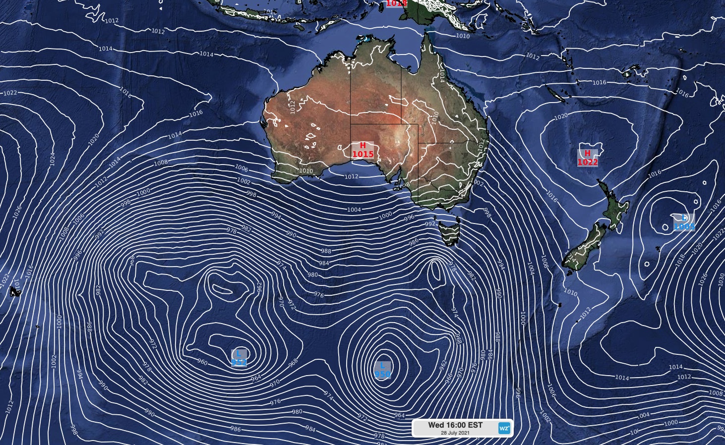
Image: Mean sea level pressure at 4pm AEST on Tuesday, July 27, according to the ECMWF model.
The chart above has a lot of white lines sitting close together to the south of Australia. These tightly packed isobars mean there is a large pressure gradient between the low pressure systems at the bottom of the image and areas of high pressure over and near Australia.
This large pressure gradient is creating powerful winds as the atmosphere attempts to balance things out. Unfortunately, Australia just happens to be in the firing line of this atmospheric stand-off.
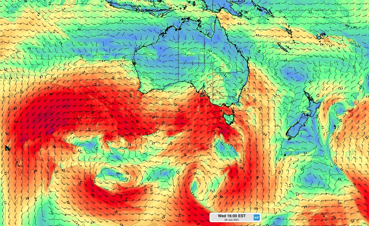
Image: Surface wind speed and direction at 4pm AEST on Tuesday, July 27, according to the ECMWF model.
As a result, damaging winds will spread across parts of Western Australia, South Australia, NSW, Victoria, Tasmania and the ACT between Tuesday and Friday. Be sure to check the latest warnings in your state.