
Whippet unimpressed by rare frost in unusual places
This chilly whippet is one of thousands of Australian dogs whose early morning walk has been significantly colder than usual in recent days.
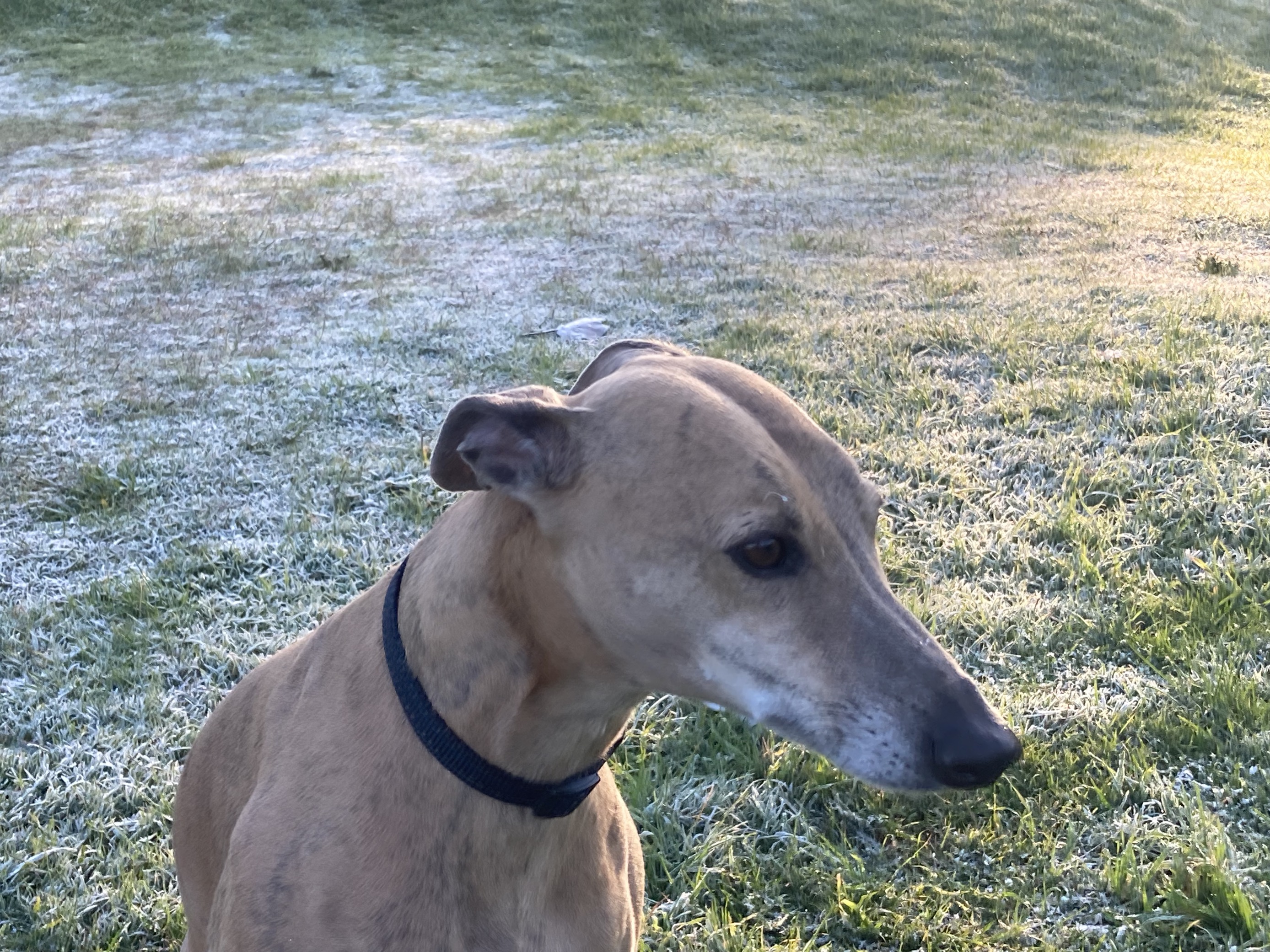
Image: Temps at ground level can be a few degrees colder than air temps a metre or two above the ground, where weather stations are routinely located. Source: author’s pic.
Cold, dry air circulating around a high pressure system has brought frost to many locations in eastern NSW and northern Qld which don't often see frost in the heart of winter, let alone late autumn.
The outer western suburbs of Sydney have endured several nights of subzero temps, while even the city's inner suburbs have been cold, with a low of 2.8°C at Canterbury on Sunday morning. That's the weather station closest to this park where Pepper the whippet found a rare frosty surface, with the ground much slipperier than usual as he chased his ball.
Frosty weather has also extended all the way up to northern parts of Queensland.
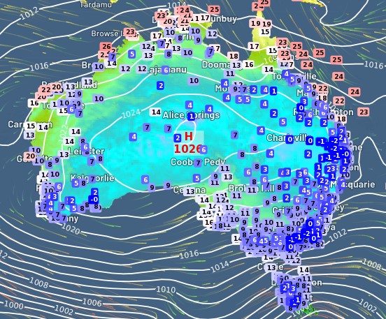
The graphic below shows live temps at 6:30 am Monday AEST. As you can see, freezing temps extend well up into Queensland, including a reading of zero at a site near Rockhampton which is technically in the tropics (as in, it's north of the Tropic of Capricorn).
Numerous locations experienced their coldest May mornings in many years on Monday morning, including:
- Woolshed 3.2°C (Qld, coldest May morning in 22 years)
- Gold Coast Seaway 8.2°C (Qld, coldest May morning in 19 years)
- Lismore Airport 0.1°C (NSW, coldest May morning in 17 years)
Many places also saw their coldest temps in any month for several years on Monday morning. These included:
- Lismore Airport 0.1°C (NSW, coldest morning in any month for three years and eight months)
- Hughenden 0.8°C (Qld, coldest morning in any month for two years)
Hughenden is located on North Queensland's Flinders Hwy, roughly halfway between Mt Isa and Townsville, so that gives you a really good idea how far north this dry cold air has penetrated.
Nights will remain cool this week in most of the places mentioned, but as the high pressure system currently centred over Central Australia drifts east, the coldest air from the current airmass will be directed towards the Tasman Sea.
So you can expect minimums to bump upwards by a few degrees in most places, but nights will still feel pretty wintry this week, which is appropriate as winter starts this Thursday, June 1.