
When a Bushfire makes its own Weather

A bushfire near Dargo, Victoria has produced its own thunderstorm out of the smoke.
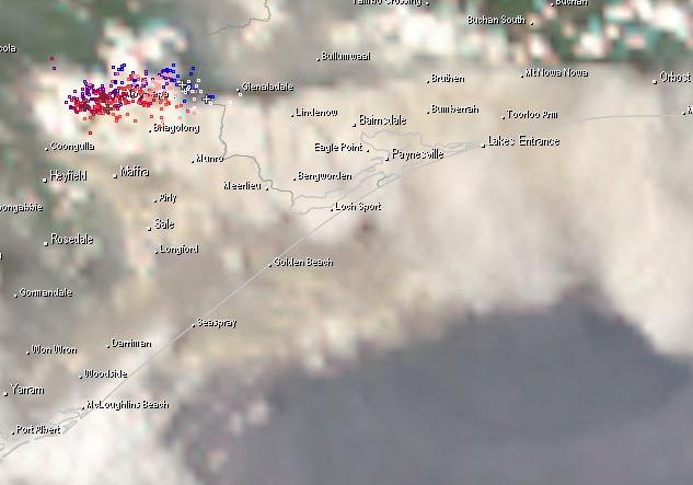
Image: Smoke from a bushfire at Dargo has created a thunderstorm at 3pm Sunday
Thunderstorms such as these are know as pyrocumulus thunderstorms. They form clouds out of the rising hot smoke created by a bushfire.
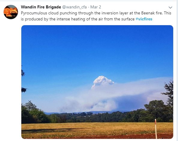
Image: A pyrocumulus cloud from bushfire at Beenak on Saturday
In this case today, the cloud has risen enough to create its own thunderstorm. The unfortunate thing about pyrocumulus thunderstorms is they rarely produce any rainfall and can help start new fires from lightning strikes ahead of the main fire.
This weekend, fire conditions have been rated Very High or Severe for all regions in Victoria, with temperatures in the mid-to-high thirties, humidity below 20% and persistent northerly winds gusting above 50-60km/h.
As these bushfires continue to burn, it is important to stay up to date with the latest bushfire warnings at http://emergency.vic.gov.au/respond/