
What is a northwest cloudband?
Cloud, rain and thunderstorms are expected to impact a large area of Australia this week, as a northwest cloudband sweeps across the country.
So, what is a northwest cloudband?
The name northwest cloudband refers to a vast layer of cloud that flows over Australia from the northwest. Once fully developed, the cloudband stretches across the country like a sash from the northwest to southeast.
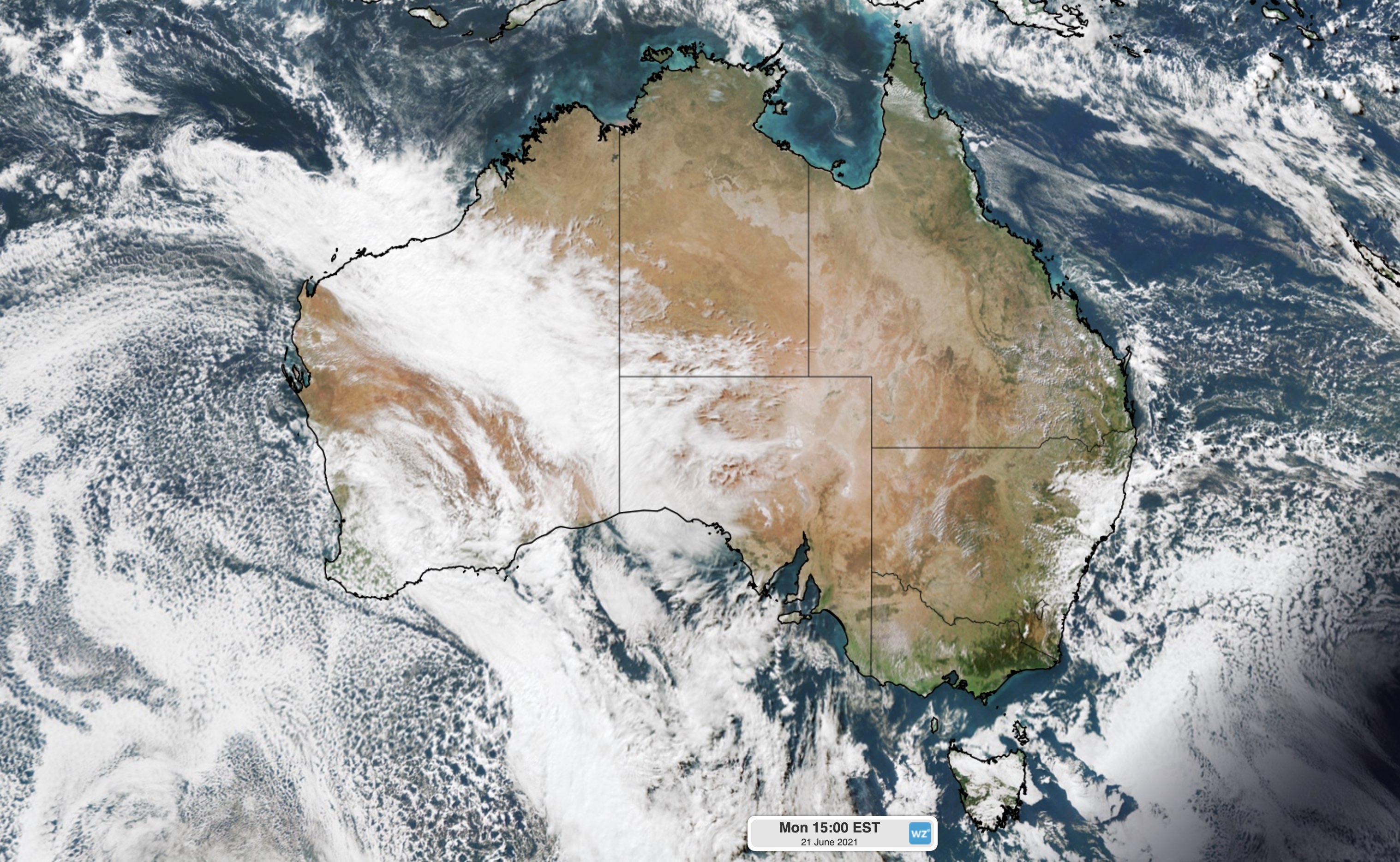
Image: A northwest cloudband developing over the western half of Australia on Monday.
Northwest cloudbands form when humid and warm tropical air over the Indian ocean moves towards the southeast and passes over Australia. As this warm and humid air moves further south, it rises over cooler air in the mid-latitudes and produces clouds.
The oceans off the northwest shelf of Australia are currently warmer than average, which is enhancing the amount of moisture into our atmosphere and providing the fuel for a northwest cloudband.
This week's cloudband is also being enhanced by a strong jetstream in the upper-atmosphere and mid-latitude low pressure system that's passing to the south of Australia.
Northwest cloudbands mostly occur during the cooler months of the year and are more common from April to September.