
Wettest start to May in two decades for Sydney
Every day in May so far has brought rain to Sydney, with the lowest daily fall still 3mm (on Tuesday 7th).
Just over 170mm has accumulated for the month so far, which is more than the total long-term monthly average, and the wettest start to May since 2001. Even record wet 2022 had a relatively dry start to May and it’s 81 years since there were 11 consecutive May days of more than 3mm in Sydney.
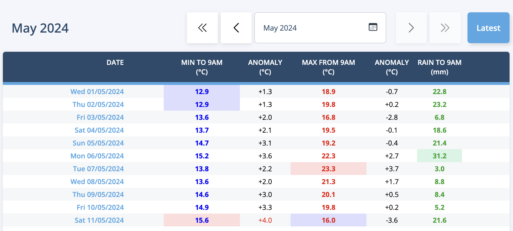 Image: Observational table for Sydney for May so far, showing daily rainfall in the last column.
Unfortunately, it’s not going to stop for the weekend. As predicted, a deep trough over central parts of NSW is drawing in masses of moisture as it tracks east, and rain will persist over Sydney and surrounds on Saturday and overnight into Sunday. Further rain of 30-50mm is likely for many suburbs between Saturday morning and Sunday afternoon, with isolated heavier falls of 80+ mm possible for some eastern suburbs.
The focus of the rain will shift southward towards the Illawarra and northern South Coast from later Saturday as the trough starts to swing east over the coast. This will lead to northeasterly winds converging over these more southern areas while less saturated southwesterlies start to stream over areas further north and west.
Monday will be much drier, with just a few isolated showers as the trough moves offshore.
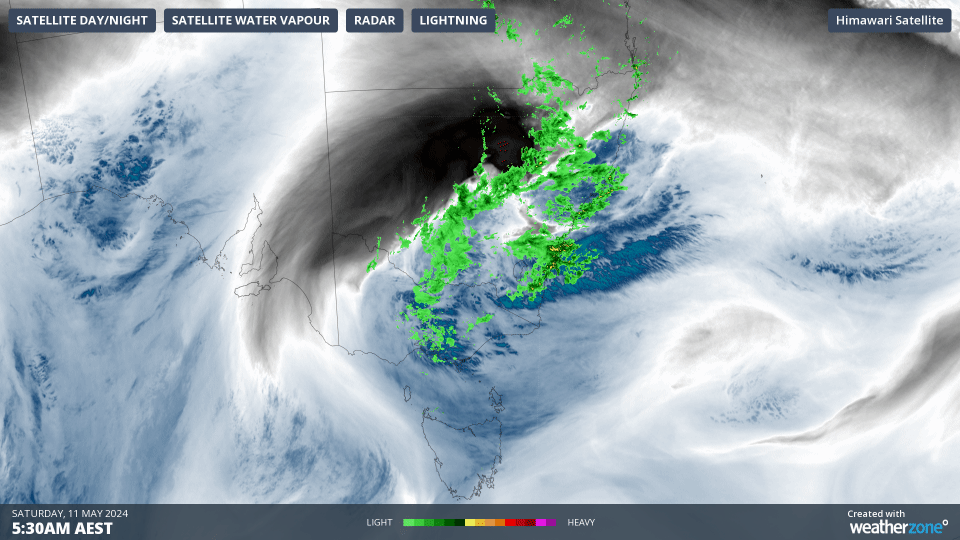
Image: Animation of water vapour satellite imagery and radar for the 3 hours to 830am AEST Saturday 11th over southeastern Australia.