
Was that fog or mist in Sydney this morning?
Parts of Sydney were shrouded by thick fog on Friday morning, engulfing the Harbour Bridge and reducing visibility to 100 meters in some suburbs.
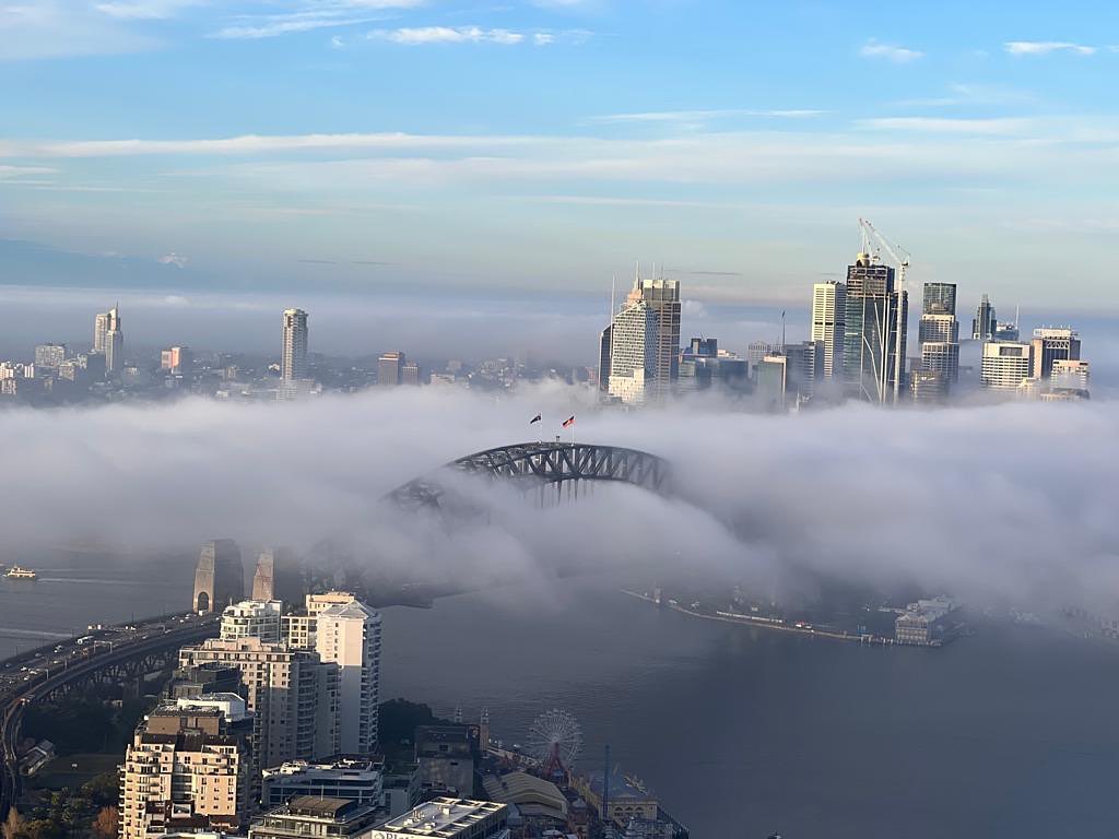
The photos below show the foggy scenes across Sydney on Friday morning.
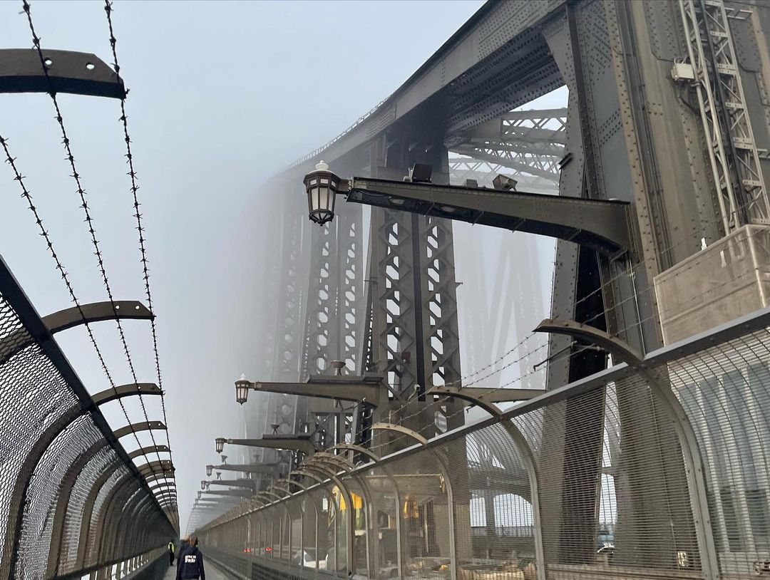
Image: Sydney Harbour Bridge in thick fog on Friday, May 27, 2022. Source: @veganlifelover / Instagram
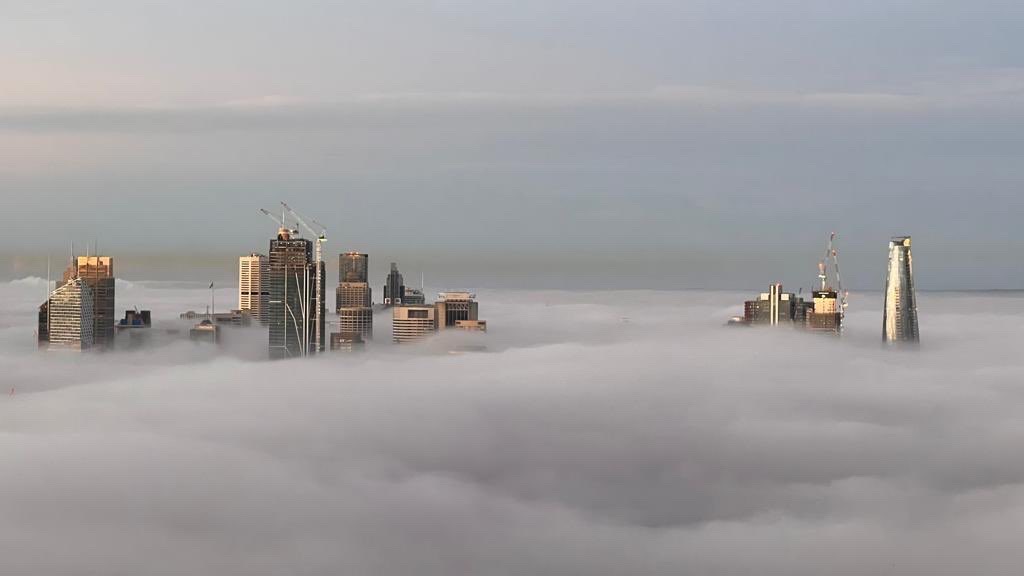
Images: Parts of the CBD were high enough to poke above the fog on Friday morning. Source: @mia_and_the_outfit / Instagram
We know the images above show fog and not mist because of a simple difference between these two phenomena:
- Fog is present when visibility is less than 1000 metres
- Mist is present when visibility is more than 1000 metres
Ground-based sensors recorded visibility down to 100 metres at Richmond, 200 metres at Camden, 300 metres at Olympic Park and 600 metres at Sydney Airport on Friday morning. So, we know this was fog.
What caused Friday’s fog?
The air over eastern NSW is currently carrying some extra moisture thanks to the evaporation of recent rainfall and lingering groundwater from a run of wetter-than-average months.
On Thursday night, this airborne moisture was converted from a gas (water vapour) into tiny liquid droplets (fog) when the air near the ground cooled to a temperature called the dew point. The dew point is simple the temperature air needs to reach for condensation to occur, and when there is more moisture in the air, its dew point temperature is higher.
Clear skies and relatively light winds on Thursday night allowed temperatures to drop steadily across the Sydney Basin. By the early hours of Friday morning, the temperature had reached the dew point in multiple suburbs and fog became widespread. Fog also developed over other areas of eastern NSW on Friday morning, as shown by the slightly yellow shading at the centre if the satellite image below.
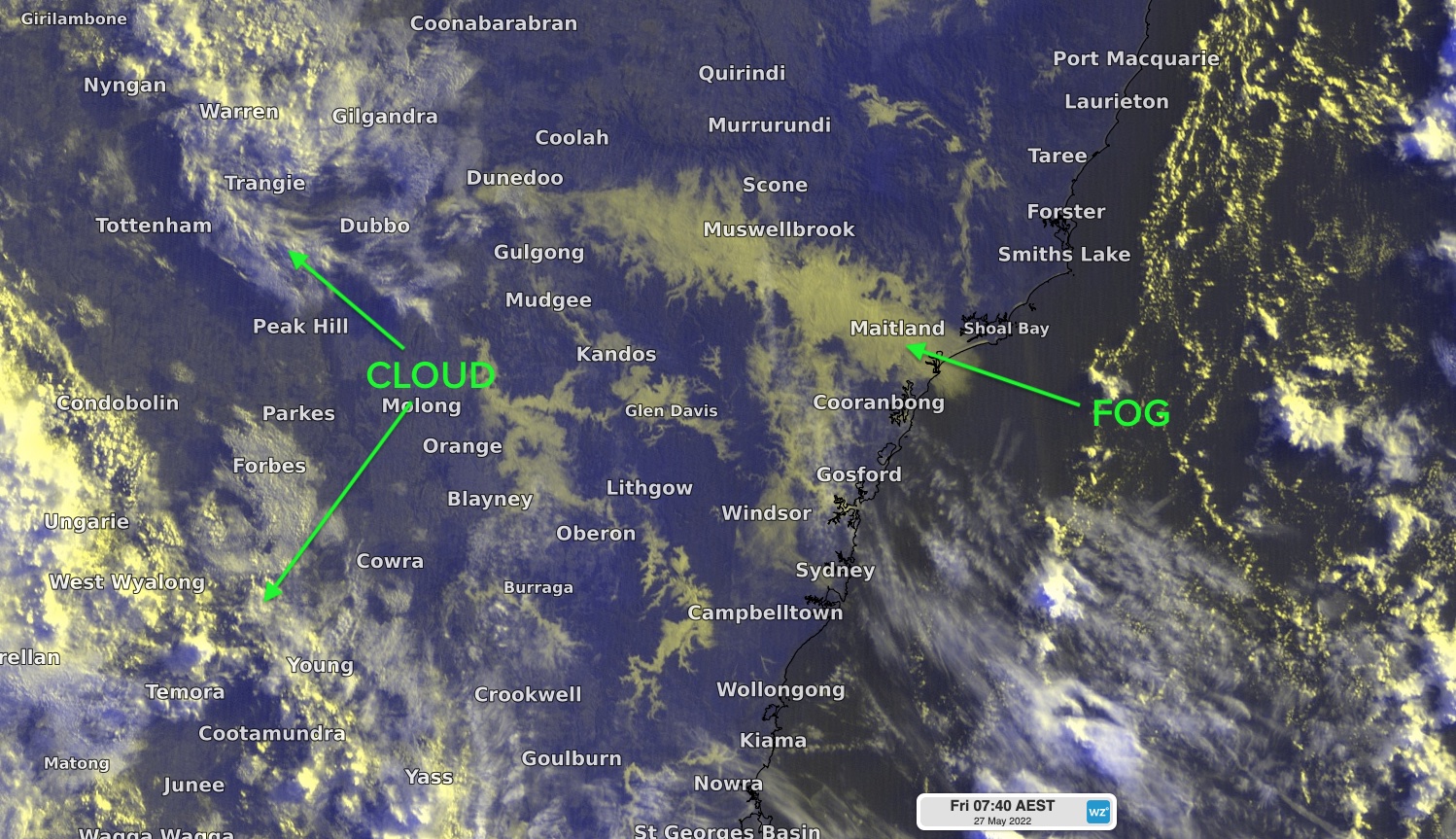
Image: The widespread fog over eastern NSW on Friday morning could be seen from space. In Sydney, the fog developed in the western suburbs before being blown towards the city and coast by a gentle land breeze.
Fog can be dangerous and disruptive when it affects transport networks. Unsurprisingly, a road weather alert was issued for all Sydney suburbs on Friday morning, advising motorists to take extreme care on the roads.
With so much water still lingering in the landscape, fog is likely to be a frequent feature in Sydney in the coming months.