
Tropical rain to follow heatwave and fire danger
An intense summer heatwave will sweep across southern and eastern Australia this weekend and early next week, before a burst of tropical rain douses the nation's south.
A near-stationary high pressure system over the Tasman Sea will cause hot air from central Australia to spread through the nation's southern and eastern states in the coming days.
Temperatures could climb more than 10ºC above average in some areas, with the abnormal summer heat lingering for a few days and nights. This intense heat will persist for long enough to be classified as a severe or extreme heatwave in multiple states and territories. These are the two highest categories on the three-tiered scale used in Australia.
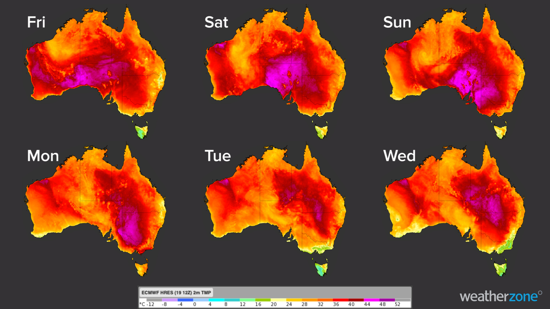
Image: Forecast surface temperature at 4pm AEST during each of the next six days, according to the ECMWF-HRES model.
The impending heat, which will be dangerous on its own, will also elevate the risk of bush and grass fires in some areas.
South Australia's Country Fire Service has issued total fire bans for six of the state's 15 districts on Sunday and four on Monday, with fire danger ratings anticipated to reach Severe to Extreme levels.
Severe fire danger has also been forecast in parts of Victoria and NSW on Monday, which will be the hottest day of the heatwave in both states.
Temperatures will reach the low to mid-forties over inland areas of central, southern and eastern Australia between Friday and Monday. Some capital cities are also in line to have at least one day in the forties, including Adelaide on Sunday, Melbourne on Monday and western Sydney on Tuesday.
There's a good chance that the impending heatwave in southeastern Australia will be enhanced by a tropical low pressure system that's currently developing near northwestern Australia. The link between these two weather events at opposite ends of the country was discovered by Australia researchers after the heatwave that preceded the Black Saturday bushfires in 2009.
But this complex interaction isn't the only way southeastern Australia will feel the effects of the tropical low.
After making landfall along the north coast of WA on Friday night as a low pressure system or weak tropical cyclone, the remnants of this system are likely to carry a large mass of moisture-laden air towards southern Australia.
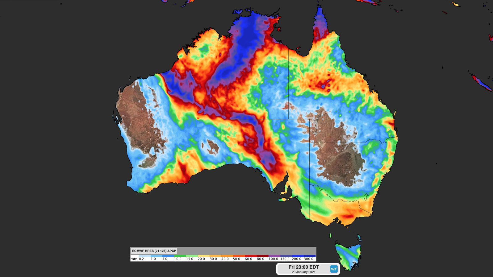
Image: Forecast accumulated rain between now and next Friday according to the ECMWF model.
A number of forecast models suggest that this injection of tropical air will cause rain and possibly thunderstorms over the Red Centre from Sunday before spreading over parts of South Australia, Victoria, Tasmania and NSW next week.
This rain could cause flooding in some areas and might also help to put out bushfires that were ignited during the heatwave preceding it.