
Tropical Cyclone spinning up near Cairns
A tropical low is deepening off the north Queensland coast, and is likely to become Tropical Cyclone Niran in the near future.
At 11:30am EST Sunday, a tropical cyclone watch was issued by the Bureau of Meteorology for the coast between Cape Flattery and Lucinda, including Cairns, Port Douglas, and Innisfail. These areas should prepare for gale force winds in the next 48 hours.
This tropical low/cyclone will linger close to the coast for several days; until at least Thursday before it starts to speed-up and head east-southeast. In the meantime, winds and waves will steadily build as the cyclone strengthens. The system could become a category 2 system on Wednesday and maybe a severe category 3 cyclone by Thursday.
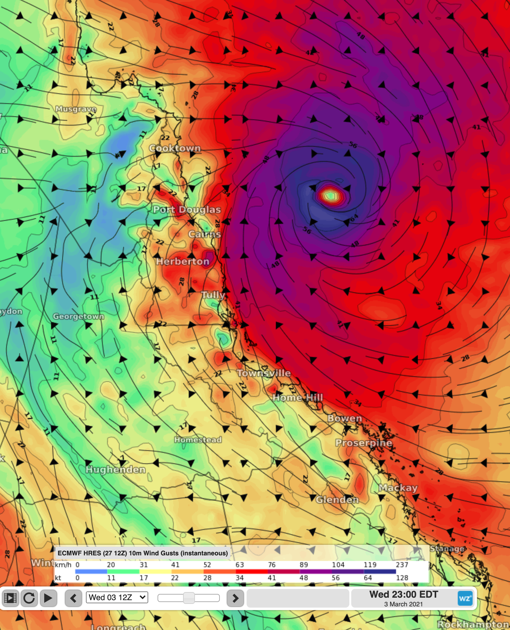
Image: Forecast wind gusts on Wednesday evening. Generally red and purple colours represent strong winds
While the worst winds will be confined over the ocean, the biggest threat with this system is likely to be flooding. The coast between Cooktown and Mackay has been rather wet the past week, and another widespread 100-200mm is expected over the coming few days. Isolated falls of 300-500mm are also possible, likely leading to riverine and flash-flooding.
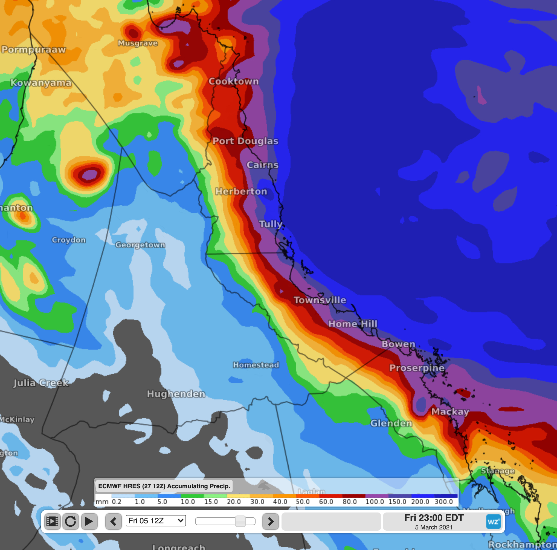
Image: Forecast weekly rainfall over the region. Any purple or dark blue rainfall is enough to cause flooding
With this situation rapidly evolving, keep up to date with the latest cyclone developments here and the latest warnings here.