
Tropical Cyclone Niran gaining strength over Coral Sea
Severe Tropical Cyclone Niran is deepening as it barrels across the Coral Sea towards New Caledonia, where it's likely to cause severe weather this weekend.
At 10am AEST on Friday, Niran was a category four severe tropical cyclone with wind speeds estimated to be averaging 165 km/h, and gusting to 230 km/h, near its core.
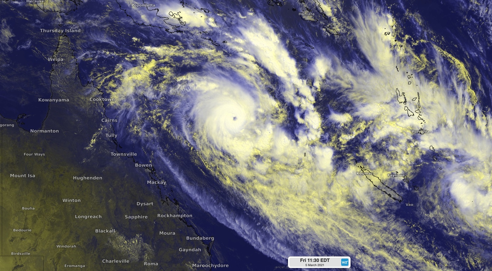
Image: Tropical Cyclone Niran showing a distinct eye on Friday as it moved over the Coral Sea towards New Caledonia.
The cyclone is moving quickly (37 km/h at 10am Friday) across the Coral Sea in a southeasterly direction, on a track away from Queensand and towards New Caledonia.
Niran is expected to strengthen further in the next 24 hours. Wind speeds near its core are forecast to reach 195 km/h (with higher gusts) on Friday night, which is only 5 km/h below category 5 intensity.
Models suggest the Tropical Cyclone Niran will pass close to or over New Caledonia region on the weekend, most likely as a category four cyclone, before weakening from Sunday.
According to Météo-France, parts of New Caledonia could experience:
- Very destructive wind gusts in the order of 200 km/h on Saturday or Sunday
- Flooding rainfall from as early as Friday and into the weekend
- A storm surge and dangerous waves, which could locally exceed six metres, and coastal inundation on the weekend.
Niran is no longer expected to have any direct impact on the Australian mainland.