
Tropical Cyclone Kimi gaining strength ahead of possible landfall
Tropical Cyclone Kimi could cause flooding rain and destructive winds in parts of northeast Queensland during the next couple of days.
Kimi became Australia's third named tropical cyclone of the season when it developed over the Coral Sea late on Sunday morning. At 7am EST on Monday, the cyclone was a category one system, located about 85 km to the east-northeast of Cairns and moving towards the south.
Tropical Cyclone Kimi's close proximity to the Queensland coast means it can be detected by the radar in Cairns. This radar imagery showed Kimi's eye moving towards the south on Monday morning, roughly parallel to the coast, while bands of rain were being driven ashore to the system's south and west.
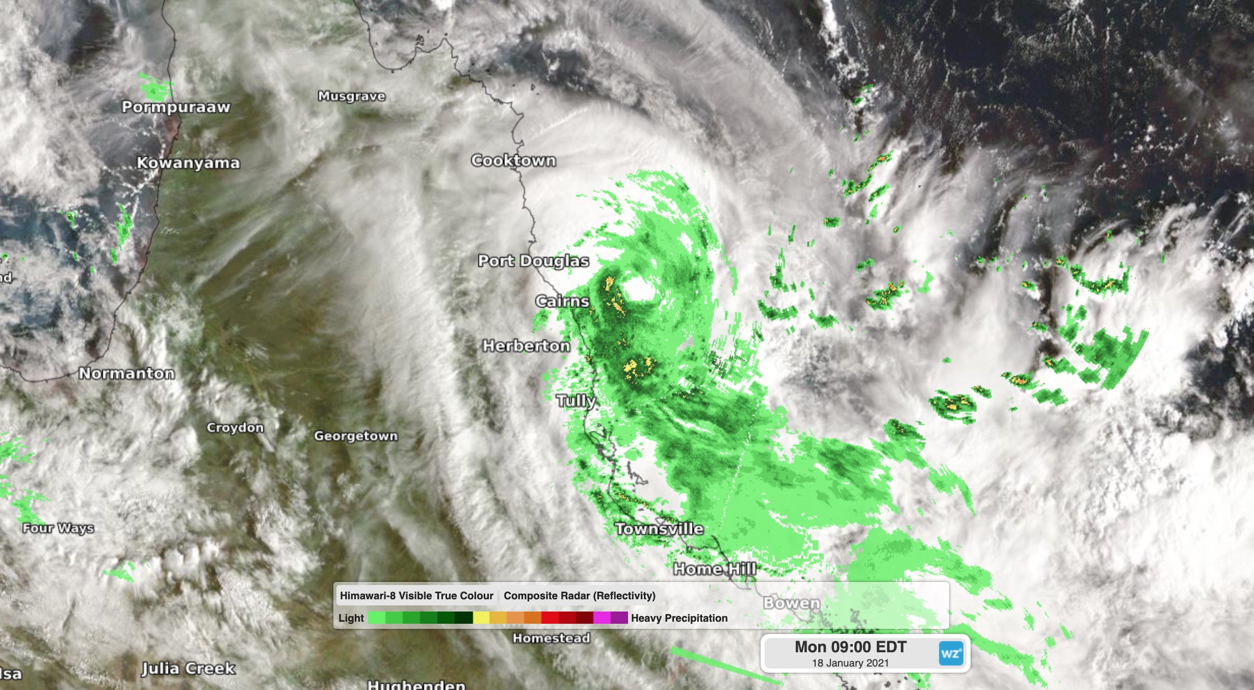
Image: Combined radar/satellite image of Tropical Cyclone Kimi to the east northeast of Cairns at 8am AEST on Monday.
The heaviest accumulated rainfall during the 24 hours to 9am on Monday occurred near Innisfail, where a rain gauge at Saltwater Creek picked up 184mm and Innisfail Wharf registered 158mm.
Looking ahead, the future path of Tropical Kimi is shrouded with uncertainty.
The official forecast track for Kimi shows the cyclone moving south and gaining strength during Monday, before turning towards the coast and making landfall on Monday night or Tuesday morning somewhere between Innisfail and Lucinda. The system could reach category two strength before crossing the coast, possibly even higher if it lingers far enough offshore for long enough.
However, some forecast models suggest that tropical cyclone Kimi will remain offshore without making landfall. This makes it very difficult to know where the cyclone will move over the next 24-48 hours.
Given Kimi's close proximity to land, heavy rain will continue to soak parts of Queensland's North Tropical Coast today and tomorrow, regardless of whether or not it makes landfall. As a result, flooding is likely as this rain falls over already saturated ground following wet weather earlier this month. A flood watch has been issued for the North Tropical Coast between Cape Flattery and Ingham, where both flash flooding and major riverine flooding are possible.
If Cyclone Kimi does drift ashore, destructive winds and a storm surge could also be added to the picture. These impacts will mainly occur near and just south of the tropical cyclone's eye.
Keep a close eye on the latest tropical cyclone advisories and track maps during the next couple of days for up-to-date information on this developing situation.