
Tropical Cyclone Freddy strengthening north of WA
Australia’s third named tropical cyclone of the season is gaining strength to the north of WA but poses no immediate threat to the Australian mainland.
Freddy became a tropical cyclone on Monday night and at 2am AWST on Tuesday, it was located 690 kilometres northwest of Broome and moving towards the south southwest at 10 km/h.
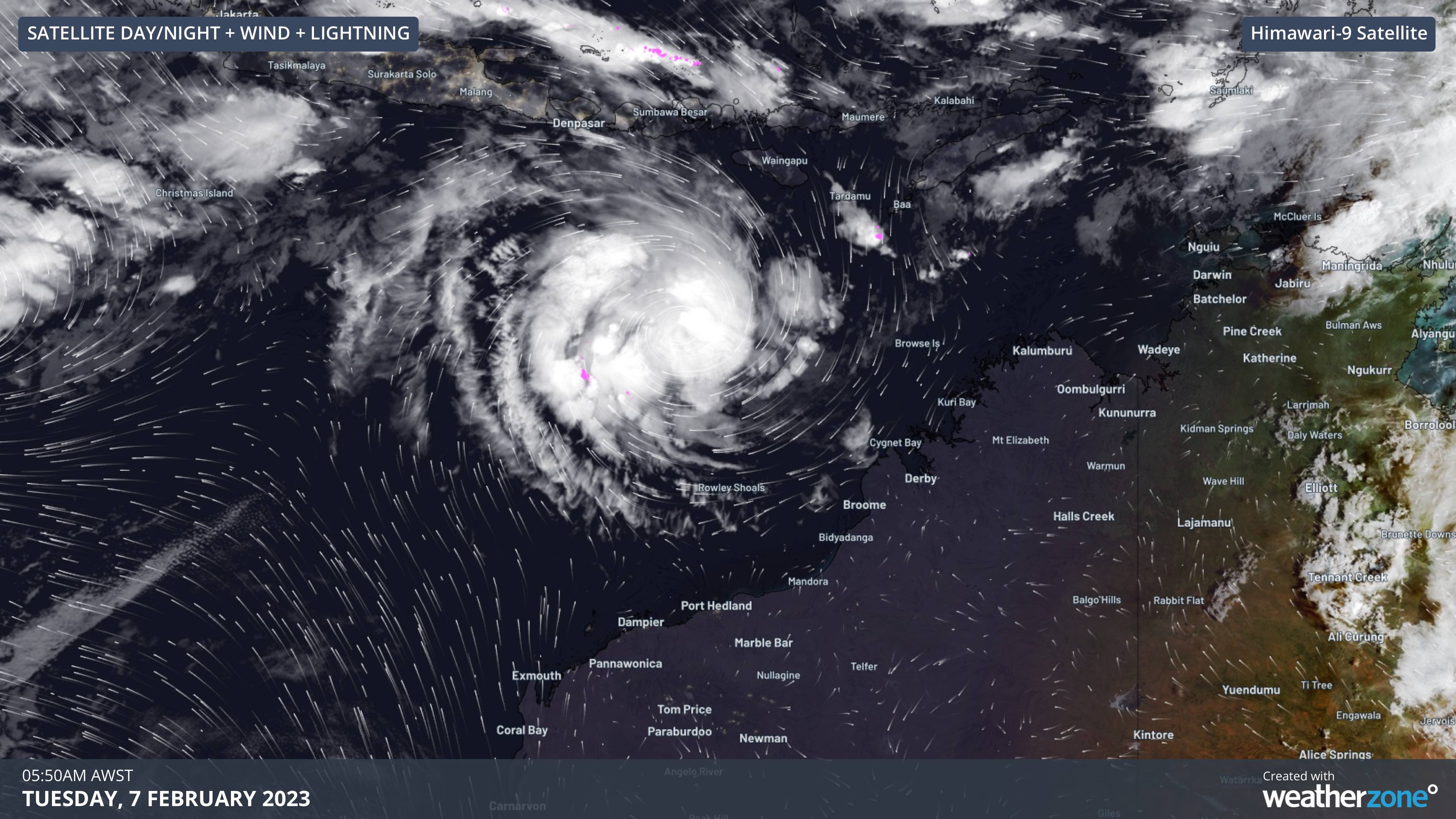
Image: Day/night satellite, lightning and modelled wind streamlines at 5:50am AWST on Tuesday, showing the location of tropical cyclone Freddy to the north of WA.
Cyclone Freddy is likely to gain strength over the next few days as it continues to move towards the southwest then west, roughly parallel but well off the northern coastline of WA. With plenty of warm, open water to fuel the strengthening cyclone, Freddy should reach category two intensity later today and may become a category three severe tropical cyclone on Wednesday.
Freddy is the third tropical cyclone to be named in Australia's area of responsibility so far during the 2022-23 season, which runs from November until April. It follows Darian and Ellie, both of which formed in December.
There are also two other Tropical Lows currently in the Austarlian region.
One Tropical Low is located roughly 2,000 km to the west of Freddy. While there was some potential for this system to also become a tropical cyclone earlier this week, this now looks unlikely.
Another Tropical Low is spinning over the western Pacific Ocean, located about 1230 kilometres northeast of Mackay at 4am AEST on Tuesday. This system will pick up some energy as it moves south over the warm Coral Sea in the coming days, likely becoming a tropical cyclone late Tuesday or on Wednesday. If this is the next tropical cyclone to form in Australia's area of responsibility, it will be named Gabrielle.
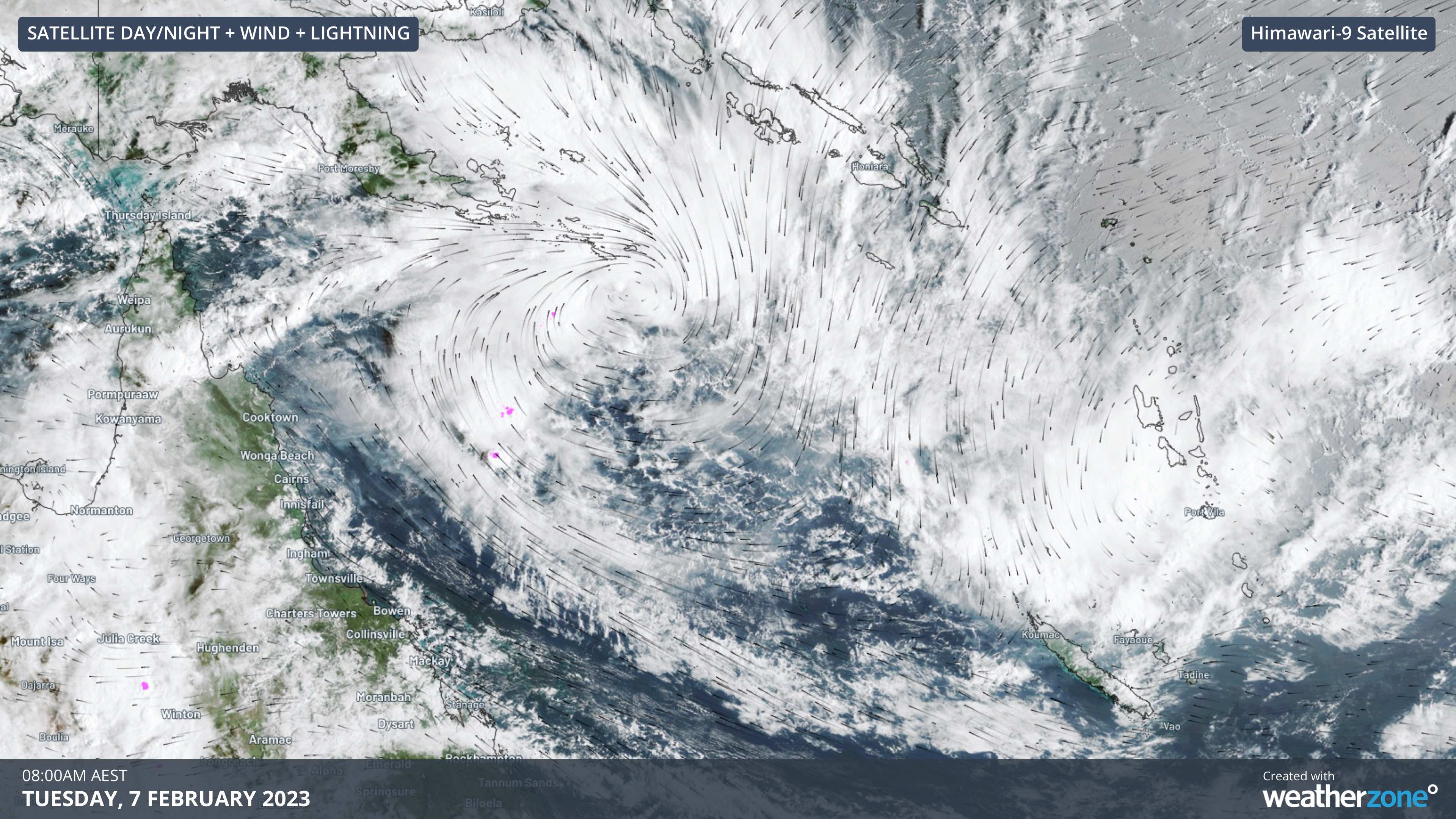
Image: Visible ’true colour’ satellite, lightning and modelled wind streamlines at 8:00am AEST on Tuesday, showing the location of a Tropical Low over the northern Coral Sea.
While soon-to-be Tropical Cyclone Gabrielle is not expected to make landfall in Australia, it should cause southerly winds to strengthen along the Qld coast over the next few days. It could also send a large and powerful swell towards eastern Australia later in the week.
You can stay up to date with the latest details on these developing systems by checking the most recent tropical cyclone advisories and track maps.