
Thick fog blankets parts of eastern NSW
It was a very foggy start to the weekend for many residents of NSW as a ridge of high-pressure drifts over eastern Australia.
Visibility dropped below 200m in many locations across eastern NSW, including parts of western Sydney, as the prevailing conditions proved favourable for fog formation. Calm-to-light winds, dry conditions, and very high humidity are the most critical factors that need to be satisfied for fog to form. Clear skies also help, as it allows temperatures to drop more rapidly towards the dewpoint. For those who don’t know, when the temperature reaches the dewpoint, it means the air is saturated and water vapor condenses into miniscule droplets e.g. fog
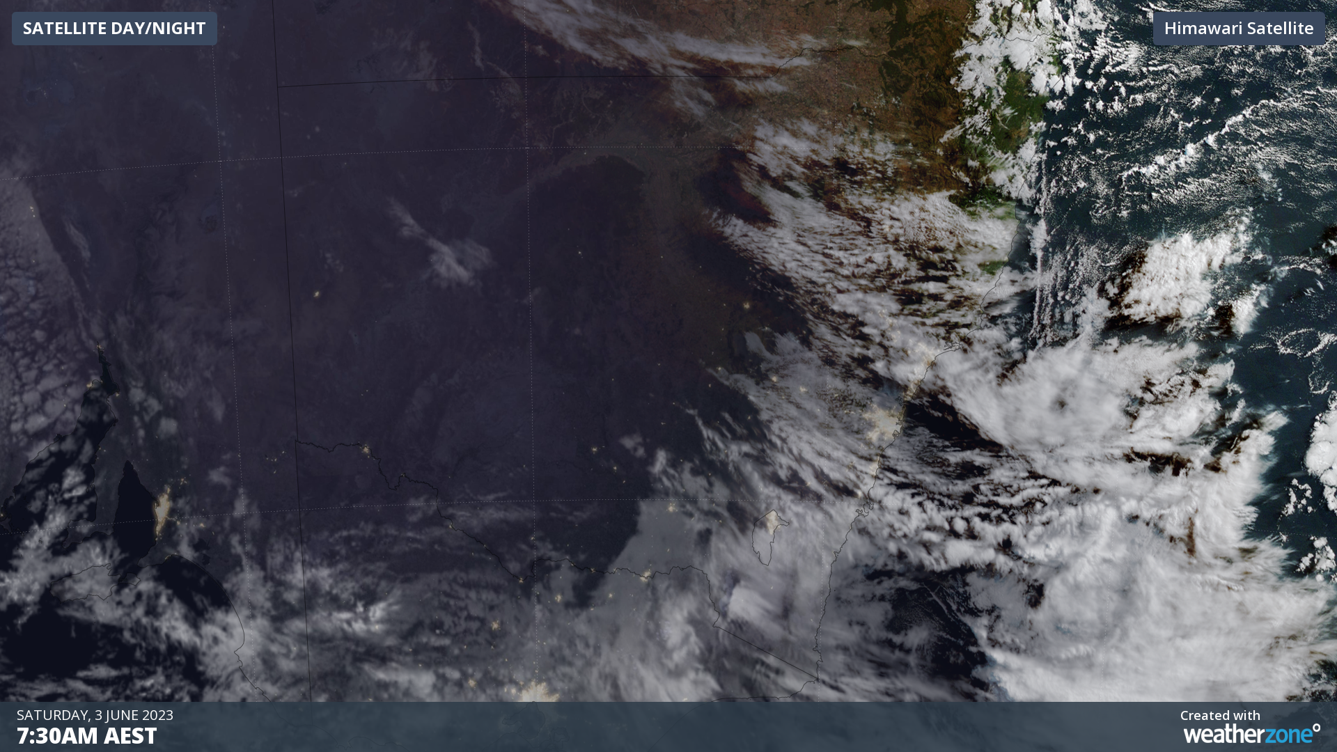
Image: Himawari satellite image of NSW at 7:30am EST Saturday 3rd of June
You can see in the above image that while there were clouds covering much of southeastern NSW overnight and into this morning, clouds were patchier over the Central and Northern Tablelands and Slopes. In addition, sustained winds were very light, and many locations recorded 100% humidity.
Visibility dropped to 0m in Moss Vale this morning, down to 100m at Goulburn Ap, Grafton Ap and Maitland, and to 200m in Scone, Glen Innes Ap, and Bathurst, as well as Oakey Ap in southeast QLD.
In Sydney, visibility plunged to 50m at Holsworthy and Camden Ap, 100m at Bankstown and 200m in Canterbury and Richmond.
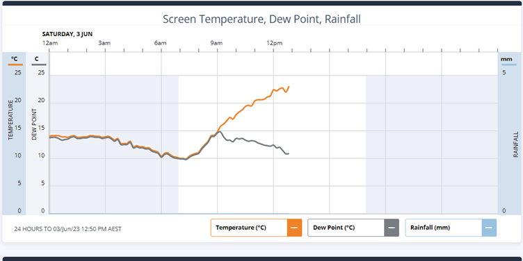
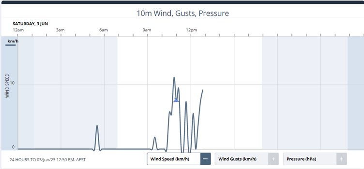
Images: observed temperature and dewpoint (top) and sustained 10m winds (bottom) for Camden from midnight to 12:50pm EST Saturday 3rd of June
Fog even formed near the coast, with Sydney Ap and Port Macquarie experiencing visibility of 400m, and Coffs Harbour Ap experiencing visibility of 300m.
As the fog lifted, skies also cleared across eastern NSW. This afternoon is shaping up to be a very warm winter day before a southerly change works its way up the east coast. Fog is less likely in Sydney tomorrow but will still be possible along the tablelands and slopes.