
Temperatures to plummet by over 10 degrees in the southeast
For residents living in the southeast of the country, Katy Perry's lyrics "cause you’re hot then you're cold" will be a very applicable phrase tomorrow.
Temperatures are soaring across a significant chunk of the country today, courtesy of a slow-moving heat trough over the interior which can be seen on the synoptic chart below.
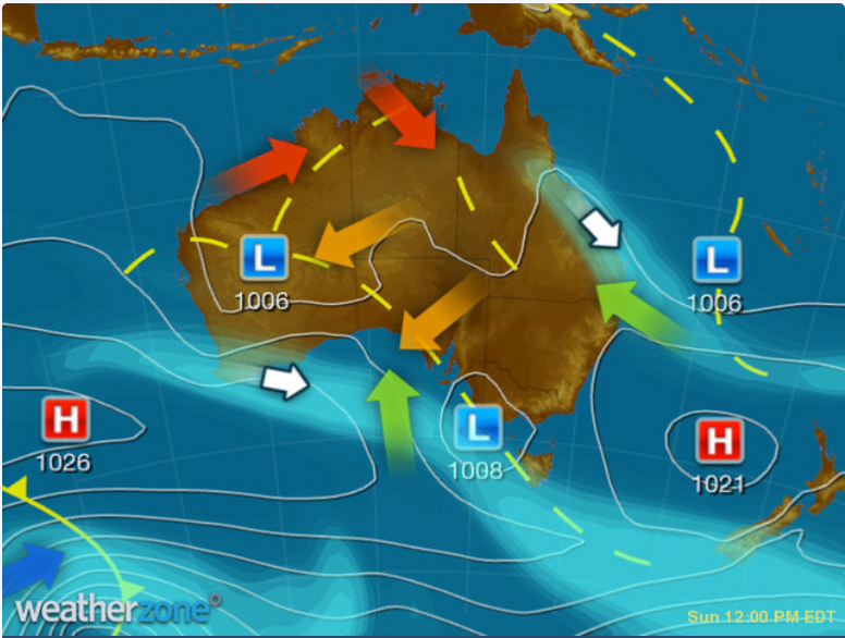
Image: Synoptic chart for today (Sunday 4th) showing troughs (dashed yellow lines)
As you can see, there is a very broad trough extending from Western Australia, all the way across into Tasmania. This is dragging hot air which typically lies over the interior into cities closer to the coast. It also interferes with the seabreezes coastal regions receive, which usually drop temperatures by a couple of degrees depending on its strength. Unfortunately, that trough is sending warm northerly winds from the interior into the southeast, preventing seabreezes from forming in some cities such as Melbourne.
Melbourne and Adelaide have both been caught up in this heat event, and are currently sitting well above average for a typical December day. Melbourne is forecast to reach 34°C today while having an average of 24°C in December, and similarly, Adelaide is forecast to reach 36°C today (which it has already hit!) while averaging 27°C on a typical December day.
Not only is the heat not typical, but the cooler temperatures tomorrow are also several degrees below average. Colder air will surge into the region behind this trough, bringing about a 23°C and 19°C day tomorrow for Adelaide and Melbourne respectively. That's a 13-degree difference in daytime temperatures in Adelaide, and 15-degrees in Melbourne!
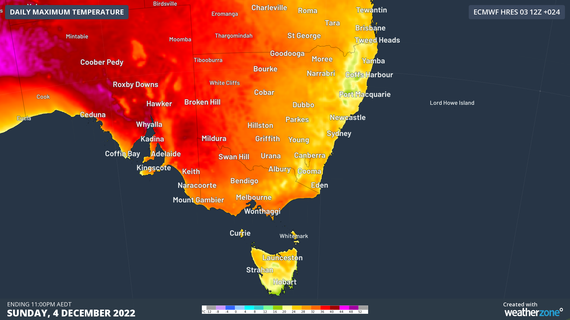
Image: Maximum temperatures for southeast Australia on Sunday 4th using ECMWF model
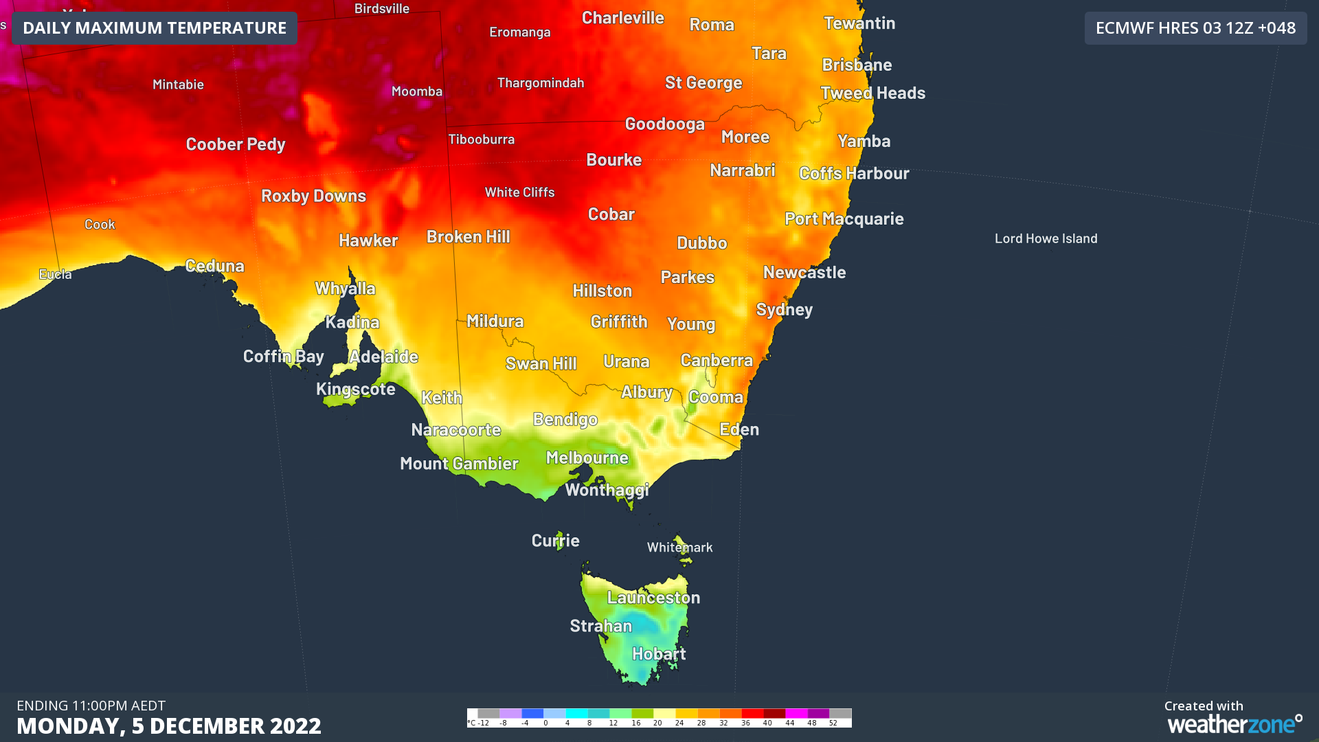
Image: Maximum temperatures for southeast Australia on Monday 5th using ECMWF model
An additional cold front later in the week will keep temperatures on the cool-to-mild side over southeast Australia, however eastern Australia will see temperatures rise before they fall. The trough will continue barrelling across the east of the country next week ahead of a cooler change.