
Tasman low whipping up winds and waves for NSW coast
The low-pressure system off the NSW coast that has been generating severe weather over the past couple of days is continuing to deliver windy conditions along the coast today.
A multitude of severe warnings has been issued for the system. The most recent was issued at 11am today and warned of damaging winds and surf for the coastal fringe in the far south to the Mid North Coast.
The strongest winds so far have been experienced along coastal areas of Illawarra and South Coast. Wattamolla recorded a 109km/h gust just after 11am. Montague Island, Kiama, Kurnell and Port Botany are some of the other locations to have already received gusts exceeding 80km/h. Sustained wind speeds haven’t topped 60km/h yet (Wattamolla’s 59km/h is the closest) but there is still a few hours before the winds begin to drop off.
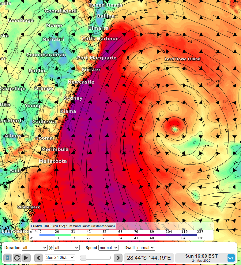
Image: Forecast surface wind gusts for Sunday afternoon, according to the ECMWF-HRES model
We saw significant wave heights peak in NSW late on Friday, with the offshore wave heights at Port Kembla and Sydney reaching 6.8m and 6.4m respectively. The swell dropped off a little over the next 24 hours but has started to increase again. At 11am today, the Sydney site had recorded waves rising to 5.8m. Waves such as these can cause beach erosion and altogether produce dangerous conditions. The southerly swell is expected to ease for locations further south as the day progresses but strengthen for northern coastal areas of NSW.
After Monday, the system is expected to weaken and move further east, easing the effects of both wind and waves on the NSW coast.