
Sydney lost in fog for three mornings in a row
Today is the third morning Sydneysiders have woken up beneath a thick blanket of fog.
The low visibility caused by Friday morning's fog has again created issues and disruptions to operations and services for several businesses, including ferries, ports and aviation - as well as disruptions to mototrists due to reduced visibility.
Fog on Wednesday and Thursday lasted well into the morning on both occasions, reducing visibility until after 10am. It cleared a little earlier in most parts on Friday, but still stuck around for long enough to cause transport delays.
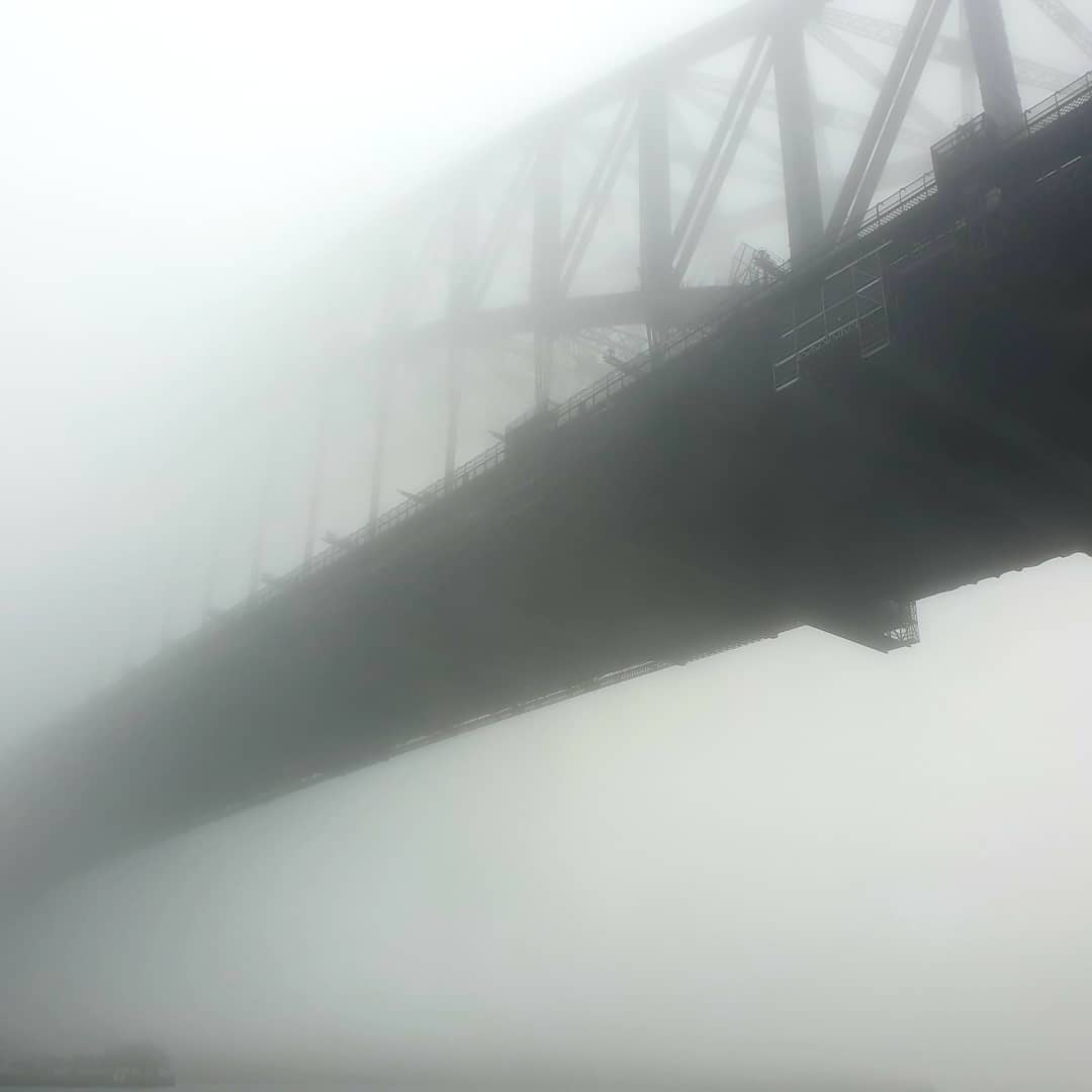
Image: We've got a lovely bridge to sell you, if only we could find it. Source: @hamgabble on Instagram.
This has been an unusual event for Sydney. Here's what usually happens with foggy weather in Sydney:
- Fog rarely forms in the city centre, but instead arrives as a wall of fog rolling in from the west.
- The fog usually forms near low-lying suburbs like Richmond in Sydney's outer northwest in the Hawkebury River basin.
- Light northwesterly winds are known to advect, or blow, thick fog along the Parramatta River and into Sydney Harbour.
- In the right setup, the fog can also drain along the Georges River in Sydney's south, which sometimes impacts the airport and Port Botany, as it has the past couple of mornings.
- And with the right wind direction and atmospheric setup, it can move across Sydney and spread into the eastern suburbs.
"The weather varies between heavy fog and pale sunshine; My thoughts follow the exact same process.”
— Amanda Scott (@tantriclens) July 1, 2021
- Virginia Woolf.
Sydney fog during the last 24hrs.#sydneylockdown pic.twitter.com/v8Hj67LfPc
So what made the last three nights in Sydney so conducive to fog?
- After days of rainfall and thick cloud, the sky cleared on Wednesday and Thursday evenings, which allowed the minimum temperatures overnight to drop. Clear skies are necessary for fog to form as cloud can trap daytime heat in.
- A high pressure system in the Tasman Sea was also generating light northwesterly winds each night, which moved the fog into Sydney's eastern suburbs during the last three mornings.
- The good news is that this high pressure system is now moving east, making fog much less likely on Friday night into Saturday morning.
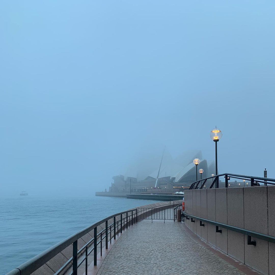
Image: The Phantom of the Opera House. Source: @kaisakaisakaisa on Instagram.
Remind me again: what causes fog?
- Fog forms when there are high levels of humidity in the atmosphere, light winds and cool temperatures.
- When the humidity is near 100%, such that the temperature cools to the dew point temperature, condensation occurs. This causes airborne water vapor to condense into tiny water droplets, which stay suspended in the air as fog.
- During this working week, rain has been recorded every day up until 9 am Friday morning at Sydney's Observatory Hill weather station. The consistent has meant that humidity in Sydney since Wednesday has consistently been above 80%.
- As of 9am on Thursday and Friday mornings, the humidity was at 100%, which means the air was completely saturated with tiny water particles.
- On Thursday ( to use just one example), the thick fog reduced visibility to 800 metres at Sydney Airport and 300 metres at Bankstown Airport and Olympic Park at 9am.
The good news?
As mentioned, the fog should now be done for the week. Sydney may even get close to 20°C on Friday and Saturday afternoons, with tops of 19°C predicted. Sunday will be cooler but things look like staying dry for a few days from Friday afternoon onwards.