
Sunset storm brings fiery rain in NSW
Widespread out-of-season thunderstorms rumbled across NSW and QLD on Wednesday, with one storm producing eerie orange rain beneath an ominous shelf cloud.
Two contrasting air masses clashed into each other above eastern Australia on Wednesday. One was a large pool of cold air moving up from the south, the other was a mass of warmer moisture-laden air that had drifted in from the north and east.
The interaction between these air masses caused widespread showers and thunderstorms across eastern Australia on Wednesday afternoon and evening.
Showers and thunderstorms along the cold front that crossed south east Australia yesterday. Light snowfalls in the wake of the front extended as far north as the NSW Central Tablelands (highest parts). pic.twitter.com/ActM8JNhrE
— Andrew Miskelly (@andrewmiskelly) June 16, 2021
According to the Bureau of Meteorology, more than half a million lightning strikes were detected over eastern Australia from this system. This is an unusually large amount of thunderstorm activity for winter.
While many areas in Queensland, NSW and even Victoria saw lightning on Wednesday, one of the most striking scenes was a sunset storm in Central West NSW.
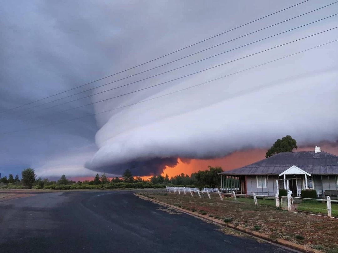
Images: An eerie shelf cloud with orange rain rolling through Lake Cargelligo on Wednesday. Source: @simplenaturephotograpy / Instagram
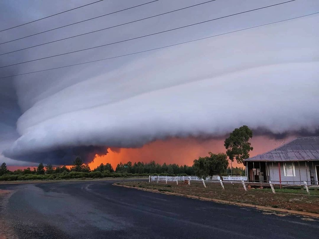
A large shelf cloud associated with a developing thunderstorm passed over the Lake Cargelligo region towards the end of the day. While the shelf cloud was impressive enough, the low angle of the setting sun illuminated the rain falling beneath the storm. The rain turned orange and from a distance, it looked like the storm was raining on fire.
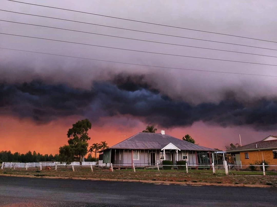
Image: Another angle of the 'orange rain' at Lake Cargelligo on Wednesday. Source: @simplenaturephotograpy / Instagram
In addition to the rain, some of Wednesday’s thunderstorms also caused hail and powerful winds as they rumbled across eastern Australia.