
Southeast QLD flooded as Cyclone Kimi weakens
A lot has happened in Queensland during the last 24 hours, from a tropical cyclone no-show to flooding rain and severe thunderstorms.
Where is Cyclone Kimi?
On Monday morning, it looked like Tropical Cyclone Kimi was going to make landfall along Queensland's North Tropical Coast some time on Monday night or Tuesday morning.
However by Tuesday morning, Kimi was still loitering offshore and had weakened below tropical cyclone strength.
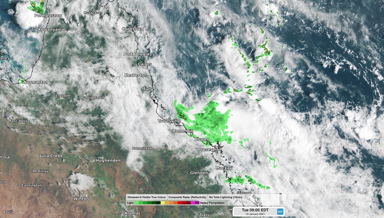
Image: What's left of Ex-Tropical Cyclone Kimi off the northeast coast of Queensland on Tuesday morning.
This puzzling system has been frustratingly difficult to predict over the last few days. It's slow and erratic movement and its small size meant global forecast models weren't able to agree on its future path.
Unfortunately, this made it hard for forecasters to accurately predict where Kimi was moving and what its impacts were likely to be. Fortunately, the system ended up sparing mainland Queensland from the destructive weather typically associated with a landfalling tropical cyclone.
At 4am AEST on Tuesday, Ex-Tropical Cyclone Kimi was located about 250km to the southeast of Cairns. The remnant tropical low is expected to remain slow-moving this morning before tracking further north from this afternoon into Wednesday.
While there is still some uncertainty with Ex-Tropical Cyclone Kimi's future movement, the system is no longer likely to cross the coast as a tropical cyclone. The main threat from the remnant low will be rain and thunderstorms, which could still cause flooding in parts of the North Tropical Coast and Herbert and Lower Burdekin Districts. A flood watch is still in place for this region.
Soaking in the southeast
Meanwhile, southeast Queensland copped a significant drenching on Monday night as a band of rain and thunderstorms swept across the region.
The severe weather was caused by a surface low pressure trough interacting with upper-level cold air and moisture laden winds coming in from the Coral Sea.
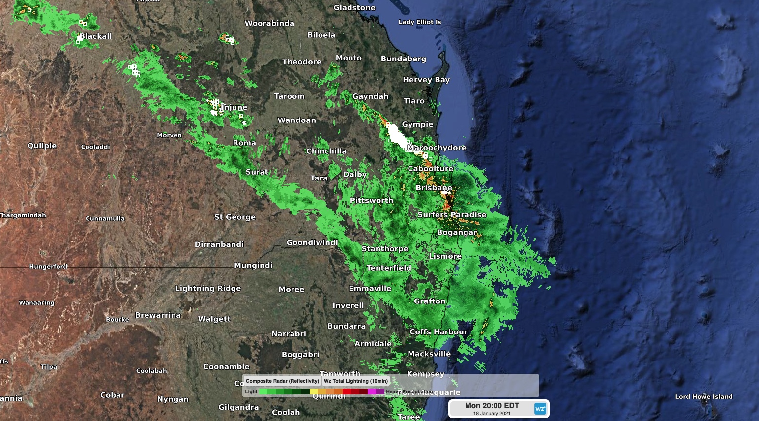
Image: Rain and thunderstorms over southeast Queensland on Monday evening.
This unstable cocktail caused rain and storms to lash southeast Queensland for hours on end, with some thunderstorms turning severe.
During the 24 hours to 8am on Tuesday, a rain gauge at Redland picked up 191mm, which was its highest daily rainfall in at least five years. North Stradbroke Island also received 137mm, while Cape Moreton saw 119mm. Brisbane's 35mm was the city's wettest day in about a month.
Showers and thunderstorms are again possible in southeast Queensland on Tuesday, most likely in the afternoon and early evening. While a repeat of last night's widespread inundating rain is unlikely, some of these storms could become severe.