
Smoke from WA bushfires visible from space
Several fires are burning across southwest WA this week, with smoke plumes seen from 36,000km above the surface.
A previously out-of-control bushfire in Perth’s southwest is now under control, after burning 3000 hectares of land and damaging property.
As of 10am WST On Tuesday, March 26, four other fires are burning in the state’s southwest near the Pagett Nature reserve, Bunbury and Waroona.
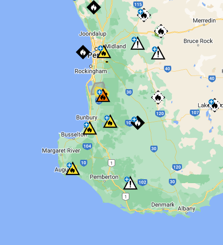
Image: The bushfires burning in southwest WA with several Bushfire advice (yellow) and one Watch and act (orange) as of 9:54am on Tuesday March 26, Source: Emergency WA, there may be new data available here.
The satellite image below shows the smoke plumes from these fires stretching out into the Indian Ocean on Sunday afternoon.
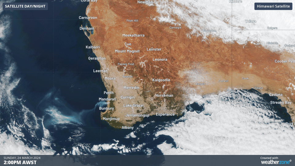
Image: Himawari satellite image showing the three hours leading from 5pm AWST on Sunday March 24.
While conditions are warm, dry and windy across southwestern WA this week, the weather wasn’t dangerous enough to prompt fire weather warnings or bans on Tuesday morning.
A dry landscape has helped fuel the recent fires across southwestern Australia, with some areas recording the lowest rainfall in the 18 months leading up to February 29. The map below shows the rainfall deciles during this period.
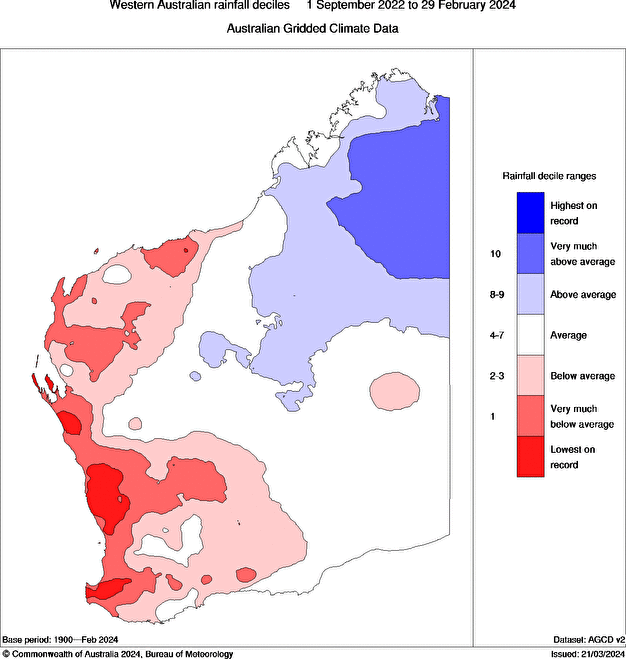
Image: 18-month rainfall deciles between September 2022 and February 2024, Source: Bureau of Meteorology
As we wrote about last week, Perth is highly likely to record the driest 6-month stretch from October 2023 to the end of March 2024, with only 22mm of rain falling during this period.
The daytime temperatures during summer were also 1-3°C warmer than average in WA, which has dried the vegetation out further.
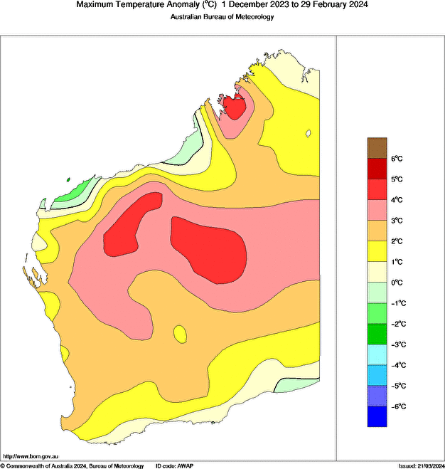
Image: 3-month maximum temperature anomaly from December 2023 to 29 February 2024, Source: BOM
While there is no rainfall forecast in the next week, climatically rainfall increases between May and September as the winter cold fronts sweep across southwestern Australia.
While rainfall should increase in winter it may not be enough to overcome these severe deficiencies.