
Severe thunderstorms sparking up over central eastern Queensland
Thunderstorms are continuing to be triggered over parts of central eastern Queensland on Monday, with a severe thunderstorm warning current for some districts.
Thunderstorms have been triggered over central eastern Queensland on Monday, due to the combination of a low pressure trough, plentiful moisture and the jet stream positioned over the region.
The jet stream is a boundary of warm air to the north and cooler to the south. The clash of the airmasses, plus instability caused by the trough and plentiful moisture, is leading to scattered thunderstorms over a wide area.
Thunderstorms from Sunday into Monday have produced some healthy, unseasonable rain totals. Somerby registered 50mm to 9am Monday, the heaviest June 24 hour rain in 19 years. Gladstone (42mm) and Biloela (12mm) both had their heaviest June one day rain in five years.
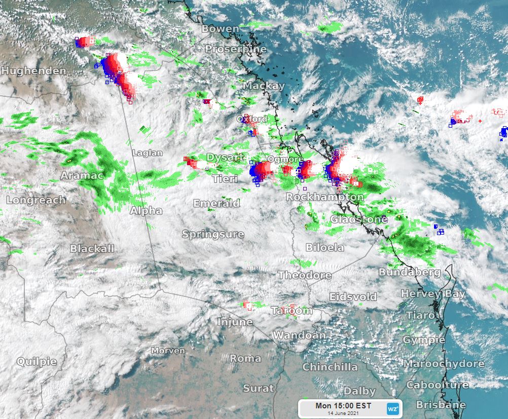 Image: rain and thunderstorms over parts of central eastern Queensland on Monday afternoon, using the Himawari-8 satellite.
A Severe Thunderstorm Warning is currently in place for parts of Central Coast and Whitsundays, Central Highlands and Coalfields and Capricornia forecast districts. Some storms in this area may produce damaging winds and large hail, not usually seen this time of year. A large shelf cloud has been reported near Rockhampton, a good sign of a severe thunderstorm.
Thunderstorms are likely to continue on Tuesday, possibly shifting a bit further north before weakening on Wednesday. Another trough may trigger storms in the south of the state on Thursday.