
Severe storms ramping up on Wednesday
Wednesday will be the first big day in a three-day outbreak of widespread rain and severe thunderstorms across Australia's eastern and southeastern states. So, which areas will see the worst weather during the next 24 hours?
The animation below shows a sequence of enhanced water vapour satellite images captured during the 24 hours ending at 3pm AEST on Tuesday.
The sequence above shows clouds building over a large area of southeastern Australia as an upper-level low pressure system interacts with a large mass of moisture-laden air.
We have already seen a few showers and thunderstorms developing over SA, Victoria, western NSW and southern Queensland on Tuesday. However, things will ramp up significantly on Wednesday.
Rain will become widespread from central Victoria up to southern Queensland on Wednesday, drenching a huge area of Australia's southeastern and eastern inland and some coastal areas. The maps below shows the predicted accumulated rainfall on Wednesday for each state.
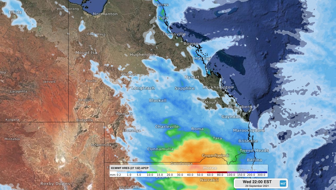
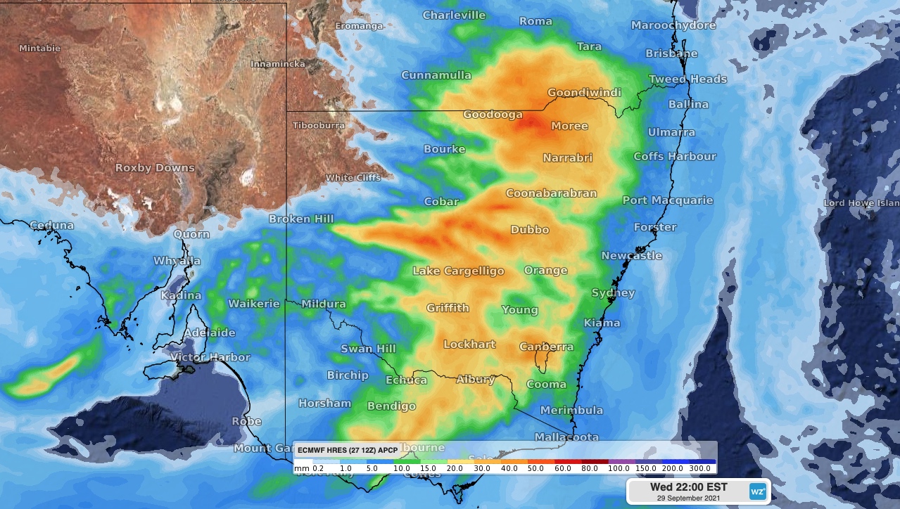
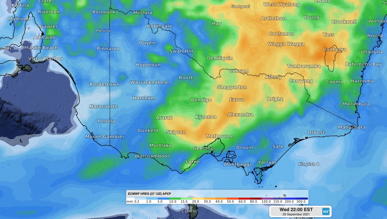
Images: Forecast accumulated rain on Wednesday according to the ECMWF model, showing the areas expected to be affected by rain or thunderstorms.
In addition to the rain, thunderstorms will also be prolific across a large inland area from northern Victoria, up through western NSW and into southern and central inland Queensland.
This broad inland corridor of storms will include plenty of severe thunderstorm activity, particularly between the Maranoa and Warrego District in southern Queensland and the Riverina District in NSW.
All of the ingredients will be in place for heavy rain, large hail and damaging winds from Wednesday's thunderstorms.
There will also be enough wind shear – a change in wind speed and direction with height – for supercell thunderstorms to develop over far northern NSW and southern inland Queensland. If supercells do spin up, some areas could see destructive winds with gusts above 125 km/h and giant hail measuring more than 5cm in diameter.
Further south, Wednesday's rain could cause some minor riverine flooding in areas of southern NSW and Victoria that are still damp from recent rainfall. A flood watch has been issued for a number of river catchments in Victoria.
More warnings be issued during the next 24 hours and later in the week, so be sure to check the latest details in your area.
We will continue to bring you updates on this evolving weather event throughout the week.