
Return of summer for WA
After a wet first week of autumn in southwestern WA, the mercury will gradually rise in the week ahead, bringing summer temperatures back under clearer skies.
A broad area of high pressure will sit off the southern coast of WA during the next couple of days, moving over the Bight on Wednesday. As winds travel anticlockwise around a high pressure system, easterly winds will dominate in southern WA turning northeast as the high moves gradually east. As a consequence, a hot airmass will be drawn down from the western interior. On top of that, a trough will form near the west coast, which will help an offshore circulation preventing sea breezes.
Daily temperatures are increasing on Sunday but the heat will be more noticeable during the first half of the coming week. At this stage, Tuesday and Wednesday appear to be the hottest days, when the mercury may nudge 35 degrees in Perth. This is not uncommon for this part of Australia, where tops of 35 degrees or above occur around 4 days in March, on average.
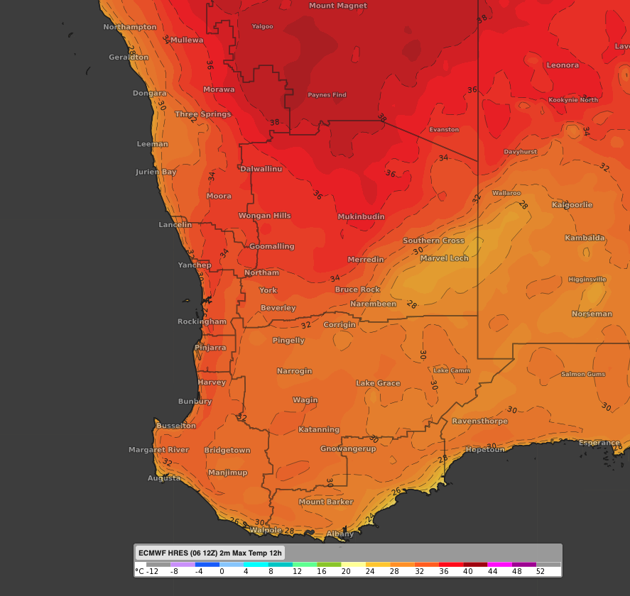 Image: forecast maximum temperature on Wednesday according to the Saturday 12z run of ECMWF.
Humidity will increase during Wednesday as a low pressure system migrates from the Gascoyne, causing winds to turn northwest. This will make it feel 2-3 degrees hotter than the actual temperature.
However, this hot spell does not seem to last long. The low should push the heat into eastern parts of WA and western SA from Thursday. Furthermore, southerly winds will bring a cooler airmass, keeping the mercury below average for the remainder of the week.