
Powerful low pressure system lashes Tasmania
A deep low-pressure system rapidly intensified overnight and began pounding Tasmania and southeast Victoria with howling winds and heavy rain.
Some of the highest wind gusts recorded overnight and this morning include 82km/h at Hobart, 91km/h at Cape Bruny and 100km/h at Mount Wellington. Many locations recorded more than 50mm of rain to 9am this morning. The highest total was at Mount Wellington with 109mm in 24 hours and 82mm in 6 hours.
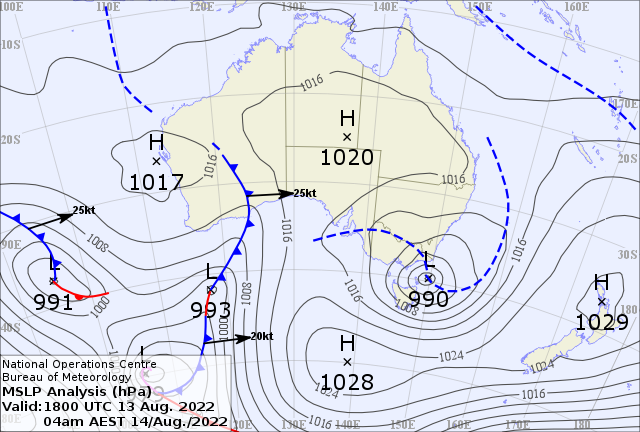
Image: BOM MSLP analysis 4am EST Sunday 14th
Like an East Coast Low, this system developed within a coastal trough and intensified rapidly due to a wave in the upper-level winds, an influx of tropical moisture and warmer-than-average sea surface temperatures.
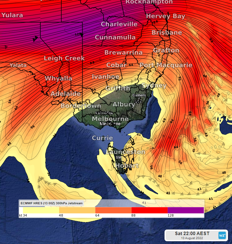
Image: Wave in the jet stream over southeast Australia at 10pm EST Sat 13th (ECMWF model)
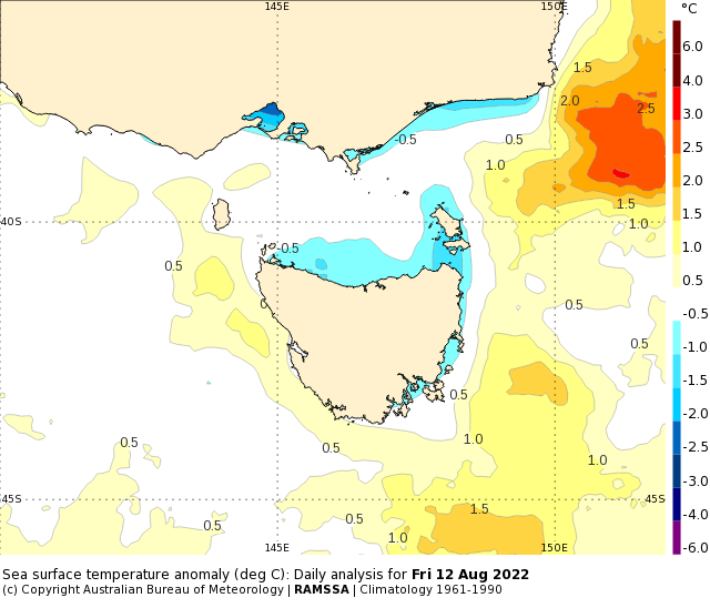
Image: BOM sea surface temperature anomaly for Fri 12th August
The system has weakened and the Bureau of Meteorology has cancelled a severe weather warning for damaging winds and heavy rainfall for southern and eastern Tasmania. Another warning for northeastern Tasmania may be issued later today due to the threat of severe thunderstorms. Stay up to date with the latest warnings using https://www.weatherzone.com.au/warnings
The system will weaken further on Monday but still cause showers and gusty winds across southeast Australia before it clears off on Tuesday. The more usual cold fronts and troughs will then return on Wednesday, making for quite a wet and windy week.