
Outback rain looms as Pacific Ocean moisture drifts over Australia
Parts of central Australia could see a season's worth of rain during the next few days as the country gets a taste of the developing La Niña conditions in the Pacific Ocean.

Two upper-level low pressure troughs interacting with moisture-laden air from the Pacific Ocean will cause widespread rain and thunderstorms across southern, central, and eastern Australia during the next four-to-five days.
The first wave of rain and storms will soak a broad area of southern and central Australia on Thursday and Friday, before spreading across some inland districts of Victoria, NSW, and Queensland this weekend.
The heaviest rain during the second half of this week will fall over northern districts of SA, far western NSW, and southwestern Queensland, mainly on Friday and Saturday. Models suggest that widespread accumulated totals of 20-40mm are likely, with isolated falls over 50mm. Some of this rain will be falling in outback areas that average about 30-50mm during all of spring.
Looking ahead, another upper-level trough will cause showers to redevelop over southern districts of SA from Sunday. This system will then move further north and east early next week, producing widespread rain and thunderstorms over Tasmania, Victoria, NSW, and Queensland between Monday and Wednesday. Some thunderstorms are likely to become severe with damaging winds over NSW and Queensland early next week.
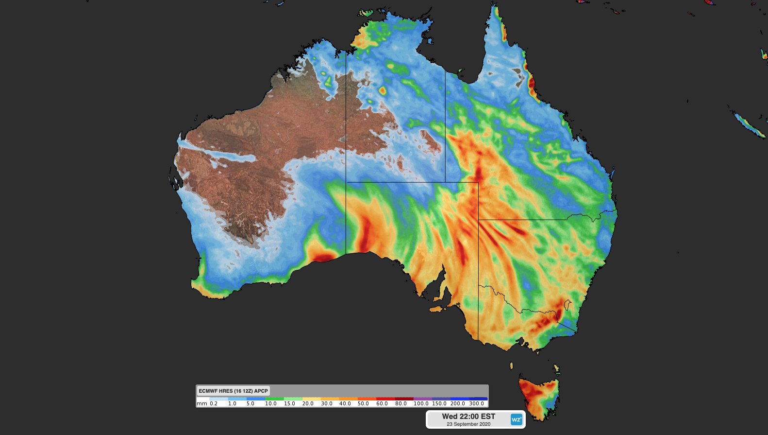
Image: Forecast accumulated rain between now and next Wednesday, according to the ECMWF-HRES model.
This multi-day rain and storm event is the type of thing Australia expects to see during La Niña. While Australia's Bureau of Meteorology is yet to formally declare La Niña, the Pacific Ocean is currently in a distinct La Niña-like pattern and this is likely having an influence on the coming week's weather. Sea surface temperatures over the western tropical Pacific Ocean are currently more than one degree warmer than average for this time of year, which is putting more moisture into the atmosphere through evaporation. With La Niña expected to become more consolidated in the Pacific Ocean during the coming months, large parts of Australia can expect to see above-average rain this spring.