
Once-in-a-lifetime rain flooding much of SA
A large swathe of South Australia's north and west has been drenched by near-record downpours, amounting to widespread 50-to-150mm, half the annual average in some areas.
So far, the state's west and northwest have been dealt the most rain, leading to flooding and swamping some towns. Parched parks and paddocks have turned into lakes deep enough to swim, boat and jet ski in.
Places that have gained more than half their annual average in about a day have been Cowell (181mm, 54 percent of its annual average), Buckelboo (165mm, 57 percent of its annual average), Mount Ive (140mm, 58 percent of its annual average).
Other notable one-to-two-day totals include 160mm at Kimba, 152mm at Darke Peake, 127mm at Wirrulla and 94mm at Streaky Bay.
This is once-in-a-lifetime stuff. It has been the biggest rainfall in at least 100 years in Kimba, Mount Ive, Darke Peake and Wirrulla, 76 years in Yardea (70mm in 24 hours), 55 years in Wharminda (71mm in 24 hours) and at least 50 years in Cowell.
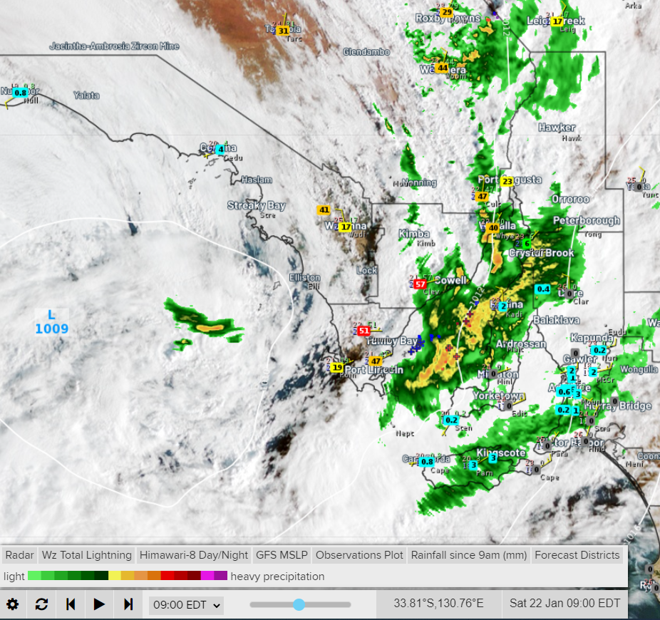
Image: satellite, radar and rainfall observations at about 9am Saturday.
And it's not just the rain getting the locals talking, it's the humidity too. How often can one say SA is more humid than Sydney and Brisbane for a whole week? Maybe once in a lifetime.
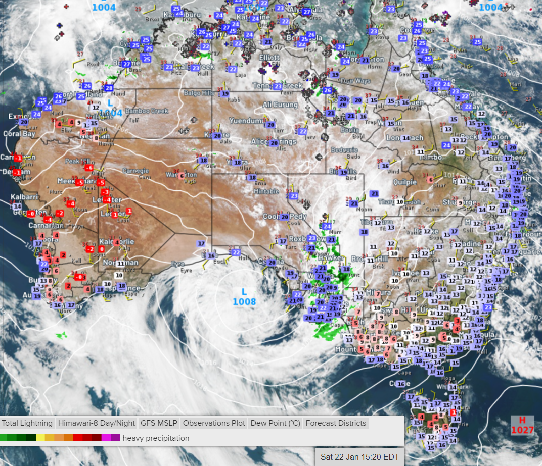
Image: Dew points (a measure of humidity) of more than 20 degrees across SA, higher than in Sydney and Brisbane.
The exceptional rain is largely due to two main factors, higher-than-normal amounts of tropical moisture and a low-pressure trough moving slow enough for this moisture to reach levels rarely experienced before in the state.
This moisture-filled system will continue to be very slow-moving and gradually weaken, causing rain and thunderstorms to persist but gradually ease as it tries to edge east.
Rain and storms can be expected in most districts on each day through to at least Thursday with the potential for more than 100mm and further flooding in the north and west. Some outback roads will become impassable, leaving communities and travellers stranded.
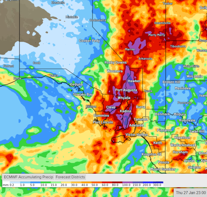
Image: forecast rainfall between Saturday 22nd Jan and Thursday 27th Jan, indicating in excess of 100mm (purple).
The Adelaide area and the state's southeast will generally get off much more lightly than further northwest, although humidity will remain much higher than normal through to about Thursday. As far as rain and storms go, they should deliver 25-to-50mm to the city and surrounds between now and then.