
NSW in firing line as thunderstorms develop across the east
Thunderstorms are drenching eastern parts of NSW this afternoon as an area of converging winds (winds which meet each other at a point) and instability develops over the region.
Onshore winds from a trough moving eastwards into the Tasman Sea, and a southwesterly flow over inland parts of the state are interacting and converging across eastern NSW, producing scattered thunderstorms, some severe, particularly over eastern areas of the Mid North Coast, where damaging wind gusts and large hailstones have been registered this afternoon (you can see the latest warnings here).
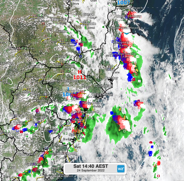
As the winds converge in the lower levels of the atmosphere, a trough in the upper levels is providing cooler air and thus, promoting instability and air rising from the surface. This set-up has resulted in thunderstorms that are currently affecting several districts across NSW, including Greater Sydney, parts of the Tablelands, the Hunter, Mid North Coast, and to a lesser extent, Illawarra, the ACT and the Snowy Mountains districts.
Storms will continue this afternoon over eastern parts of the state, being particularly intense and possibly severe in the Hunter and the Mid North Coast.
Fortunately, the threat is likely to ease during the early evening as a high pressure establishes over the region, giving way to a settled and dry end to the long weekend across NSW.