
Northwest cloudband delivers welcome rain

Parts of South Australia have enjoyed their best rain so far this year as the season's first northwest cloudband delivers welcome falls in the parched state.
Northwest cloudbands are broad bands of thick cloud that stretch across Australia from the northwest down to the southeast, appearing like a sash draped across the country.
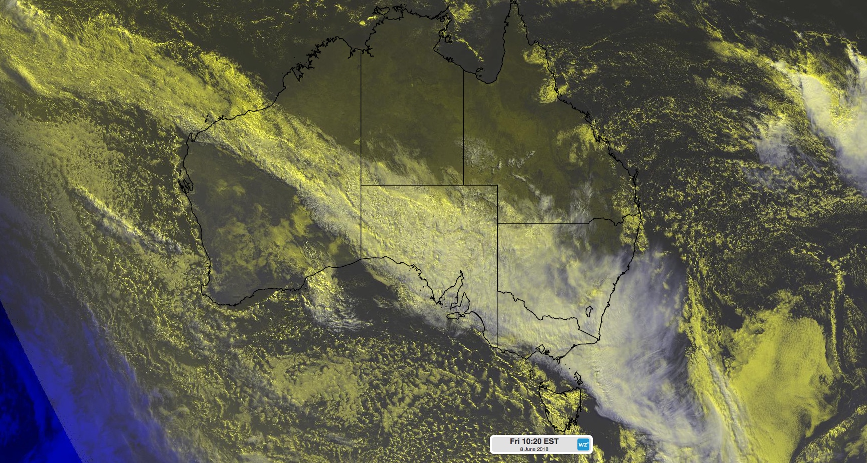
Image: A northwest cloudband draped across Australia on Friday, 8th June 2018.
These bands of cloud form when moisture from the Indian Ocean streams across Australia along a trough of low pressure, often ahead of an approaching cold front. They most commonly develop between April and September and typically cause rain in multiple states and territories simultaneously.
This particular northwest cloudband has already delivered more than two month's worth of rain in parts of Western Australia's Pilbara District during the last few days. Now, rain is spreading across the nation's parched southern states.
A number of places in South Australia received their best rain so far this year during the 24 hours to 9am on Friday, including Nullarbor (15mm), Whyalla (13mm), Port Augusta (12mm) and Renmark (10mm).
In Tasmania, Launceston's 18mm was its heaviest rain in three months, while Wynyard (16mm) received its best rain since April.
The northwest cloudband will continue moving towards the east during the next 48 hours, causing rain to spread across Victoria and NSW during Friday and Saturday.
Some areas of northern Victoria and southern NSW could receive 10-20mm of rain between now and the end of Saturday, with heavier falls likely in some areas.
In addition to the rain, damaging winds are also occurring in parts of southeastern Australia this morning with the passage of a cold front. The strongest wind gusts on Friday morning were: 141km/h at Thredbo Top Station, 113km/h at Wilsons Promontory, 106km/h at Maatsuyker Island and 104km/h at Scotts Peak Dam and Mount Wellington.
Wind will ease during Friday afternoon as the front moves out into the Tasman Sea.