
Hot and getting hotter in northern Australia
It's hot right now in northern Australia, which is far from unusual at any time of year, but the level of recent heat has been even higher than you'd expect.
Check out the graphic below. We used it in our story last week on Australia’s 2nd-wettest spring on record, which was also a cooler spring than usual in most parts of the country due to all that cloud and rain.
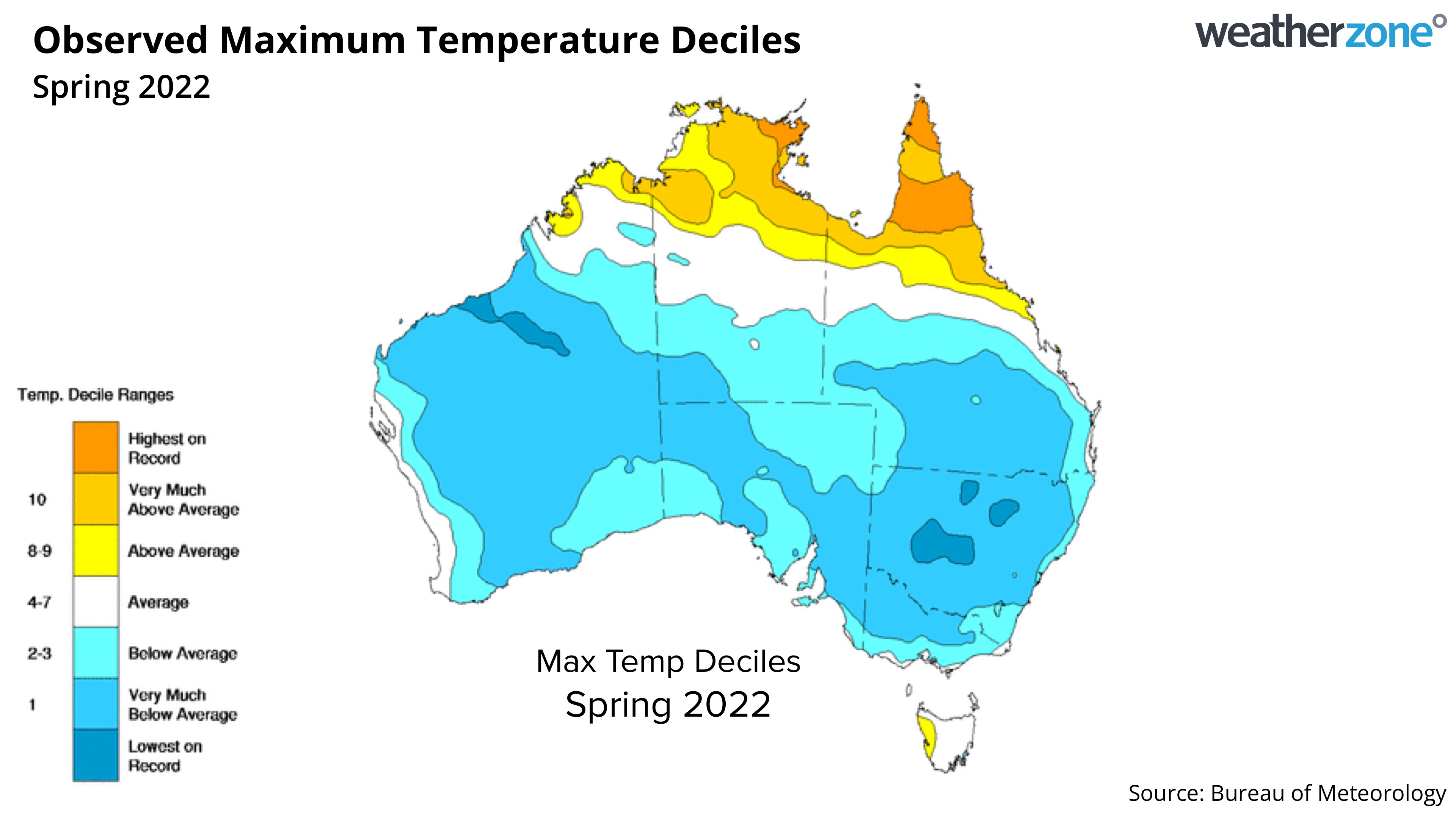
See how there was a band of higher than average temps up north – from the northeastern tip of WA, through the NT Top End, all the way to Far North Queensland and Cape York throughout spring 2022?
The pattern was similar in winter, autumn, and over last summer too.
Why is Australia's consistently hottest region even warmer than usual?
Broadly speaking, we know that the climate is warming overall both globally and in Australia, and the northernmost parts of Australia experience much less temperature variation than southern parts of the country. So the underlying warming trend is reflected quite accurately up north.
In terms of recent conditions, we can also attribute the influence unusually warm sea surface temperatures in Australia's northern waters.
As the BoM's sea surface temp temperature anomaly chart below shows, the waters are warm in (from west to east) the Timor, Arafura and Coral Seas.
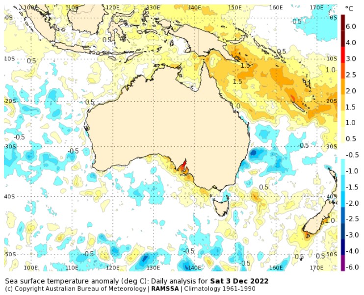
Image: Northern Australia is warm like a bath right now. Source: BoM.
How do warm tropical seas make northern Australia warmer?
As Weatherzone meteorologist Joel Pippard explains:
- Warmer waters lead to higher humidity and more clouds. Clouds trap in the heat overnight like a blanket, and when you get numerous such days in a row, daytime temps start to show a slight increase.
- There is also warmer air above warmer waters, and this air eventually makes its way over land through daily sea breezes. A warmer than normal sea breeze over time will lead to warmer days.
Meanwhile, things are set to heat up even more this week in northern Australia, with heatwave conditions forecast midweek across most of the region. Here's the BoM's heatwave map for Tuesday, Wednesday and Thursday.
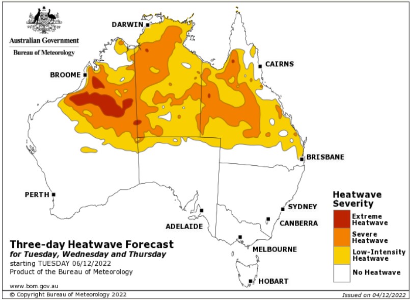
Image: Source: BoM.
The BoM describes a heatwave as "a three-day period when the maximum and the minimum temperatures are unusually hot at a location".
Note that the yellow zone for a low-intensity heatwave dips all the way down to Brisbane.
Last week's near-record cold start to December will be a distant memory by Thursday evening for Brisbanites, after three straight days of mid-30s maximums.