
Heavy rain and storms in QLD, northeast NSW
Flooding could affect parts of Queensland and northern NSW on Thursday and Friday as more rain and thunderstorms soak already saturated river catchments.
The first few days of February have seen widespread rain and storms spreading across eastern Australia. During the 24 hours to 9am on Thursday, widespread falls of 50 to 100mm were recorded from central Queensland down to northeast NSW.
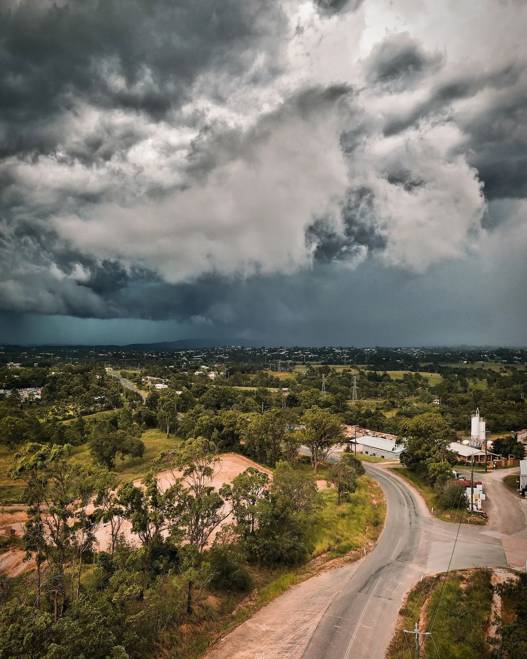
Image: Stormy skies in Gympie, QLD this week. Source: @gympie_weather_and_floods / Instagram
Some of the higher totals in the 24 hours to 9am Thursday included 145mm at Theodore and 130mm at Mundabbera in Queensland, and 124mm at Mooral Creek near Comboyne in NSW. Casino’s 81mm was its highest daily total in a year.
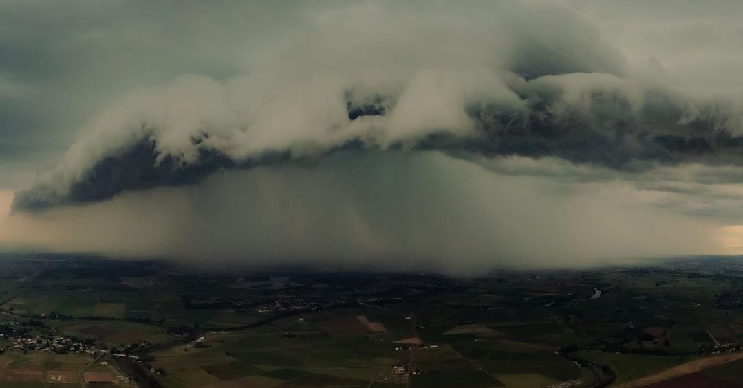
Image: An ominous thunderstorm dumping rain on Maitland, NSW on Wednesday. Source: @vision_above / Instagram
On Thursday, areas of heavy rain and potentially severe thunderstorms will continue over a broad area of Queensland and northeast NSW, as moisture-laden air feeds into a low pressure trough.
The map below shows where and how much rain one computer model is predicting on Thursday, which gives an indication of where some of the heaviest rain could fall. It shows that another 50-100mm of rain is possible for some areas that have already had a decent drop this week.
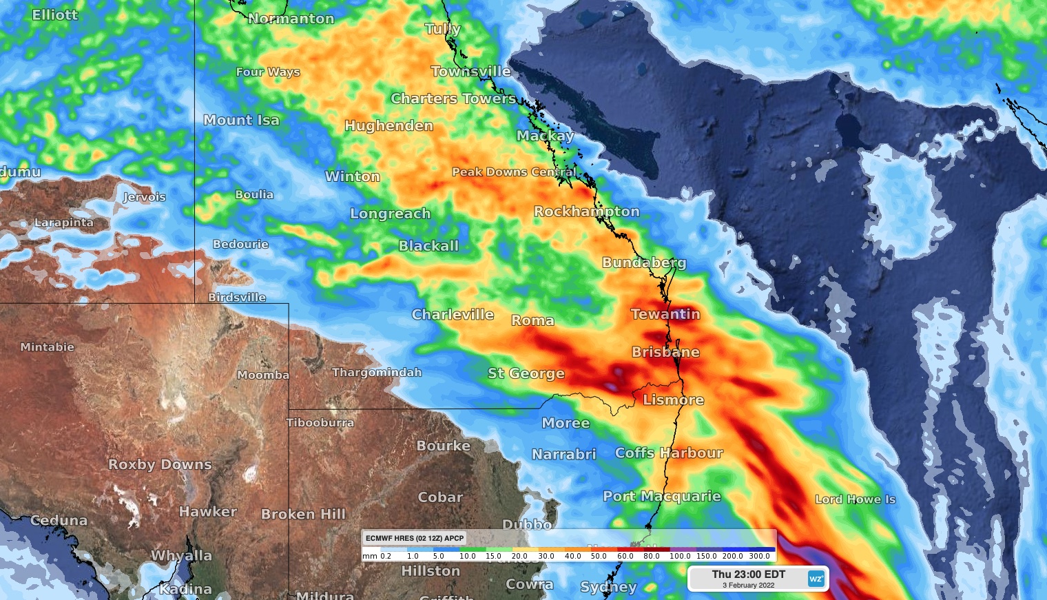
Image: Forecast accumulated rain on Thursday, February 3, according to the ECMWF model.
Flood Watches have been issued in northeast NSW and parts of southern and southeast Queensland in response to this week’s rain, with minor to moderate flooding possible in both states on Thursday and Friday.
Severe thunderstorm warnings are also likely to be issued during the next 24-48 hours as abundant atmospheric moisture causes areas of intense rainfall and flash flooding.
The moisture that is fueling this week’s wet and stormy weather has also been making it feel very hot and muggy in parts of eastern Australia over the last few days and nights.
In Brisbane, the temperature felt like 40ºC at times on Wednesday and didn’t feel cooler than 30ºC at any point last night.
Fortunately for those that don’t like this muggy warmth, it won’t last much longer. Showers, thunderstorms and a southerly change will flush the heat out of southeast QLD on Thursday.