
Healthy winter rain for southwest Queensland and western NSW
A slow-moving trough brought tropical moisture to dry parts of southwest Qld and western NSW on Friday and Saturday, resulting in record July rain for some areas.
The last couple of months have been extremely dry for much of western Queensland and NSW, and the dry continued well into July. That all changed on Friday for many areas as a moisture laden trough slowly made its way across the region.
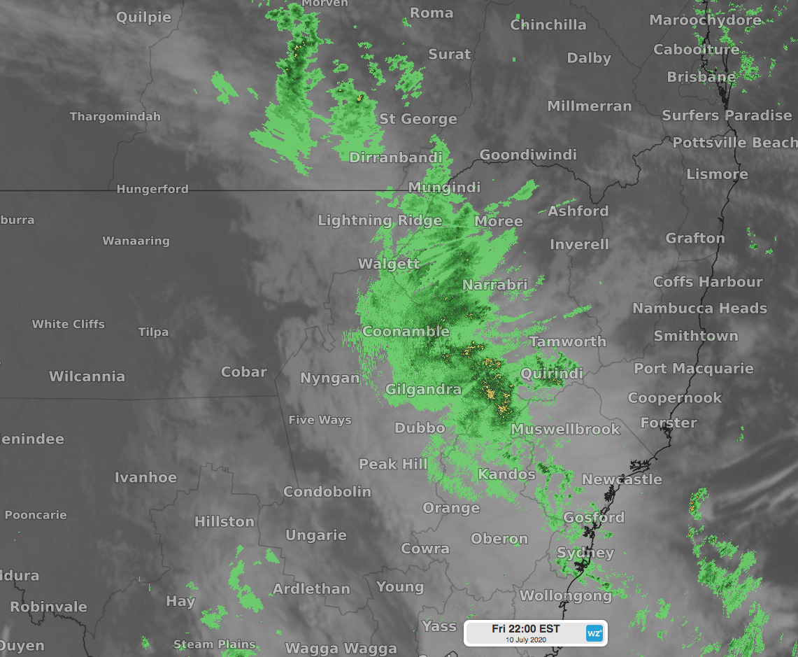 Image: rain falling over western parts of Queensland and NSW on Friday night.
Thargomindah, where only 1.8mm of rain fell in May and June combined, has collected over 57mm in the last two days, with over 52mm falling in the 24 hours to 9am Saturday. That two day total is nearing the average rain for the months of April, May, June and July combined. It also happens to be the wettest July 24-hour rain total since records began in the area over 140 years ago.
Coonabarabran Airport's rain gauge had almost 50mm in it at 9am Saturday. That is the wettest July 24-hour total for the site with records going back to 2001.
Other notable rain totals in the 24 hours to 9am Saturday were 42mm at Coonabarabran Showgrounds, and 15mm at Brewarrina, both their highest July rain since 2012. Mudgee Airport's 32mm and Dubbo's 28mm are both their wettest July daily rainfalls in four years.
Further rainfall for southwest Queensland is a low chance during the rest of the weekend, however parts of western NSW should pick up a few more millimetres as an upper low crosses the state.