
Easter deluge possible as tropical moisture moves south
The tropical moisture that caused significant flooding in the NT and Qld is set to move southeast over Easter, bringing heavy rainfall, thunderstorms and possible flooding and damaging winds with it.
The map below shows the massive rainfall totals that fell across the southern NT and parts of Qld over the last week.
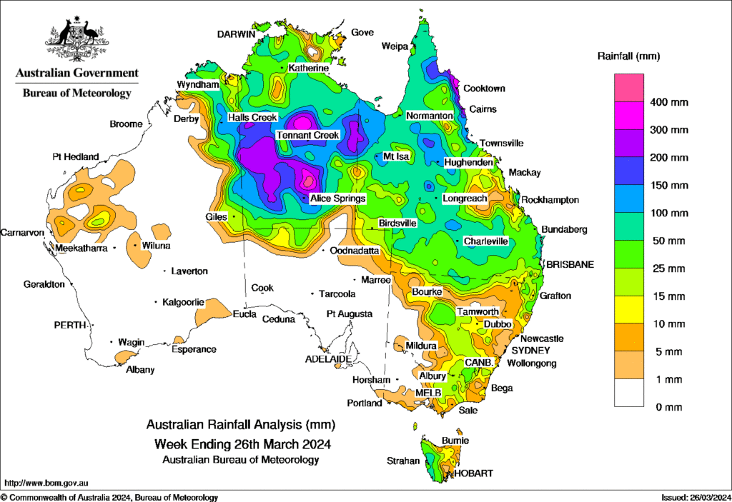
Image: The Red Centre became the purple centre. Source: Bureau of Meteorology
During the week ending on Wednesday, March 27, Rabbit Flat in the NT recorded 277 mm, contributing to its wettest March on record.
The moisture from Ex-Tropical Cyclone Megan and a low-pressure trough combined to cause this extremely wet week.
This moisture and trough will continue to generate thunderstorms and heavy rainfall over the coming days across parts of the NT and Qld.
The tropical moisture is expected to move south and then east over the Easter weekend, with heavy rainfall expected in eastern SA and western NSW on Sunday.
There is still considerable uncertainty on where and how much rainfall will fall over the region, but one computer model suggests widespread falls of 20-30mm and isolated areas of 50-100mm are possible in western SA on Sunday.
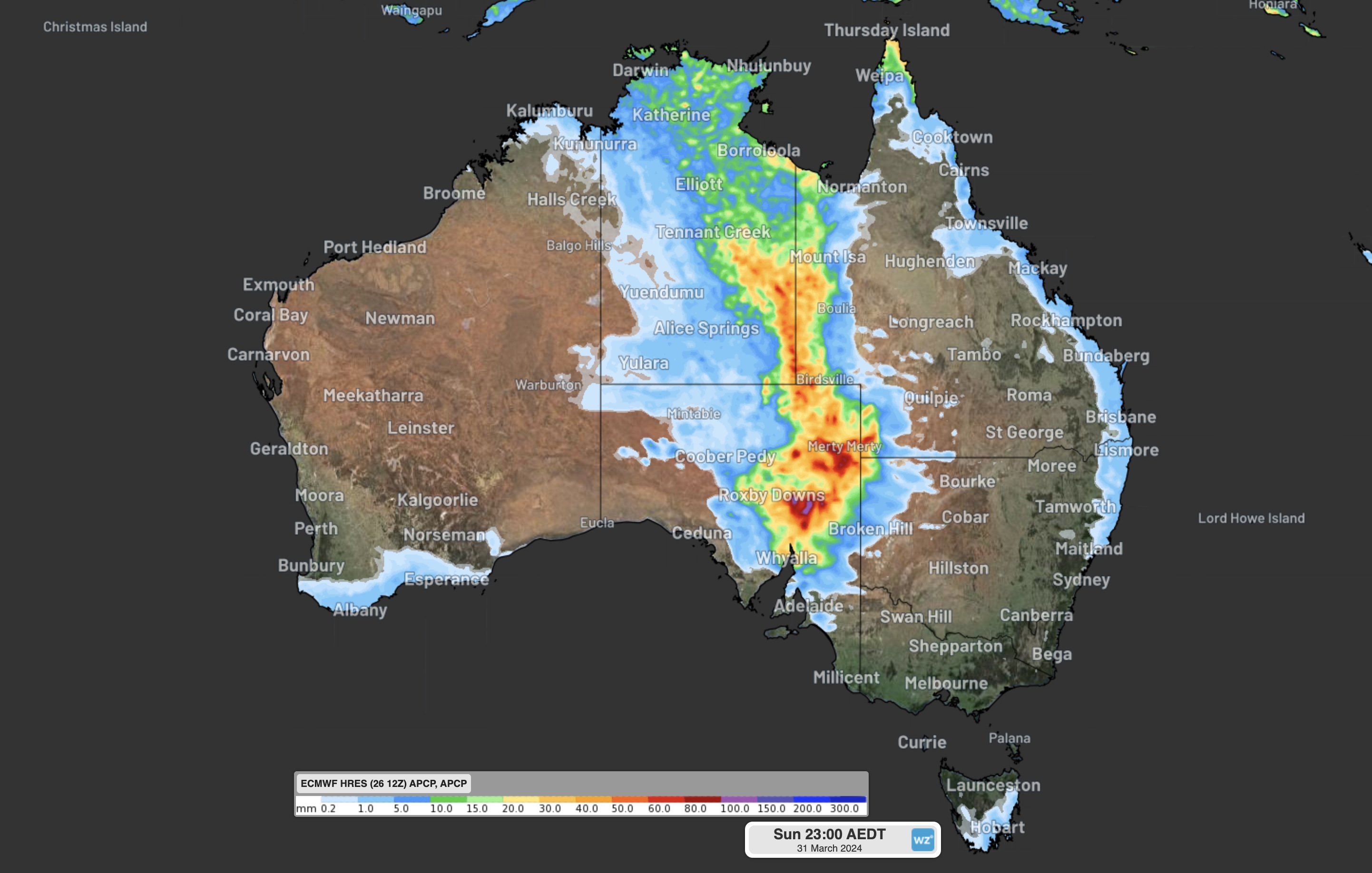
Image: Accumulated rainfall for the 24 hours leading up to 11pm on Sunday, March 31, according to ECMWF
The tropical moisture should link up with a cold front that will sweep across southeastern Australia in the back end of the Easter long weekend, dragging the rainband eastward into western and central Vic on Monday.
The map below shows that 20-30mm could fall in southeastern SA and western Vic on Monday.
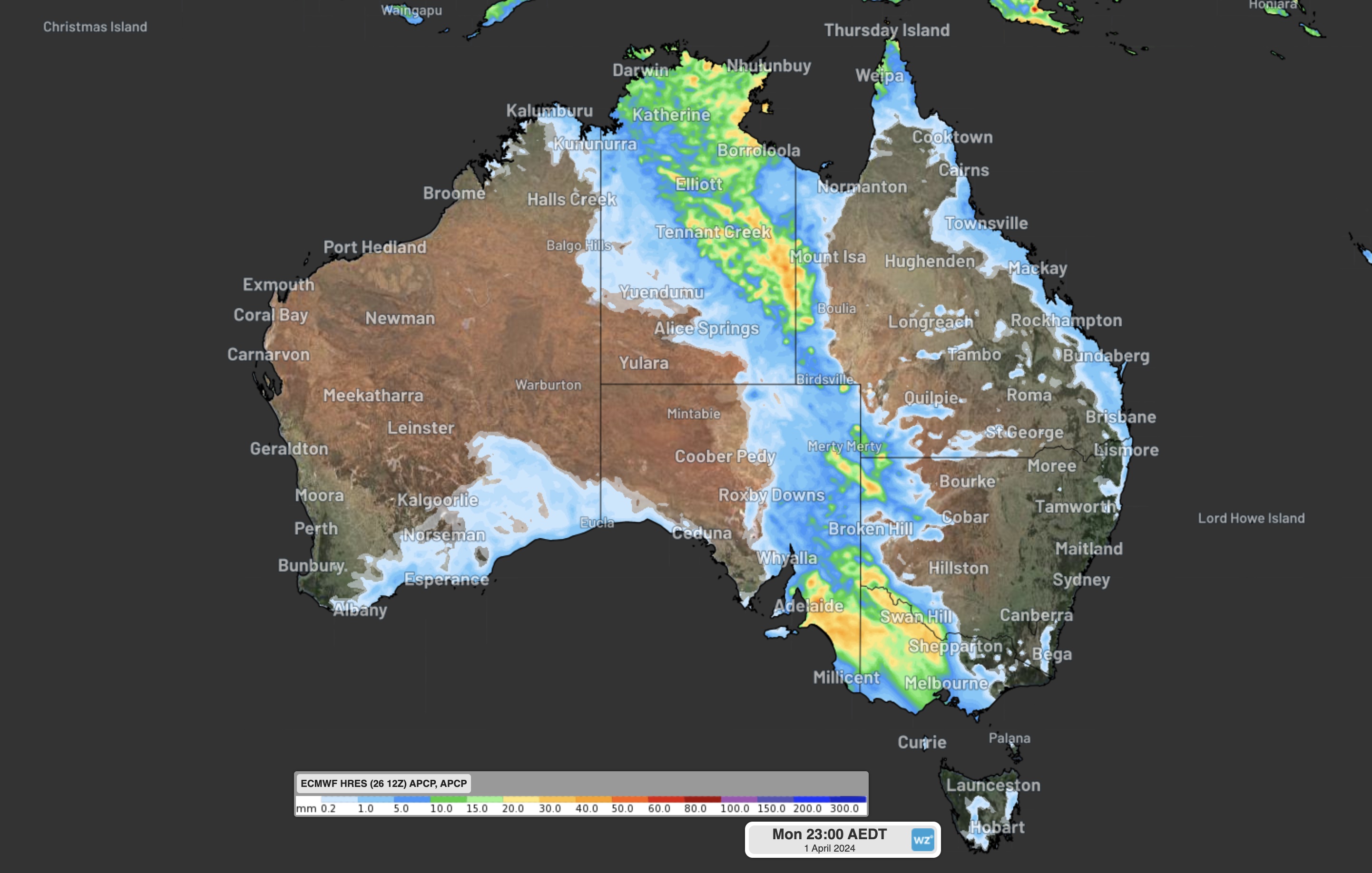
Image: Accumulated rainfall for the 24 hours leading up to 11pm on Monday, April 1, according to ECMWF
Early next week, there are early signs that a cut off low could develop in the Tasman Sea near NSW and Vic.
Some computer models are showing rainfall increasing across central and eastern Vic and parts of NSW on Tuesday, with 40-60 mm in a day possible in some areas.
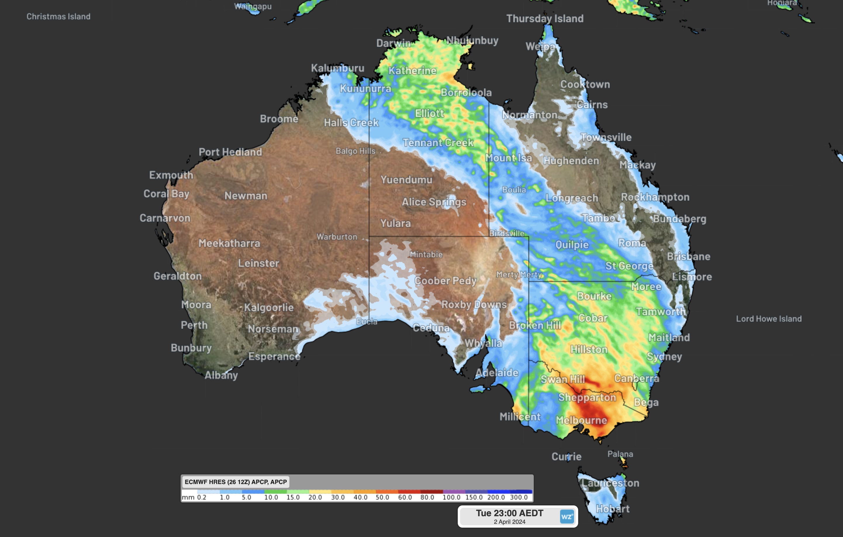
Image: Accumulated rainfall for the 24 hours leading up to 11pm on Tuesday, April 2, according to ECMWF
On Wednesday, the models predict heavy falls across eastern Vic and southern NSW, which could cause flooding in the region. If the low develops, damaging winds could also impact parts of central and eastern Vic early next week.
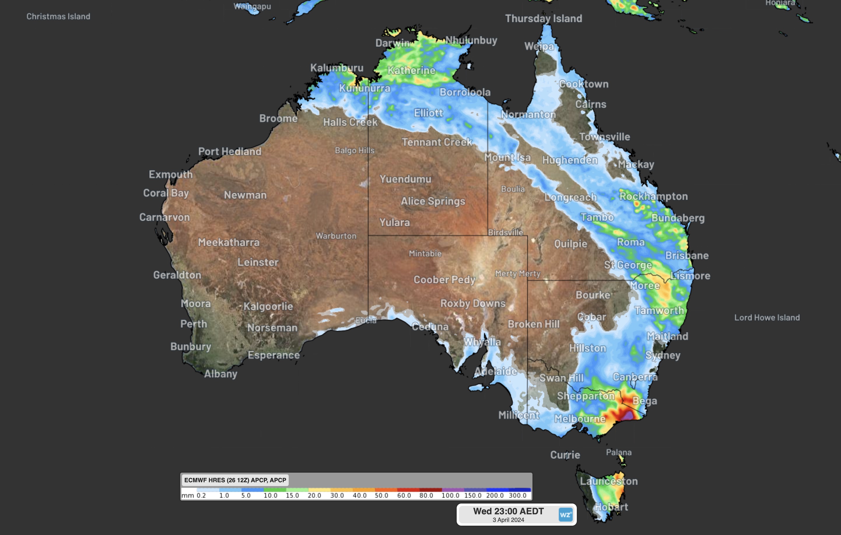
Image: Accumulated rainfall for the 24 hours leading up to 11pm on Wednesday, April 3, according to ECMWF
Please keep an eye out for the latest warnings as this weekend unfolds here.