
Dusting of snow above Hobart as cold, wild weather heads for mainland
The snow cam on the summit of Kunanyi/Mt Wellington reveals a dusting of snow on Tuesday morning, as cold air heads northwards to the mainland, bringing with it potentially dangerous weather.
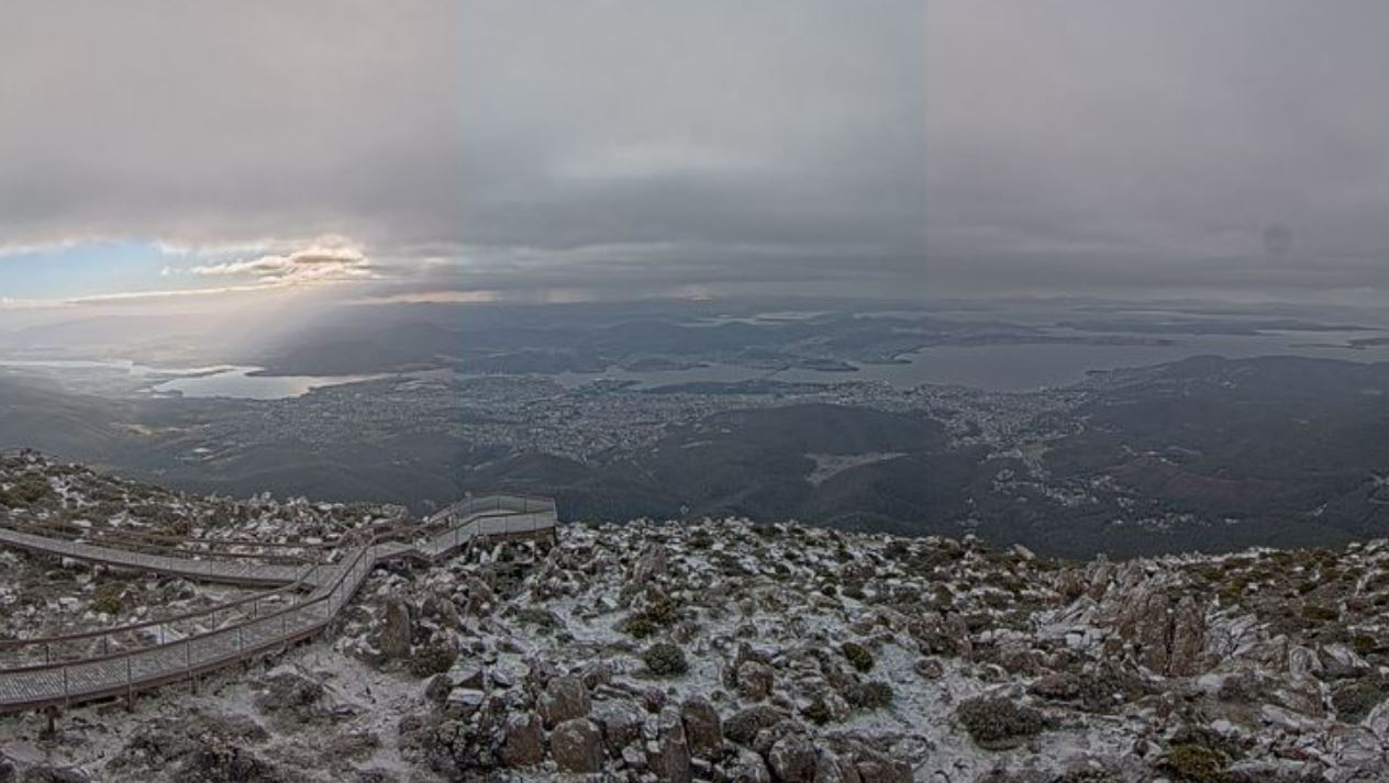
Image: Just a bit of icing sugar on the cake. Source: ski.com.au via hobartcity.com.au.
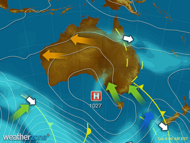
As Weatherzone meteorologist Ben Domensino explained on Monday night, an upper-level cut-off low pressure system passing over southeast Australia will create an ideal environment for widespread severe weather on Tuesday.
The hot spot of this system - or rather, the coldest wettest spot - will be eastern Victoria and the far southeast corner of NSW. By the end of the day, some locations in this area could receive over 100 mm of rain, as moisture-laden air feeds into a surface-based low pressure system.
What's a cut-off low again?
Though there's cold air around, this system is not your classic late autumn or winter weather system which brings heavy snow from a generally westerly direction to the mountains.
As the 8 am Tuesday synoptic chart shows, the cold pool of air in this system has been directed northwards (the blue and green arrows), from the band of cold westerlies which circulates the globe at higher latitudes. But the cold air has become "cut off" from that circulation. That's why these systems are called cut-off lows.
The localised effects of cut-off lows can be difficult to predict, but for now can say that some parts of far southeast Australia will likely experience severe weather on Tuesday, as illustrated by the official BoM warning maps below.
Keep up to date with NSW warnings for this weather system here and Victorian warnings here.
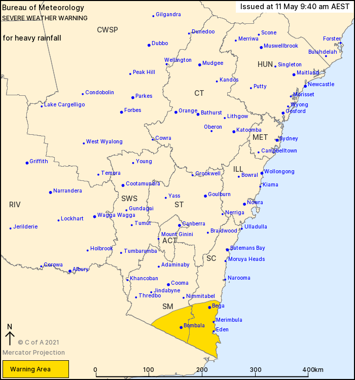
Source: BoM
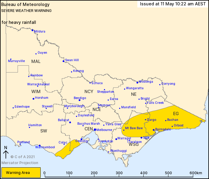
Source: BoM.
Severe storms could also form in northeast NSW and southeast Queensland on Tuesday afternoon.
Tasmania will remain cool to cold on Tuesday, but the likelihood of severe weather from this weather system has well and truly passed for now.