
Dichotomous overnight temperatures in eastern Australia
If you could have had one foot in Sydney and the other in Melbourne last night, you would have been amazed by the vastly different overnight conditions (and be astounded by the fact that your feet could reach over 500 km apart).
A cold front impacting the southeast on Friday provided a contrast in airmass temperature which was largely responsible for this split in temperature. To add to this, a trough ahead of the front increased cloud cover for the already warmer locations, acting as a blanket to trap even more heat in.
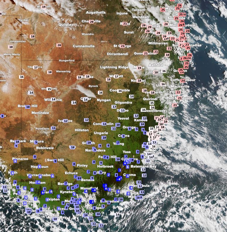
Image: Satellite (Himawari-8) imagery with observed temperature overlay showing temperature split between VIC, NSW and QLD at 8am EDT.
The warming effect was so much so that some locations had their warmest October night in a while. In Queensland, it was the warmest October night in:
- 23 years at Willis Island (26.6oC only just missing out on the record of 26.7oC)
- 21 years at Tewantin (23.5oC)
- 19 years at Rockhampton (23.4oC)
- 18 years at Rundle Island (24.5oC)
For Lord Howe Island in NSW, the 21.8oC minimum was the warmest October night in over 32 years.
By contrast, Victoria and Tasmania were shivering. Although the temperatures were not as spectacular, Larapuna in Tasmania still recorded its lowest October minimum since 2013 (3.7oC).
Over the next couple of days, the variation from average between the north and south of eastern Australia should even out as the colder airmass moves up the coast.