
Dangerous day of storms in eastern Australia
Severe thunderstorms will hit several states in eastern and southeastern Australia on Thursday, with very dangerous supercells possible in NSW and QLD.
A large mass of cold air interacting with much warmer, moisture laden air will cause showers and thunderstorms across parts of QLD, NSW, the ACT, VIC, TAS and SA on Thursday.
A few of these storms were already causing lightning as the sun rose on Thursday morning. When storms occur this early in the day, it's a sign that there is plenty of moisture and instability in the atmosphere.
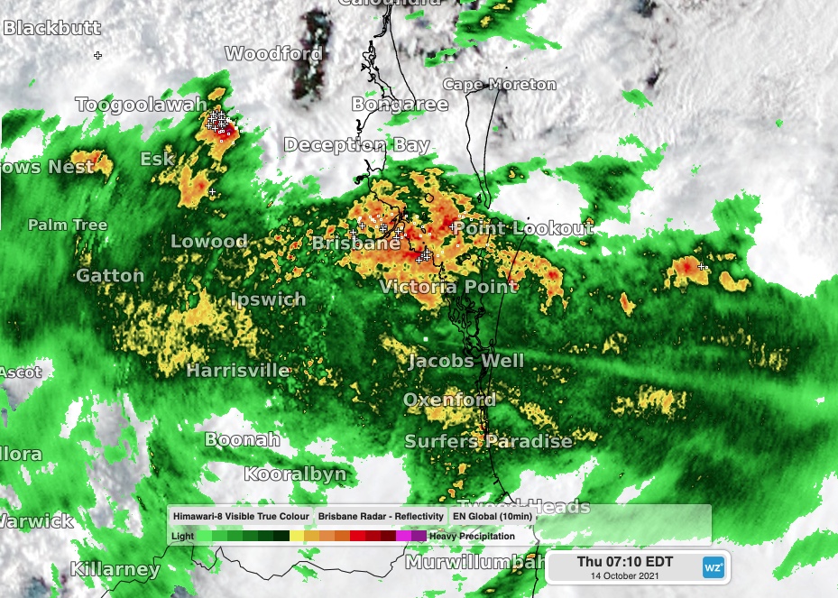
Image: Storms over southeast Queensland shortly after sunrise on Thursday.
In eastern Australia, convective clouds will grow taller as the day warms up, allowing showers and thunderstorms to become more widespread and intense from the late morning and afternoon. Storms are likely to develop over a broad area stretching from central QLD down to northern TAS.
While severe thunderstorms are possible in TAS, VIC and the ACT on Thursday, the most dangerous storms should strike NSW and QLD.
The region stretching from central NSW up to central QLD (including Sydney and Brisbane) should see some of the most intense thunderstorms on Thursday, with damaging wind, large hail and heavy rain all a risk.
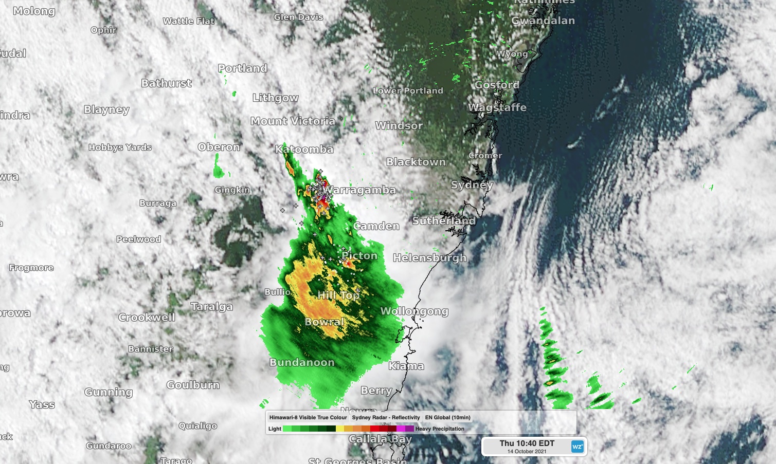
Image: A severe-warned thunderstorm to the southwest of Sydney on Thursday morning.
Some of the storms in this area could become supercells, which are capable of producing destructive wind gusts above 125 km/h, giant hail measuring more than 5cm in diameter and very heavy rainfall. It's not possible to know where supercells will hit until they start to develop and can be seen using radar images.
In addition to the threat of severe storms in TAS, the state will also see heavy rain on Thursday, which may cause areas of localised flooding. A flood watch has been issued for the North and North East, Mersey, Huon, Derwent and South East catchments.
In SA, showers, cold air, blustery winds and a few storms will sweep over the state on Thursday with a deep low pressure system. The strongest winds will occur in the state's west and north, where a severe weather warning has been issued for damaging gusts in parts of the West Coast, Flinders, North West Pastoral and North East Pastoral districts.
This severe weather event will continue into Friday and Saturday for parts of eastern and southeastern Australia, so be sure to check the latest forecasts and warnings if you live in these areas. Weatherzone will bring more updates as this event unfolds in the coming days,